|
We drove up to look at some of the dispersed camping available in the National Forest land north of Sundance, Wyoming. Most of the public lands out west have free camping areas. We were disappointed to find that almost every camping area warned of logging and timber removal. This meant lots of traffic and some pretty loud days. The high point of our drive was Warren Peak at just over 6,600 feet. We got some fantastic views in all directions. The lookout tower was closed beyond the first level. The surprise was what had been here during the cold war. Our only nuclear powered radar station was here. It was in operation from 1961 to 1968. We drove a little further and thought we had found a perfect spot. It was flat, an official camping area, beautiful views, but one very big negative. It was also a cattle watering area and the number of cow pies was excessive.
0 Comments
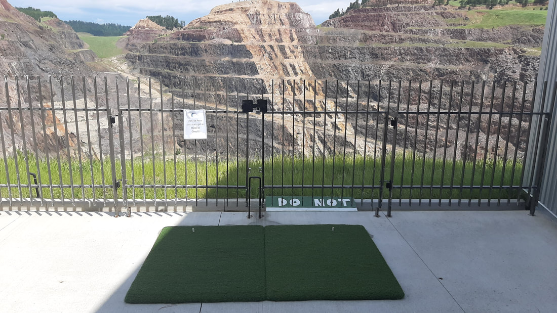
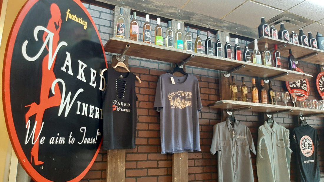
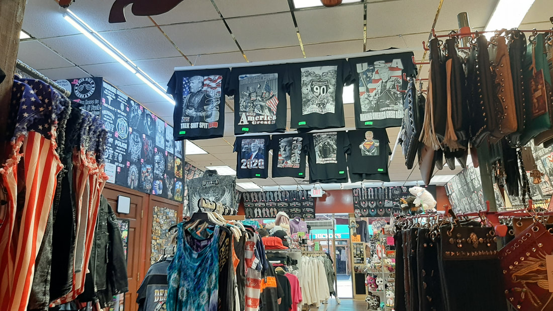
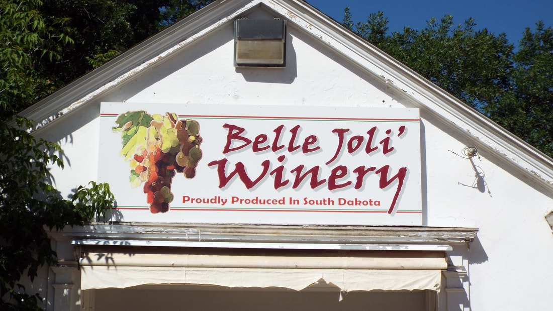
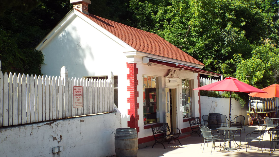
Today, we decided to stay in this park for one more day. We are not in a hurry to be somewhere so why not. Sturgis has a brewery that we had not visited so that was corrected today.  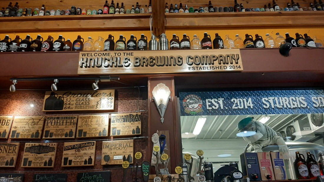 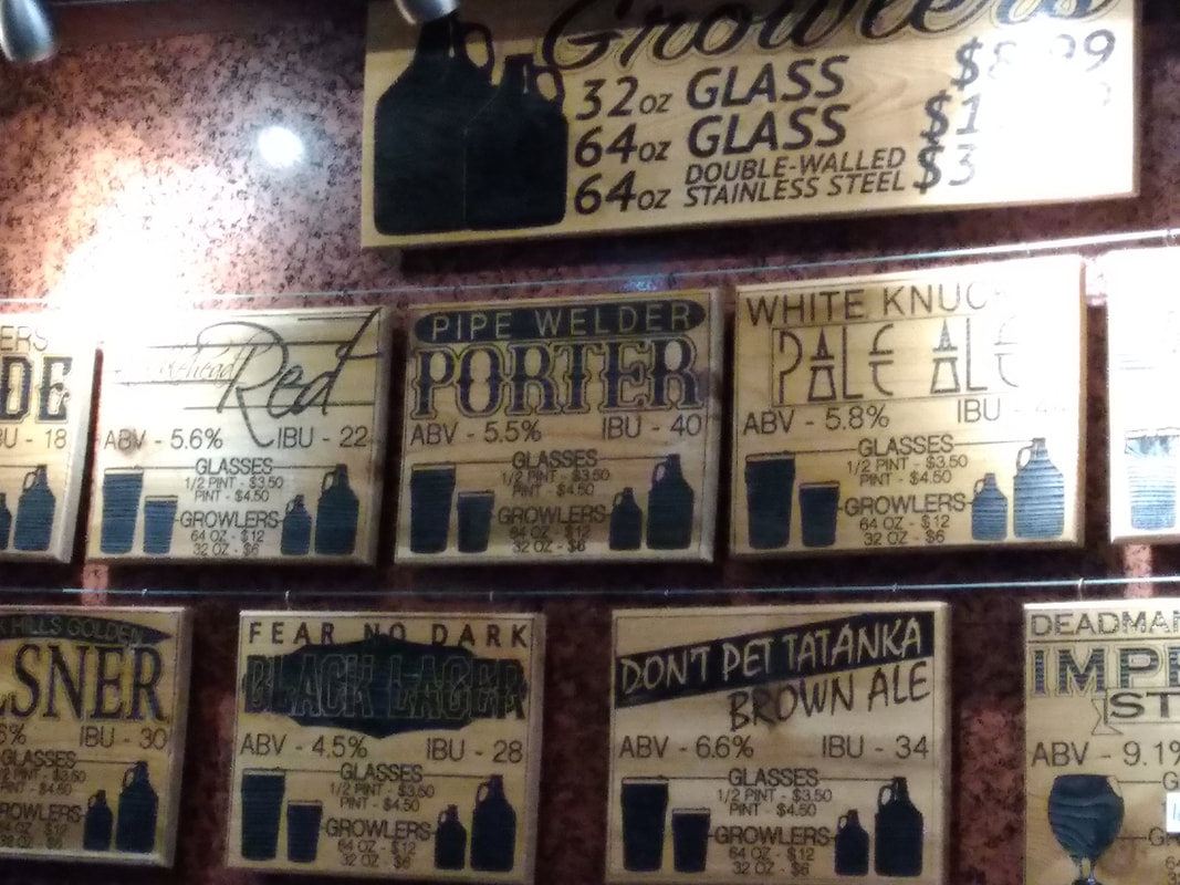 We had a nice time and Shawna got a growler filled. We will be heading further west tomorrow. I thought I would put some pictures of our site and some sunsets. This guy has been around the site today. We are not sure what kind of bird it is but it would walk around the site with a strange walk. Today, we decided to go back to Lead and Deadwood to visit several museums we missed on our last visit. In Lead, Sanford University has an exhibit of information on the scientific studies being done in the mines. They even have a three dimensional model of the mine itself. The model is 1:5000 scale. 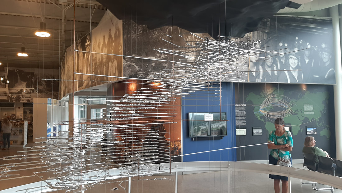 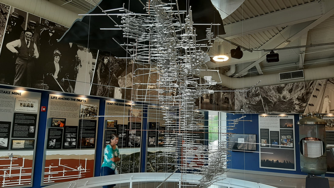 The displays had a lot of information on the mine. The mine had as many as 1,000 miners working at a time, 370 miles of tunnels, 331 miles of railways, and an average of 750 gallons of water flow into the mine every minute. It is very difficult to pump water up 6,000 or more feet so instead it is pumped up to tanks about every 1,200 feet and then up to the next level until it reaches the surface. Currently more than 700 scientist work in the mine each year. The area where scientist work looks nothing like it did when gold was being extracted. 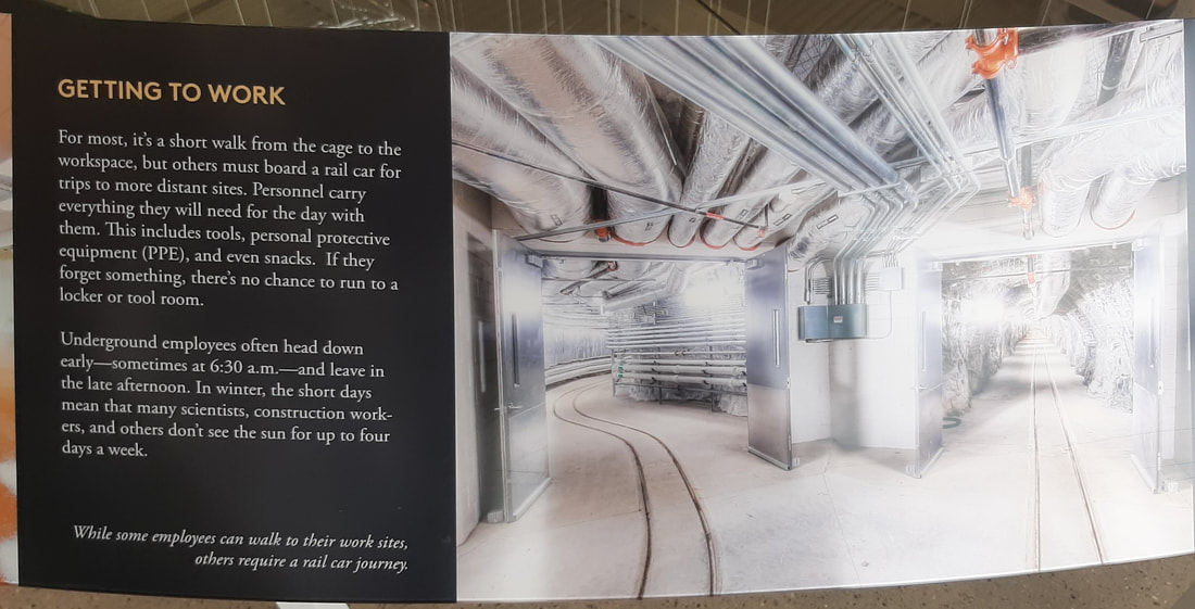 Out on the observation deck, you can look down into the open cut and even hit a hole-in-one. I don't know if it is even possible to miss that hole. Back in Deadwood, we visited the Adams museum. They say that the best way to make money from a gold rush is to sell food and supplies. That was definitely true for Mr. Adams. For many years he had the only grocery and mercantile in Deadwood and quickly became very wealthy. The museum is filled with memorabilia from the early days of Deadwood and includes examples from the days of the wild west attitude of the town. They even have an 8 oz nugget of gold. Lunch time. We stopped in the Naked Winery for some pizza and for Shawna to have a wine tasting. You may guess from the number of Trump supportive shirts, bumper stickers, and flags that this area is VERY supportive of the President. Next we visited the '76 museum in Deadwood. Half of the museum is focused on the annual rodeo they have here. The rest of the museum was about tribes from the area and stagecoaches, wagons, carriages, and other horse drawn transportation. They even had some horse drawn fire fighting equipment. They even included what we immediately recognized as an early version of an R-Pod which is a small RV trailer with a kitchen in the back. Our parking pass was not quite out of time so we walked around downtown deadwood for a couple of hours visiting stores. 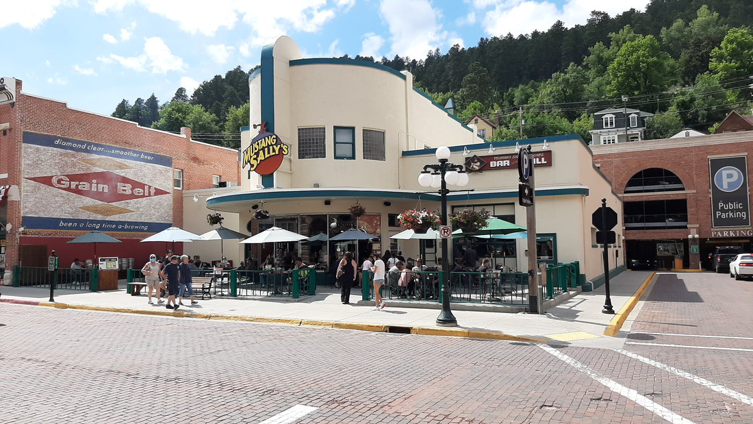 One hotel/casino (everything here is a casino - no really everything is a casino) has display cases from movies and musicians. Today, we hiked to the top of Bear Butte. It is in the same State Park where we are camping. We can see it from the table in the RV. The park is about 5 miles north of Sturgis, SD. You may know of Sturgis as the motorcycle capital of the world. During bike week, the town swells in population from about 6,000 to over 500,000. As you can guess, we plan to be far away from here during that week. We have been warned that people start to arrive as early as the last week of July. 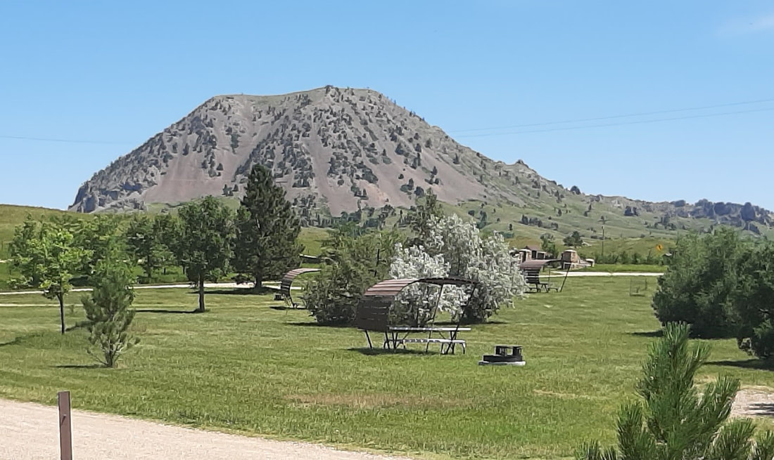 The Butte is an uplift of magma that never quite broke through the surface. So no this is not a volcano even though from a distance it looks like one. This is a sacred site to the Native American people. Prayer cloths are tied many places on the mountain. It is know that Red Cloud, Crazy Horse, and Sitting Bull all made pilgrimages to the site. The hike up to the top of Bear Butte gains 1,000 feet in elevation and is a 2.8 mile trail round trip. The views are pretty impressive even from halfway up the mountain. We can even see the RV from here. We did see some pretty flowers and wild raspberries. Only a few animals. The most surprising was caterpillars. The last third of the hike up was even more interesting. We crossed rock "falls" several times. If one of these were time lapsed over a couple of years, it would look like a waterfall moving down the mountain side. At the top, we got a great view of the Black Hills to the south and prairie West, North, and East. There are several informative signs around the platform on the top. Time to head down. 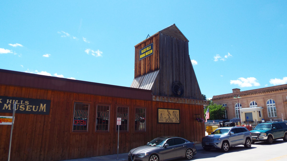 Leed is known for an ENORMOUS gold rush that rivaled the one in California. Lead is pronounced “leed” and was officially founded in 1876, after gold was discovered in the creek running through the area. Lead is a mining term meaning an outcrop of gold ore. The mine is HUGE! 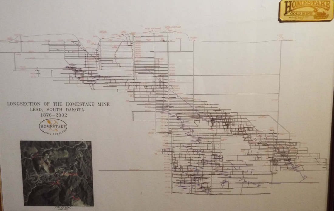 Look at the map of the mine above and notice the cone shaped indentation in the surface. It is 1,200 feet deep and 1/2 mile wide. When standing looking down it looks huge but when compared to the rest of the mine it is tiny. The mine extends down 8,000 feet. 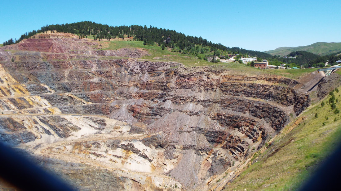 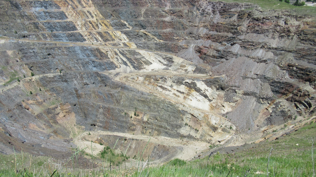 Warning History... One of the first enterprises of the Gold Rush of 1876 was Homestake Gold Mine. The Homestake Gold Mine was claimed by two brothers, Fred and Moses Manuel, and their partner, Hank Harney on April 9, 1876. In June of 1877, George Hearst purchased the claim from the Manuel brothers for a mere $70,000. The Homestake Gold Mine would go on to produce over 40 million ounces of gold during its lifetime, valuing over a billion dollars. The mine would also go on to accomplish many technological and civic achievements. The Homestake Gold Mine was America’s longest continuously operated gold mine. It closed in 2002 as the oldest, largest and deepest mine in the western hemisphere, stretching over 8,000 feet below the town of Lead. Lead is at 5,200 feet in elevation so that means that the bottom of the mine is about 3,000 feet below sea level. The 370 miles of tunnels that were dug during the mine's 126 years of activity. Homestake Mining Company carved 370 miles of tunnels as deep as 8,000 feet, creating one of the deepest mines in the country Forty million ounces of gold were removed from the mine. By the time of this post, that would be $72 billion. This does not include the $140 million in silver removed. From our tour, we learned that two things are always found in a mine. It's hot and there is water. Normally I think of caves and caverns as cool and they are but once you pass the 4,000 foot level it starts to be warm to hot. At 4,800 foot level the rock is over 90 degrees and at 8,000 feet it is over 120 degrees. Mining requires lots of ventilation to keep the air cool enough to allow miners to work. My first thought is that the mine would be fairly dry being just a hole dug in rock but the humidity in the mine is regularly above 95% and in some areas closer to 100%. The mine closed in 2000 because the value of the gold dropped to $200 an ounce. The cost to mine the gold was $400 an ounce. Sanford University continues to do research in the mine. Tunnels in the mine are so long and interconnected that a particle accelerator was assembled inside. The purpose was for the isolation of the equipment from solar particles. You may not know that neutrinos are generated in stars including ours and they pass through most matter unaffected. When they pass through several 1,000 feet of earth, they are absorbed. One of the current experiment is for neutrinos to be generated at Fermilab near Chicago and attempt to detect them in Lead, SD. Not sure how they determine which ones were generated but so cool and nerdy. I liked the science behind the idea. The museum had several examples of gold both raw and refined. There were many examples of the early days of panning to mining in the area. The guided tour takes you down into a simulated mine. It includes examples from the early days with candles for light to more modern equipment. Early in the mines existence, mules and horses were used. They even went so far as to set aside a portion of the mine as a stable. Some animals lived most of their lives in the mine. The pollution of the animals and the problems of any other engine caused them to look for a non-polluting alternative. What they came up with was a "train" powered by compressed air. They had an example of a "Little Red Wagon" . 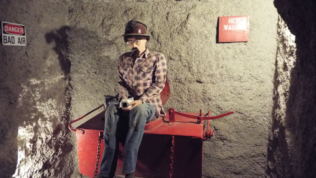 Next, we drove the mile back down to Deadwood. The town has been destroyed several times both by floods and fires. Each time they rebuilt the town back. The town is very heavily oriented to tourists. They even have a stage couch and regularly scheduled shootouts. Deadwood is where Wild Bill Hickok was murdered. So many "colorful" people like Calamity Jane, Poker Alice, Seth Bullock, and Al Swearengen actually lived in Deadwood. Almost every building has gambling of some kind, the hotels, gift shops, restaurants, ... it's everywhere. The only vice that is no longer legal in Deadwood is prostitution. Several of the original locations of brothels still exist like the Pink Door and Purple Door but are now stores. Many of the upper floors have mannequins dressed in lingerie visible from the street. We had lunch in the Gem Steakhouse which is part of the Mineral Palace Casino and Hotel. This is where the dance hall in the Deadwood TV show was set. Shawna had a Ribeye Steak Salad which she said was very good. I had the Buffalo Bill Combo which was texas toast covered with mashed potatoes, red unions, Roast Buffalo steak, and covered with brown gravy. We enjoyed watching from the front windows overlooking the street below. 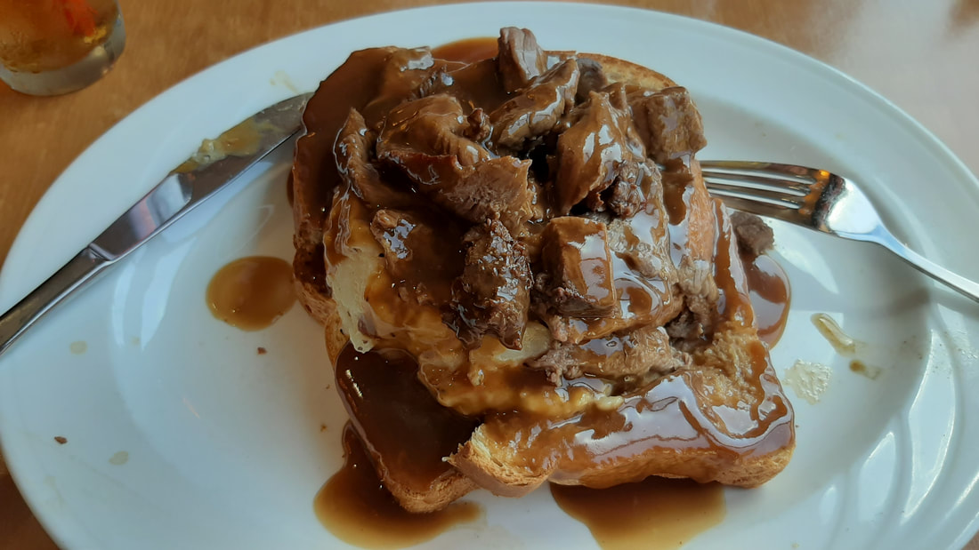 We also visited a winery for some wine tasting.
Today we leave on a hike that will have us backpacking. It is something that we have not done since we have been married.
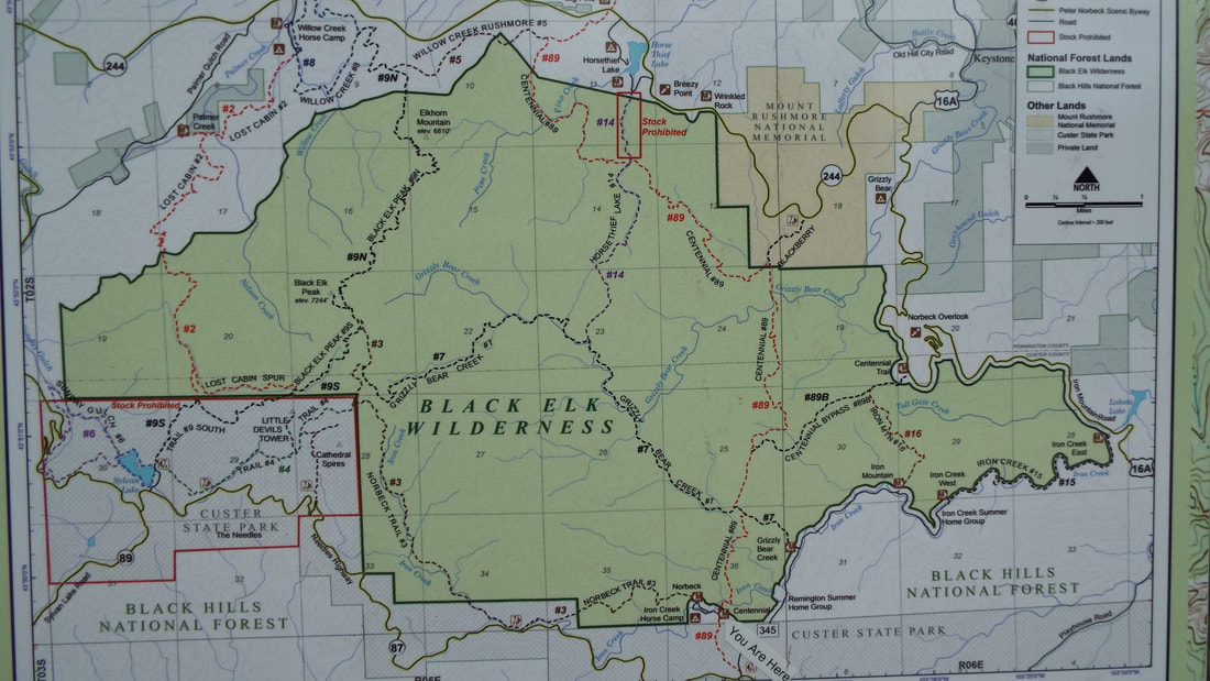
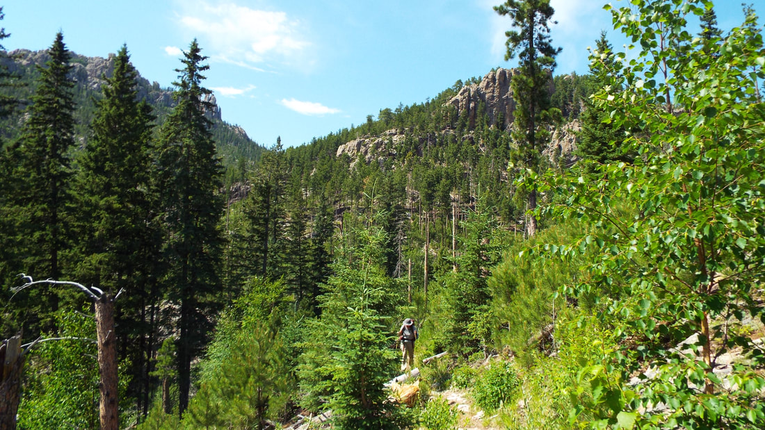
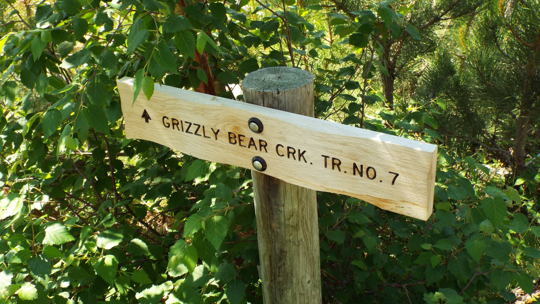
We have all the gear. Modern packs, sleeping bags, and tents that are so much lighter than they were when we were kids. This hike will take us up a mile of the Centennial Trail to Grizzly Bear Creek trail. We will take that trail a little over 6 miles and climb about 2,000 feet in elevation. Along that trail, we will setup camp and stay overnight. The next day we will hike up to Norbeck Trail and follow it to the branch that will take us to the Cathedral Spires. Then we will move further down the Norbeck Trail and find a place to camp for our second night. The last night we will return to the trailhead and truck. Total we should travel about 14 miles. My backpack started at 35 pounds and Shawna's at 30. 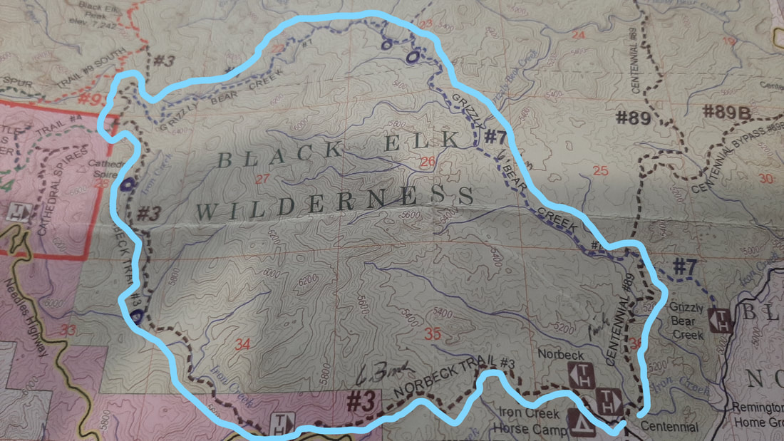
We have a new tech gadget to keep us safe. You know us plan, backup plan, emergency plan, emergency backup plan.... Anyway we have a Satellite emergency SOS device. It is called a Garmin InReach Mini and we can call for help, send and receive text messages over satellite. We have three message we can send that are pre-written we can send for free but any other text messages cost us to send or receive. That reminds me of the early days of cell phones. Does anyone remember having to keep track of how many text messages they have left for the month?
Now, we have a way to call from help anywhere we can see sky. 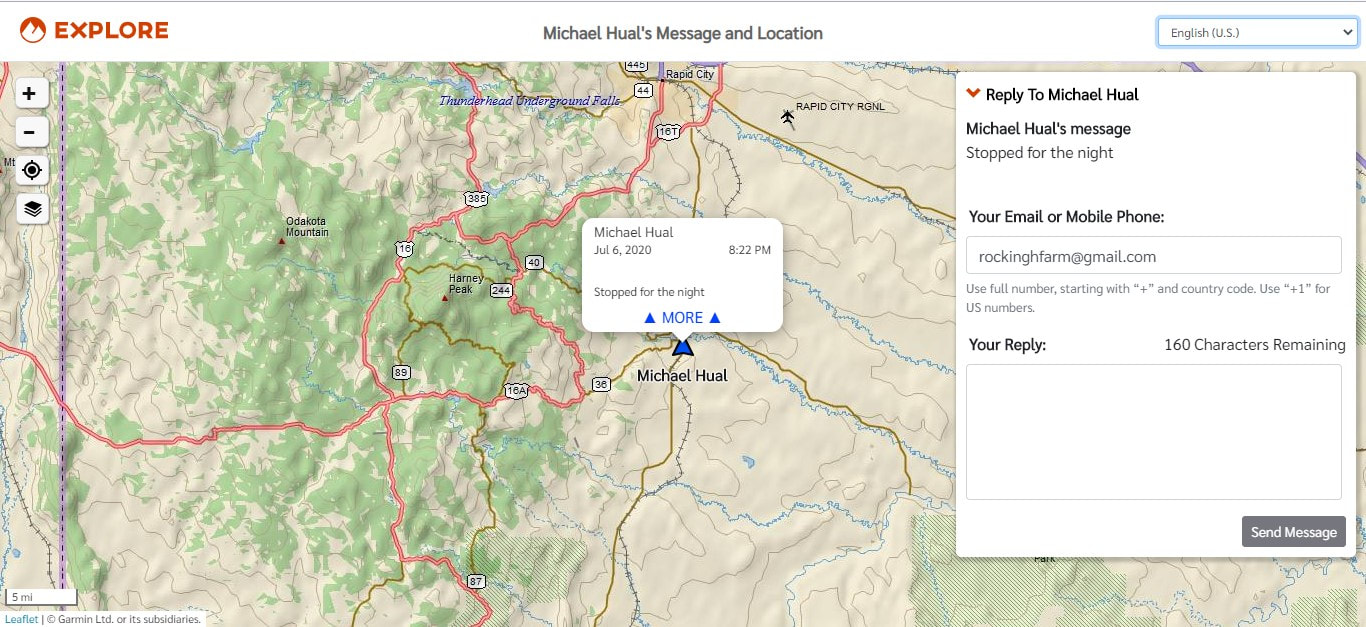
To our surprise on the drive to the trailhead, we came upon Bighorn Sheep at the same location in Custer State Park. This time there were even more females and babies.
Time to get to the trailhead. We parked the truck at the trail parking area. It is just outside the horse camping area. I think we will be have horses pass us on some of the hike.
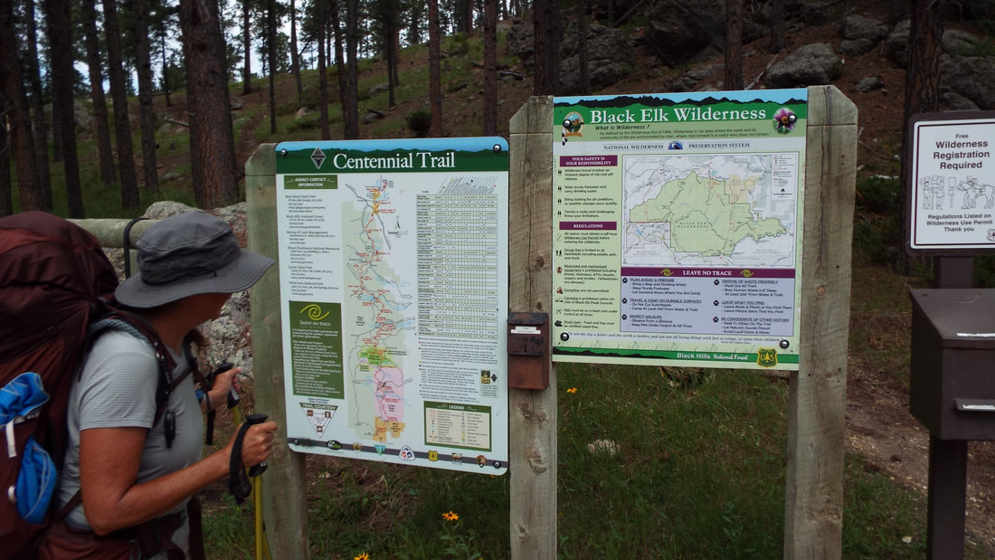
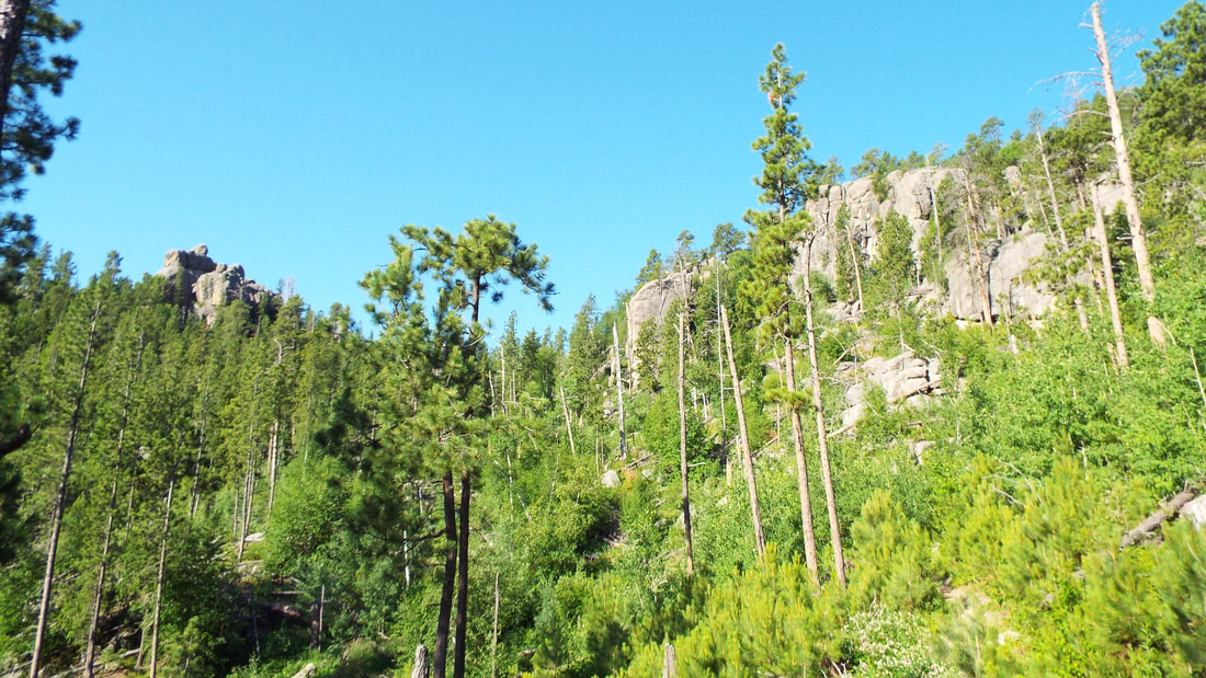
We will be hiking through a big portion of the National Forest.
Time to get going. We have about 4 or 5 miles up a mountain to hike before we reach our stop for the night. We will have a lot of water crossings. It does mean we will have water we can filter along the way.
Yes, we have a filter that can make stream water clean and safe to drink. The Sawyer filters are really good but intended for camping not as a home filter. I guess you could make it a home filter but it needs to be backflushed every few days.
The views along the trail are great.
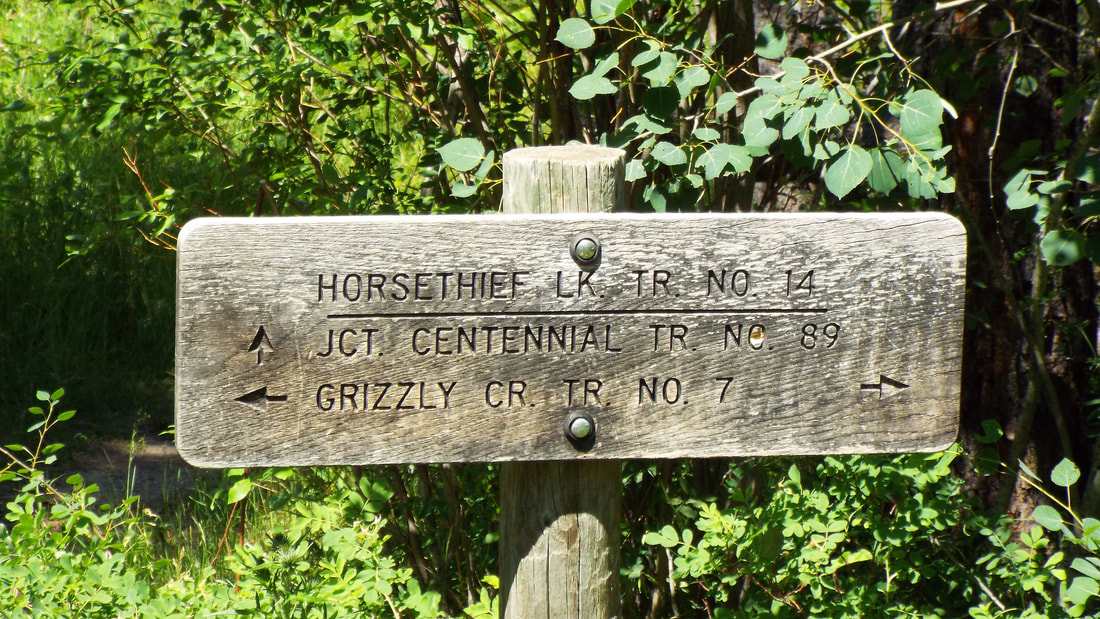
Time to switch to our next trail.
Later in the day we found our campsite. Just a patch of flat ground but very nice views. We also could see some clouds building up so the tent needed to be up soon.
We have been watching the forecast for any problems and it predicted NO RAIN. Of course, a weather forecast is only a bit better than a guess over a couple of days out. Don't even get me started on how ridiculous it is for "scientists" to try to predict a change in the climate many years from now.
We were able to utilize some rocks as some of our tie downs. They worked great.
Time to get some water and make dinner. The creek is just a 100 feet further down the trail and dinner is freeze dried.
Rain but we are ready.
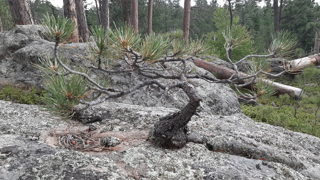
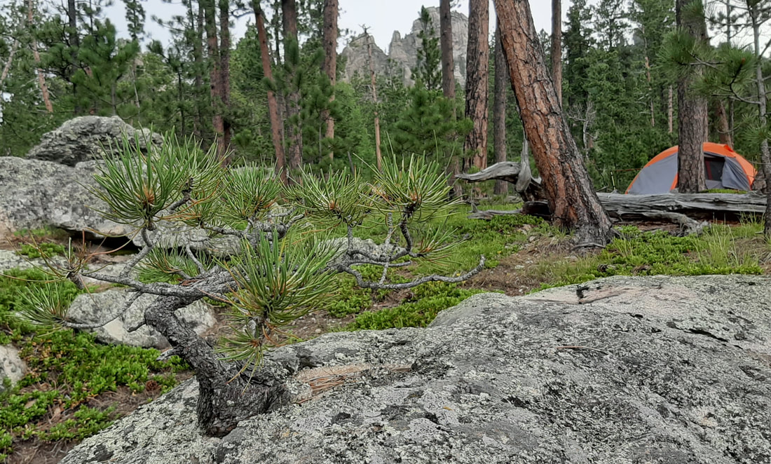
On a bolder near our campsite was a natural bonsai.
Our views at sunset. Pretty!
Morning comes early in the morning. This is our view at 5:30am. It has been light enough to not need a flashlight for over an hour. The sun peeked over the mountains at about 6:30am. Our coffee with breakfast was fantastic! Thank you, Julie and Matt, the filter worked great!
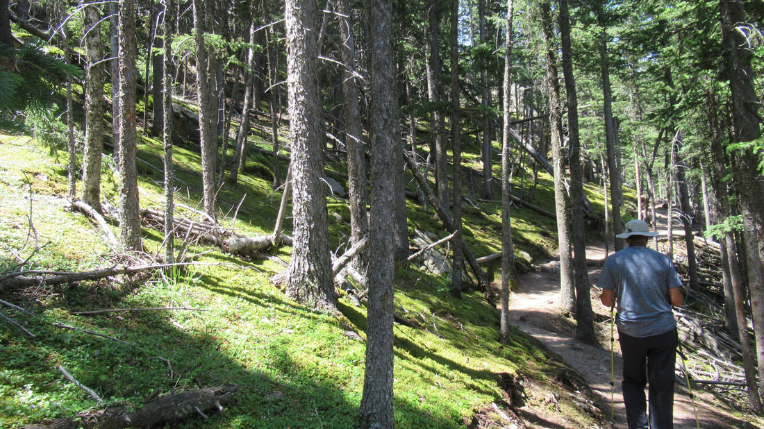
On with the hike.
We did have a lot of pretty flowers on the hike.
Pretty brooks and streams.
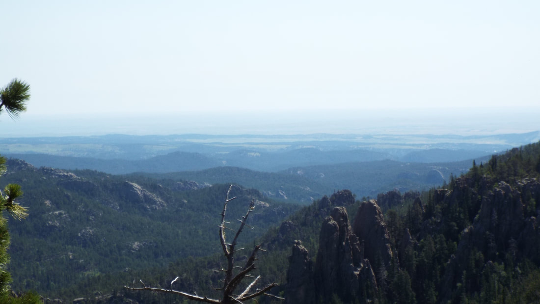
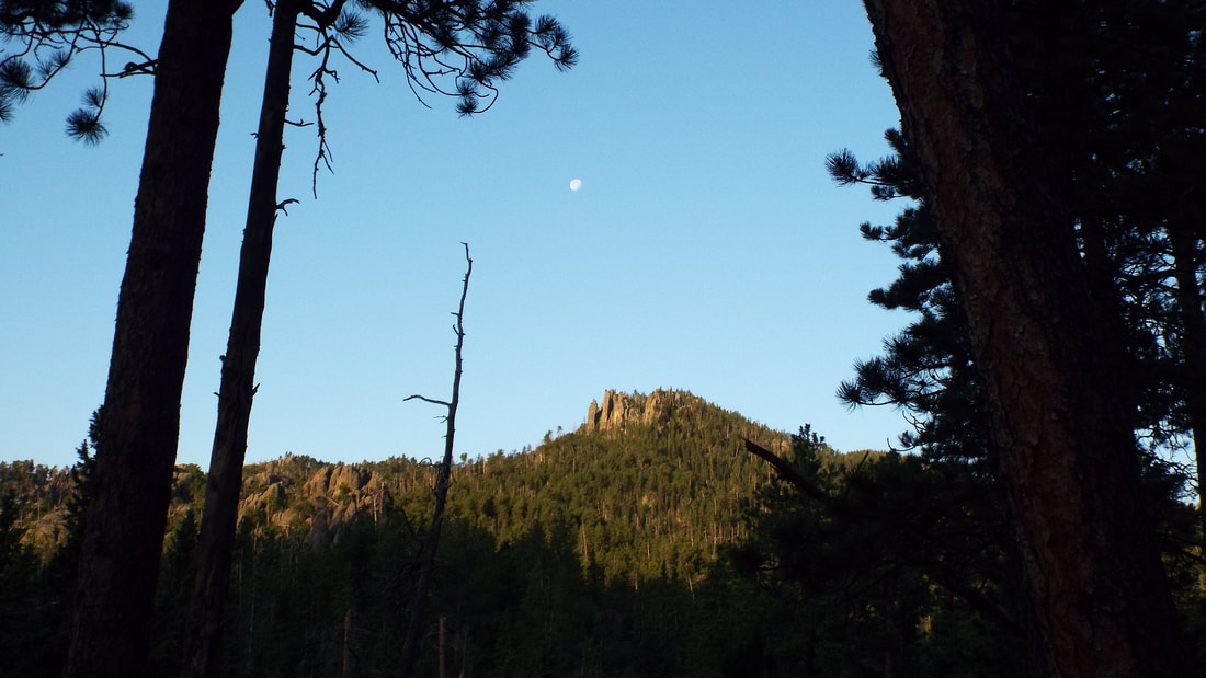
We got to the high point in our hike and the view was fantastic.
We could see Cathedral Spires in the distance. The trail to them is fairly short so we "stash" (hide them off trail) our packs.
As we hiked, we passed through a part of the forest where instead of grass the ground was covered in a moss. The patch of moss covered the ground for hundreds of feet up the hillside.
Everything you see green growing across the ground above is a moss.
The Spires are really impressive.
We switch to our final trail back to the truck.
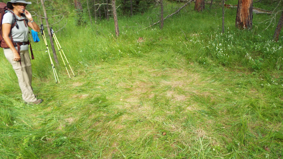
We found our campsite for tonight. It is a big meadow of tall grass so we have to do a dance to press it down where we setup the tent.
The results in the morning are that it looks like an elephant took a nap.
We enjoyed the hike but now it is time to return to civilization, showers and a visit to the hot tub at the RV Park to workout the sore muscles. Mainly we need showers.
Today we drove up into Custer State Park. Soon after driving into the park, we got caught in a wildlife traffic jam. Several female Bighorn Sheep were standing just at the edge of the road. They came to the hill to get minerals.
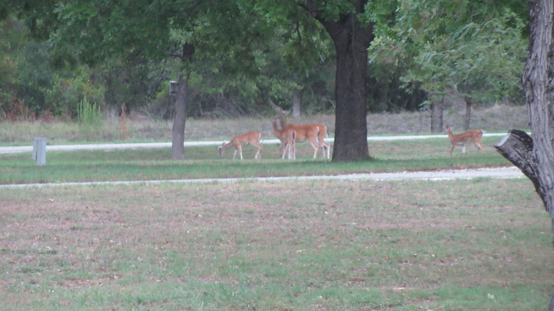
Deer!
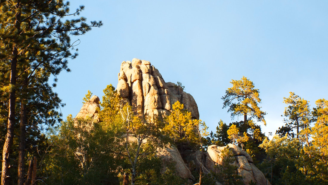
The mountains in this park are amazing.
After a drive up the very narrow dirt road up, we arrived a the top of Mt. Coolidge Lookout. The view was incredible.
Crazy Horse faces the lookout. We could also see the Cathedral Spires, the back of Rushmore and Black Elk Peak with Harney Lookout.
We hoped to see buffalo (yep still not calling them bison) and were not disappointed. First was a HUGE bull. He was just off the road.
Later we found the herd. The wildlife traffic jam was super long. A huge group all over a field by the road which include bulls, cows, and lots and lots of calves.
Some of the moms were feeding their babies.
This big bull walked calmly between cars knowing that everyone would stop and wait. Then he stood on a small hill watching the tourist pass by him.
The last animals we saw were burros. There were even babies.
When we got back to the RV park, a really amazing cloud came over.
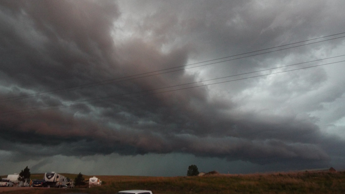

This cloud developed and wow did it look scary. Thankfully nothing developed. 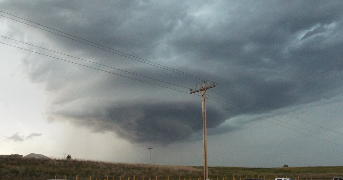 |
AuthorWe are a couple who have started on a new adventure... Archives
January 2024
Categories |


 RSS Feed