|
We have seen information on the highway that leads from Red Lodge to the northeast entrance to Yellowstone. It is described as a scenic drive with pretty overlooks and lots of switchbacks. If you are longer than 40 feet in length, you are not supposed to drive on this section of highway. You would not be able to turn and keep to your lane on the switchbacks.
They were not kidding about the switchbacks. In fact looking at the GPS, it looks like a a ribbon was dropped and fell looping back and forth. Pictures do not do the road justice and at one point on the road 1 mile of forward progress requires 8 miles of switchbacks and increases altitude from 5,000 feet to the top of Bear tooth peak at 10,900 feet.
Because rock slides are common, they have put up barriers to stop boulders from crashing into the road. They look like gigantic chain link fences. The "links" are made of loops 1 foot across with 1 inch diameter metal. There was plenty of evidence that the road had been recently destroyed by huge boulders and repairs made to the roadway.
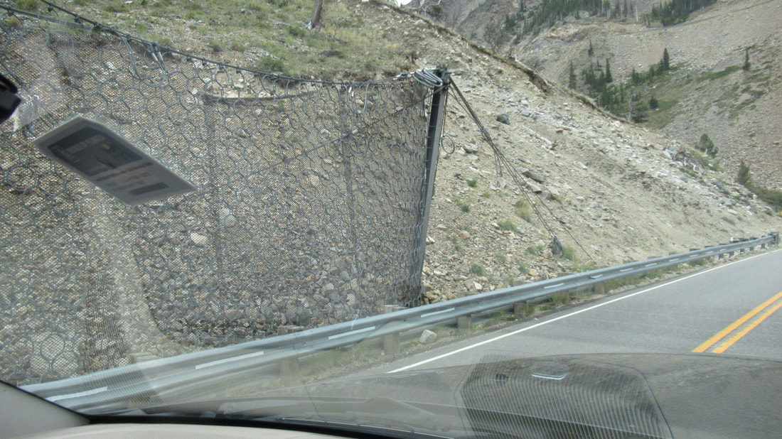
Looking ahead, we could see the road was going to be interesting. On many of the switchbacks, I was turning the wheels almost all the way to stay on the road. The overlooks gave some spectacular views of the valley.
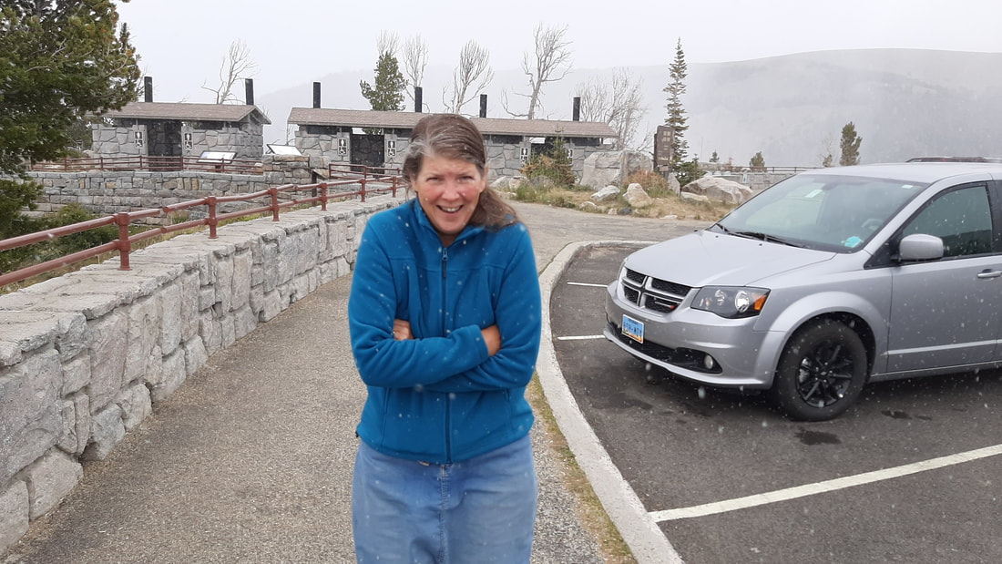
Then there was SNOW! On August 31, 2020, it was snowing!
We could see that snow was also falling in the valley below.
As we were driving up to the next pullout and discussing the weather conditions and as to whether we should we continue when we passed a snow plow in the opposite lane - with the plow down. He was pushing ice off the road. Yes, it was definitely time to head back down the mountain. This is the first time in my entire life that I have seen a snowplow actually being used.
Even at the next stop which is 2 thousand feet lower, it was snowing. After getting back to the RV Park, we talked with the owner about what happened. She told us that is was good that we came back down because at anytime they could close the road and we could have been stuck up there until the next day.
0 Comments
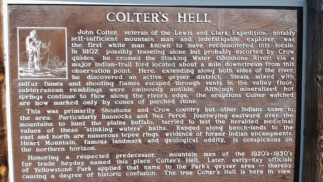
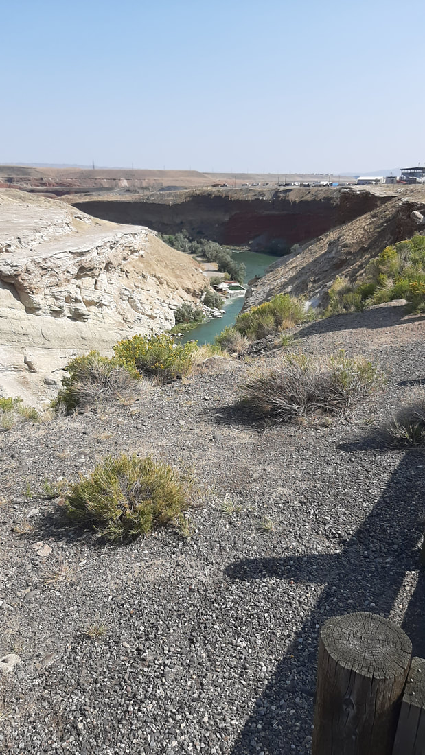
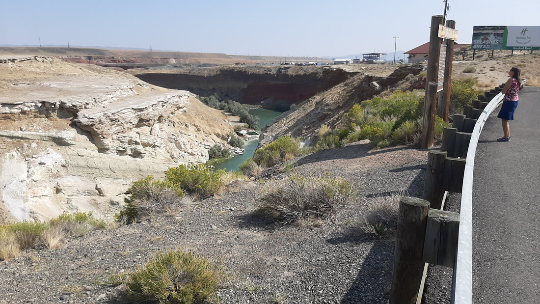
Today, we move to Red Lodge, Montana. It was an interesting drive from Cody, WY. This is our the first time to visit Montana. Our site at Perry's RV park is right on the river.  Today, we played tourist in Cody. First, we stopped at a few overlooks. The first was an area called Colter’s Hell and Extinct Geyser Basin. John Colter was part of the Lewis and Clark Expedition in 1804-1806. In 1807, he was the first American to explore the area and found geysers, steam vents, and flames shooting from some vents. When he reported what he had found, some did not believe him and called it Colter’s Hell. The name stuck even after he was proven to be accurate. Today, only a few hot springs are still active. We visited the Buffalo Bill Dam. For several years, it was the tallest dam in the world. It is not very wide just tall. The dam was installed to give Cody and the farms in the area access to water year round. Until the dam was completed, water was only available during the spring melt of snow from the mountains to the west. Today not only is power generated but 93,000 acres of land are irrigated. Warning history lesson.... The dam was installed to give Cody and the farms in the area access to water year round. Until the dam was completed water was only available during the Spring melt of snow from the mountains to the west. Today not only is power generated but 93,000 acres of land are irrigated. It was completed in 1910. For many years and several companies tried to finish the dam but most went bankrupt trying to get the dam built. One problem with building the dam was that construction had to be done during the winter months. This was because the river would be low and in the spring there were frequent flash floods making work impossible. Working in winter means temperatures below zero and concrete does not set well in freezing weather. This required that canvas be draped over the work area and steam be pumped in to heat the area above freezing. The amazing thing is that the construction was completed, even with the failed attempts, in 5 years. Today this would be impossible. The dam is 200 feet wide, 108 feet thick at the base but only 10 feet thick at the top. To prove this point the 25 feet was added to the dam. This work was started in 1985 and not complete until 1993. At that rate if the dam were started in 1910, it would still not be finished. We walked out on the dam and looked down. The river is 325 feet down on the east side. To the west the lake formed by the dam is very large and extends for xx miles and holds 623,000 acre feet of water (whatever that means and what normal person measures water in acres?). Below the dam is a hydro electric power station which can create 91 gigawatts per year. That is a lot of power and far more than needed by the Cody and other local communities. The visitor center at the dam had very good information and a video showing the history of the construction. There was also information on a cave nearby. Because of the shape of the opening, animals unlucky enough to fall in died in the cave. This left a history of animal bones to investigate. 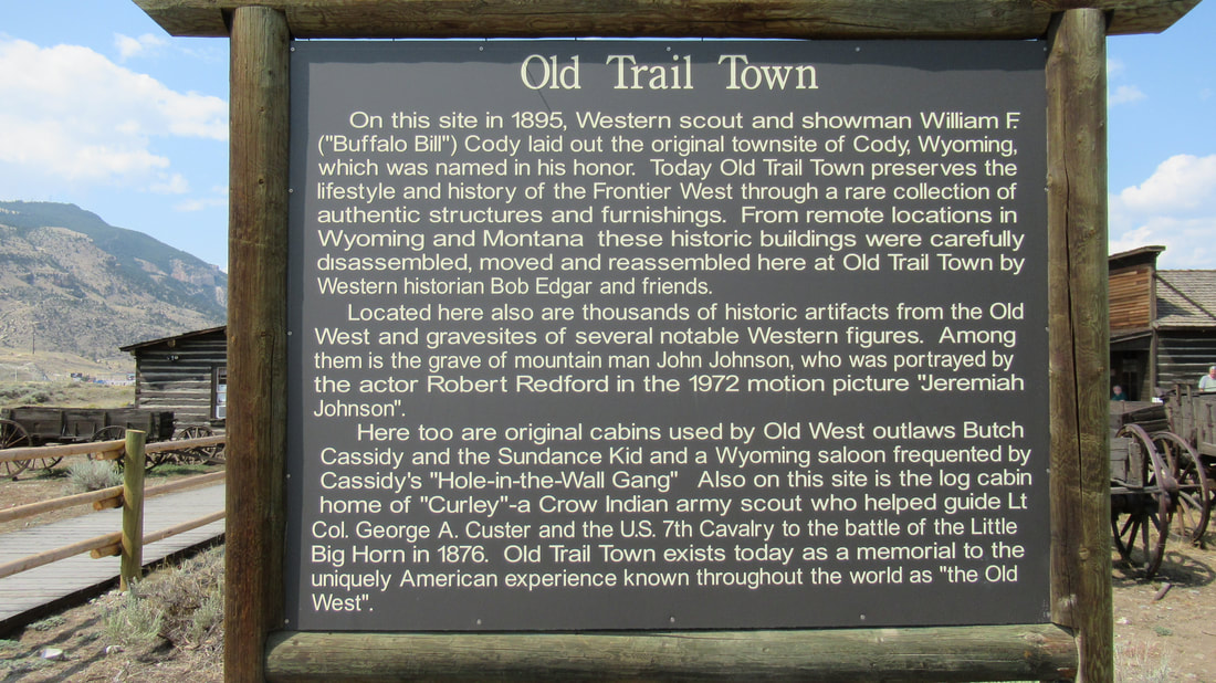 Next, we stopped at “Old Town” which is a collection of 100 year old or older buildings from the area and the original town of Cody. The layout was in the form of an old west town and included every kind of building of the day. Cody City was established in 1895 by Buffalo Bill Cody with a general store and blacksmith shop. By the start of the next year, they had 12 business including 2 saloons. Two years later, the railroad came to the area and the town moved to its current location near where the railroad stopped. The down was then renamed to just Cody. Some of the buildings were surprising like the "Hole in the Wall Gang" cabin. There was also a second cabin used by Butch and Sundance. They also frequented the Rivers Saloon. There is a small cemetery on at the "town". Buried there is Jeremiah Johnson 1824-1900, Jim White "Buffalo Hunter" 1828-1880, Jack Stilwell "Frontiersman" 1828-1903, and several others but also included was Belle Drewry 1867-1897 who was a lady of the evening. A couple of buildings were setup with cases of memorabilia and wagons. We ended the day with a visit to a local brewery and a trip to Walmart to refill the fridge and pantry.
Today, we started out earlier than usual. We were on our way before sunrise. The plan was to arrive at our hike early and possibly see more wildlife.
Just before the pull out for our hike is a road to an overlook. It is about 1 mile up to the top of a mountain and gives some great views of the lake. The "smoke" you see in some pictures is steam from thermal features.
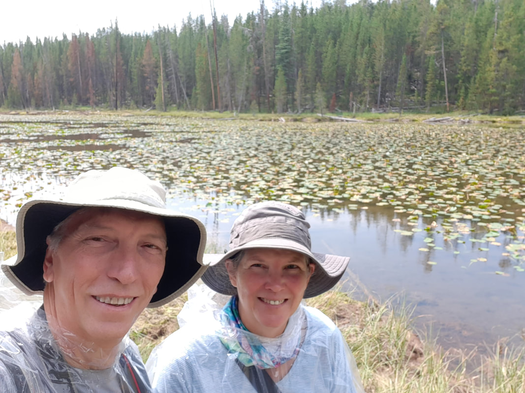
The trail starts at a pullout right at the lake on the east entrance road. It is a very long trail that follows the entire east side of the lake. We will only be hiking a portion of the 27 mile trail. We could have walked for days on this trail and many people do.
The first part was a bit exciting because just as we started a man in the parking lot said that two bears were seen on the trail ½ hour earlier. Not long after we got on the trail, we saw prints for a larger and smaller bear. We think it was a mom and cub. They had moved on so we did not ever see them. We did see some “scat” (fresh bear poop).
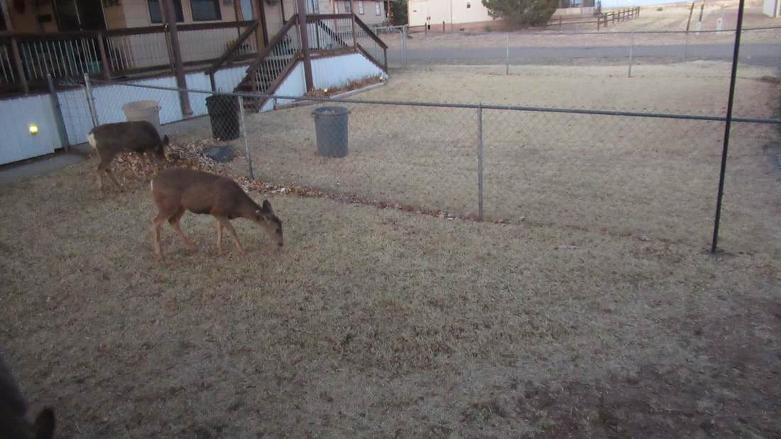
Several times on the trail, we found that deer had been through earlier in the day. We also took pictures of several flowers and berry plants.
The trail had a lot of variety of landscapes. We hiked through old burned forest where all the trees were burned but new trees were already starting to grow. We did pass a really surprising burned tree that was "holding" up another tree that had fallen.
The other areas were fields and thick forests with small streams we had to cross.
One was wider than a stream was more interesting to cross. There were no good ways across other than just walking in several inches of water flowing past. We did try to use a log that had fallen across the stream but it was not stable. The crossing was about 15 feet across.
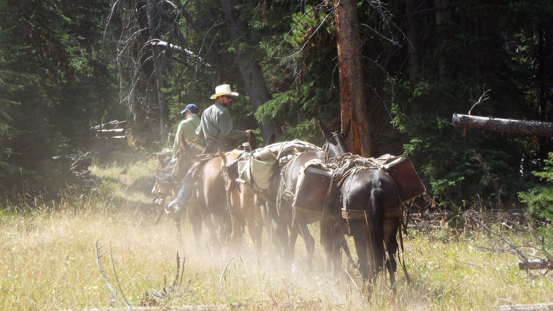
We only passed or were passed by 10 people, a group of six who had been hiking and camping for several days, a couple hiking together, two rangers on horse back with three pack mules headed to a ranger cabin much further down the trail, and our return trip a single woman hiking alone (pretty gutsy though she was very concerned about the evidence of bears she had seen). So in 12 miles, we saw 10 people that is less than one per mile. Wow!
When we got to just over the 6 mile mark, we came to three campsites. One was on the lake so we walked to that one. Lucky for us no one was using the site at lunch time. It was nice to have lunch looking across Yellowstone Lake.
On our return to the trail head, we walked alone except for one woman hiking by herself. She let us know that she had seen scat and large prints on the trail. We thought that they were from the same bear until we saw the scat and prints. We were wrong. The print and scat were much larger and not where we had seen the first prints at the start of the hike.
I think this is a large male looking for the female with her cub. We kept seeing the tracks in the trail until the last mile of the trail. It is possible that he turned off the trail still seeking “romance”.
We did see a lone buffalo relaxing about 50 feet off the trail. 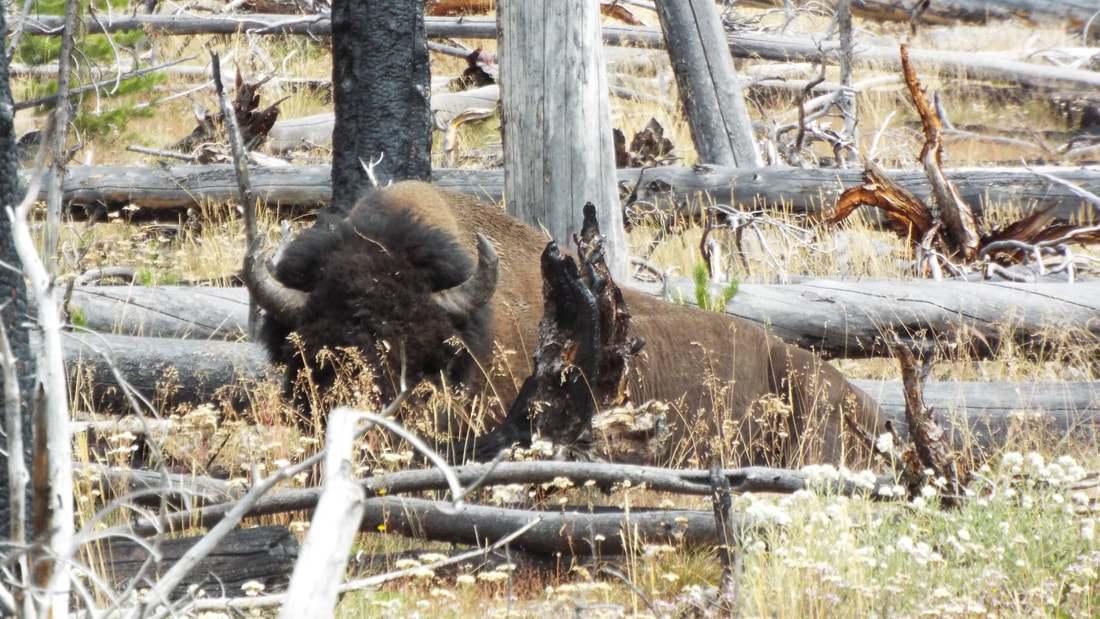
By the time we got back to the truck, we were exhausted and had hiked 12.6 miles round trip and our climb was up to 1,178 feet. Our starting altitude was 7,700 feet.
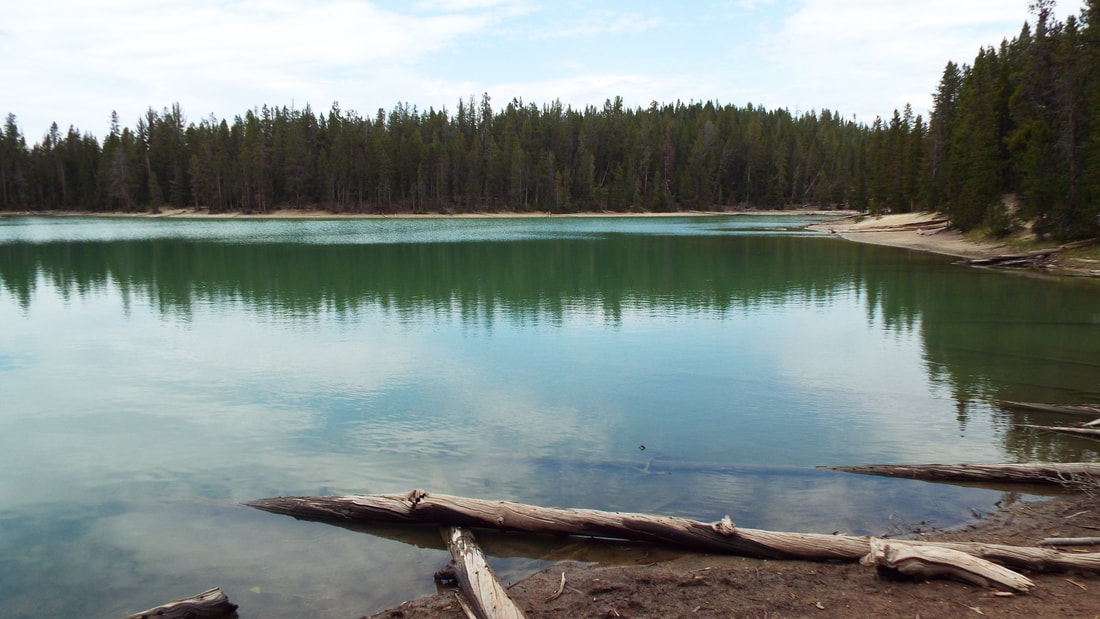
We stopped for a photo of Sylvan lake and the high pass we have driven through every day.
We leave tomorrow for Cody.
We started the day at 47 degrees. Wow! The heat wave persists.
We pass a short drive up to an overlook each time we drive into the park. Most days we did not think it was worth driving up because of the smoke. Today, the air was much clearer.
Today, we took another hike. Big surprise!
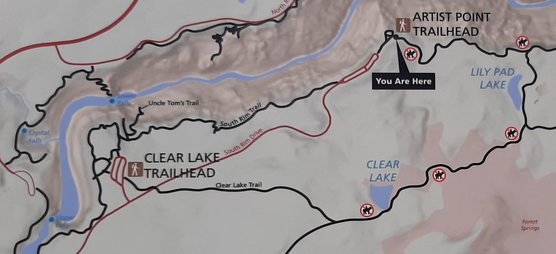
The trail head is at Artist Point on the south side of the canyon. The hike follows the canyon for a half a mile and then turns to the south. 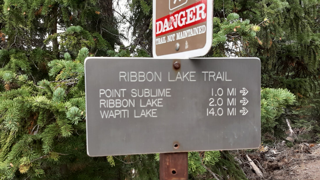
Along the path, we got a really good view of the canyon.
Well, it is pretty rare that we walk an entire hike without some amount of rain and this one was no exception.
Our first lake was pretty. It did have a few areas we could see bubbles meaning there is thermal activity under the surface.


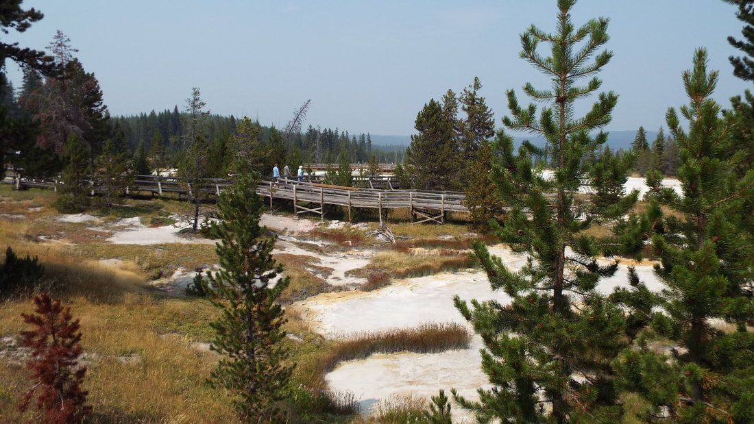
Next was the area of thermal features which included a big mud pot.
I got as close as I could but the ground temperature got over 100 degrees so I knew I was as close as I dared. Just a few feet in front of me the ground temperature is 120 degrees. The pool reads as over 160 degrees. We have been using a little laser thermometer to check the temperature of hot areas just to be safe.
There were several other steam vents and mud pots. I get the impression that we are walking around on a volcano.
Next was a green lake. Really green. Pretty I guess. Along the shoreline we did see some huge prints. We are guessing elk.
We walked up to a hillside where we could take pictures of the valley.
Hiked back across to the canyon for some spectacular views of the falls and the canyon.
It was a nice hike but tiring. In total 3.8 miles with an elevation change of 600 feet up and down.
Time to head back to the RV.
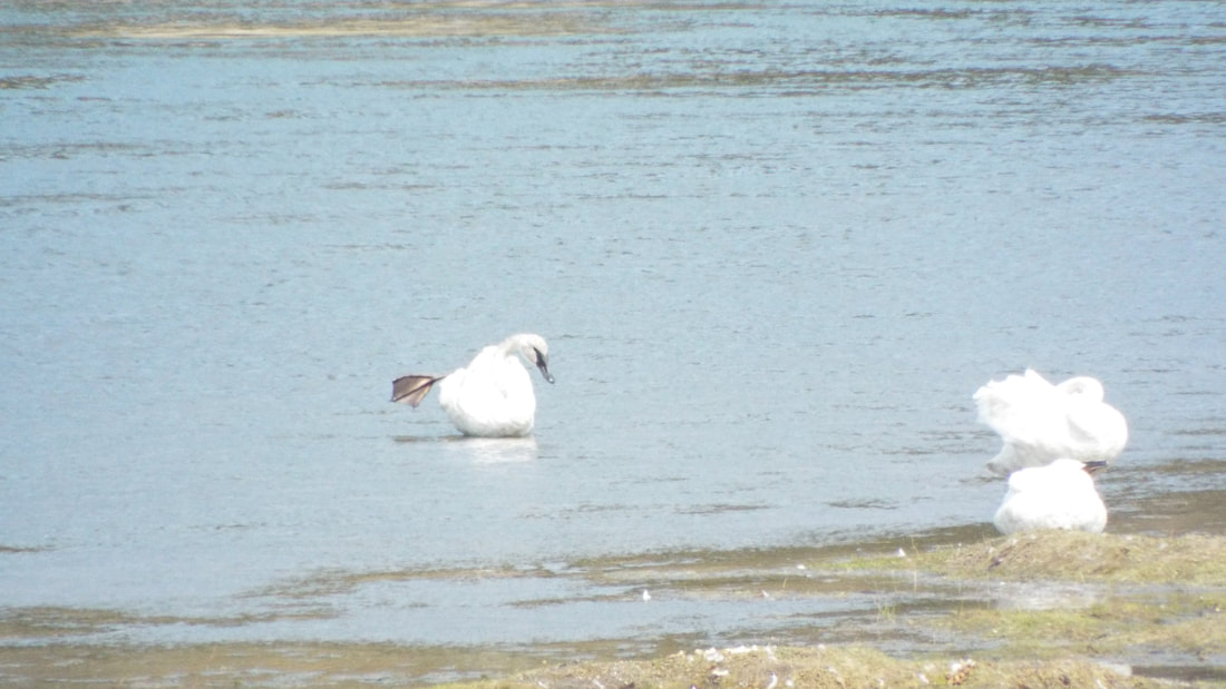
We did have three wildlife encounters before getting home. The first was a group of swans in the river.
The second was a huge bighorn male who was looking down on us from a hillside about 50 feet above the road.
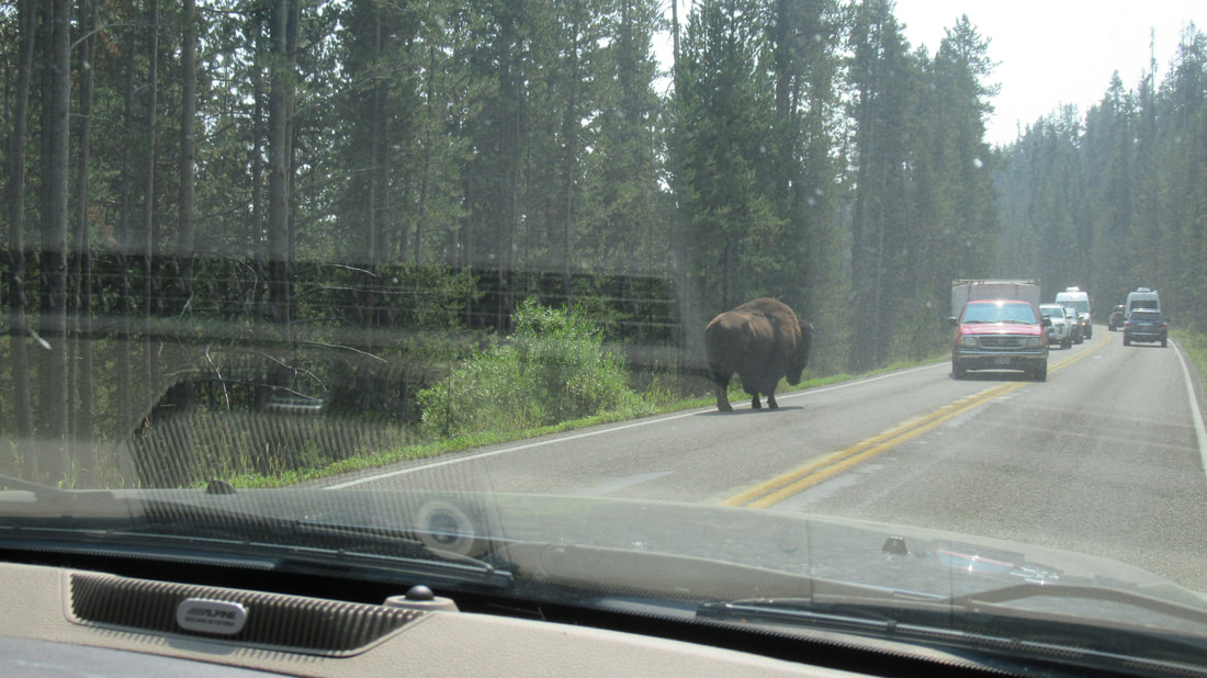
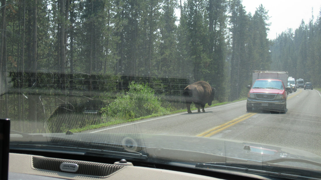
Next was one of the loner buffalo that we frequently see on our drives in and out of the park. He was walking down the road in the east bound lane in an area where there was a shear drop to the south and a steep hillside to the north. We are not sure how far he will need to walk before finding a safe place to walk away from the road. Being late in the day there was very little traffic so we just passed on the other lane. At our closest, we were no more than 5 feet from him.
The next afternoon, we saw him in the field at the east entrance gate.
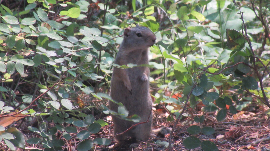
We started the day at 38 degrees. Today, we plan to hike a couple of trails. To our disappointment, the trail head for one of them was blocked by a construction crew. It looks like they are about to repave the parking area. Instead we went to our second trail. It is the Natural Bridge Trail which is 2.9 miles and an elevation change of 131 feet. Most of the trail was fairly flat but to get to the top of the natural bridge was pretty steep. It was a pretty if small “bridge”. From the small stream that flows under it to the top of the bridge is only 51 feet. 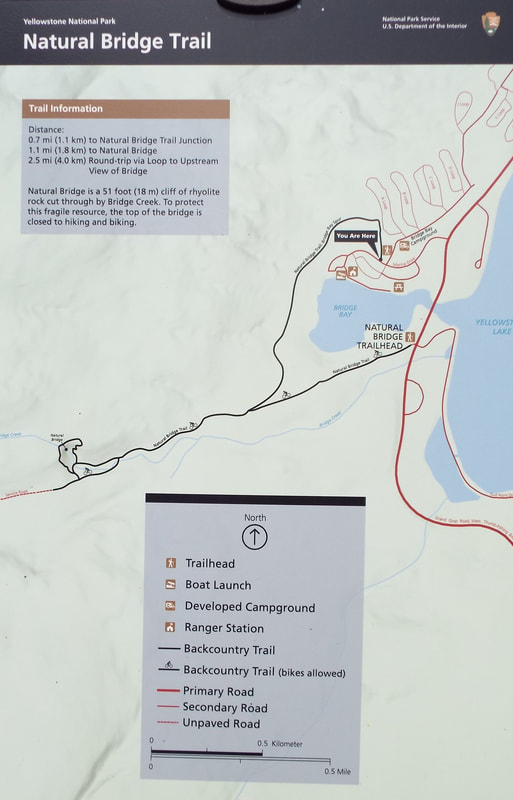 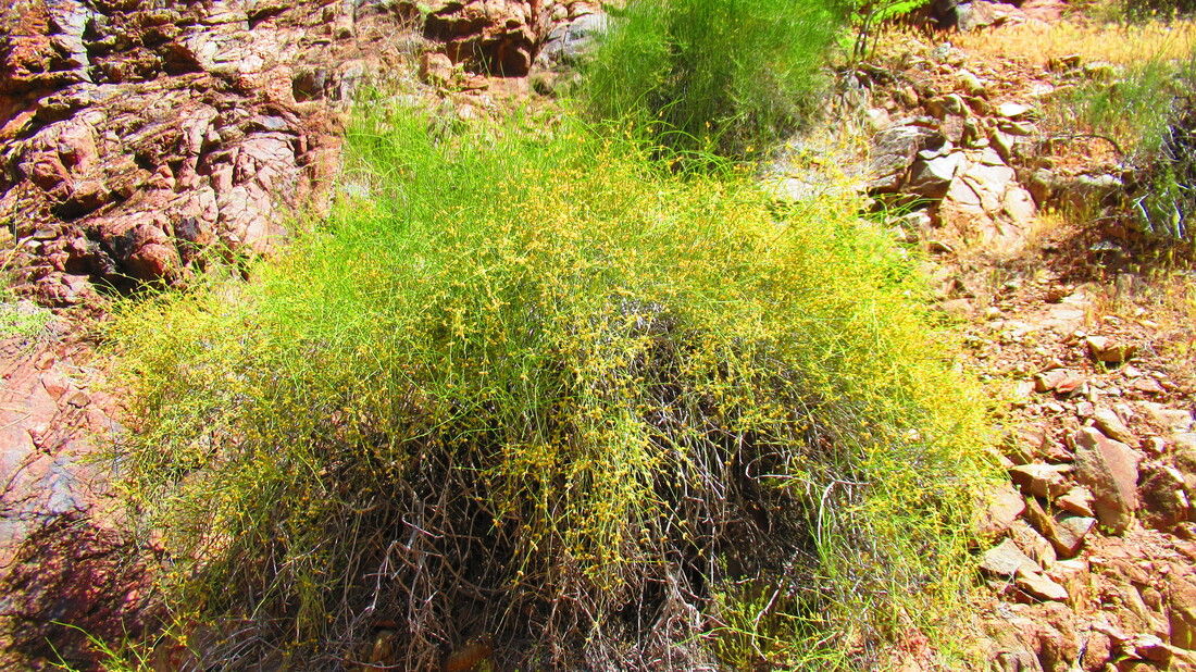 The bridge spans about 15 feet and is about 6 feet wide and deep. We could see an obvious crack running from top to bottom so it may only be here for a few more years. 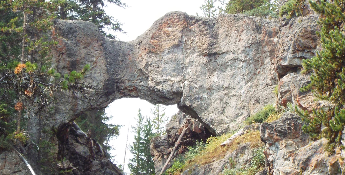 We did get a surprise. As we walked up to the bridge, two marmots were sunning themselves on a large rock just 10 feet off the trail. They were not afraid of us and barely took notice as we passed by them.  A short loop trail took us up to the top of the bridge. We did not walk on the bridge. There was a path behind it that crossed the stream to the other side. There were some nice views and a few pretty flowers. After the hike, we returned to look around the small store at the marina. Shawna wanted one of the Wyoming beers. As with most craft beers, it has an interesting name. This one is called Moose Drool. Last, we parked at the Fishing Bridge parking lot to get some cell service and to wait out a storm that was passing over the lake. We never got wet so the truck is still really needs a bath. On our way back home for dinner, we had 4 deer run across the road. 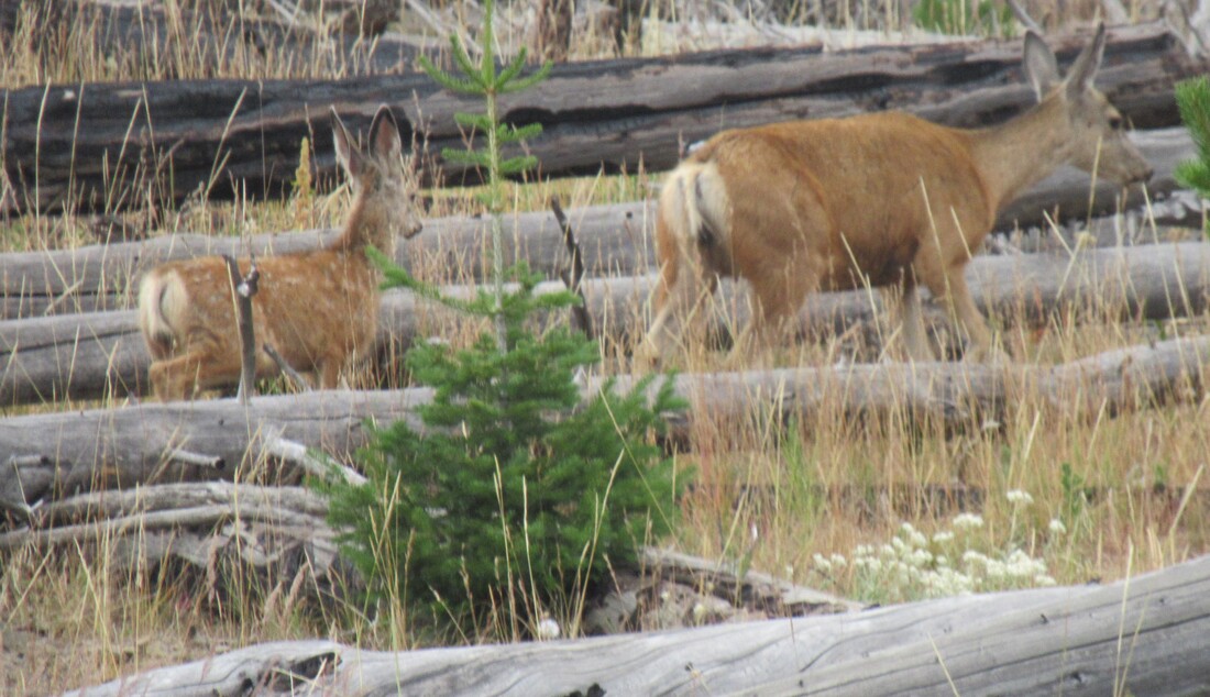 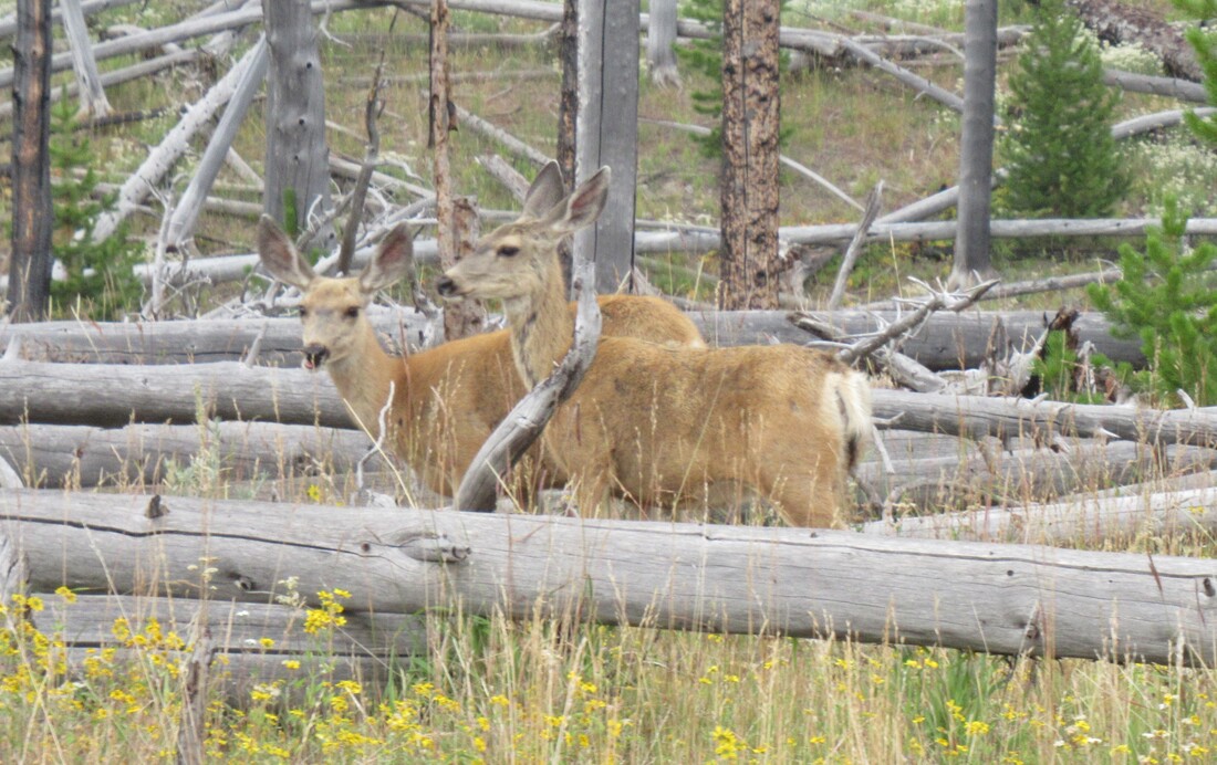 We started the day at 37 degrees. My only comment is people here would completely freak out if they had a hot night. We decided to drive in and hike a short trail. On our way, in we passed several lone bull Buffalo along the highway. They were all off to the sides so no traffic jam. 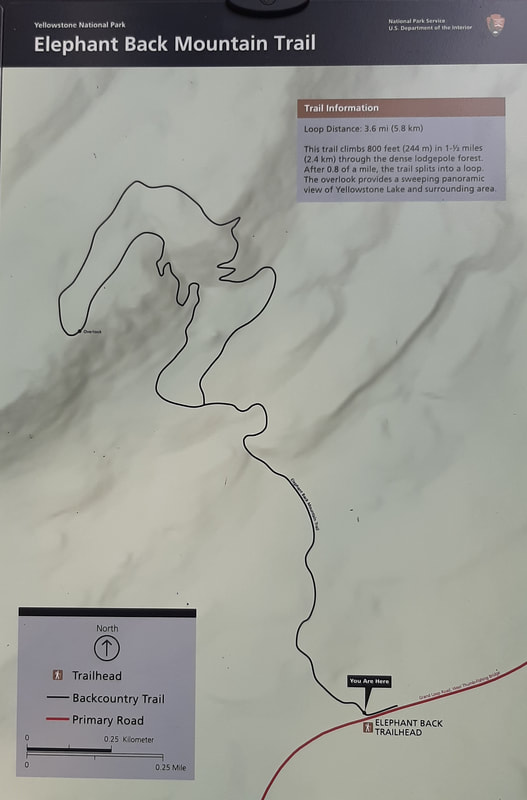 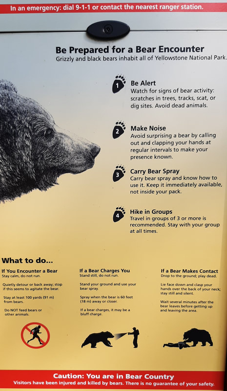 The air was a bit smokey today. We found out later that several fires had been started by lightning in Oregon and Idaho and that smoke added to what had been coming up from the California fires made the air a bit worse. 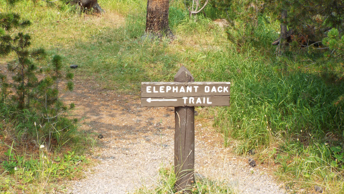 Our trail was the Elephant Back Mountain Trail. The trail is 4.1 miles with an elevation gain and loss of 800 feet. It was pretty steep at times but overall a nice hike. We were disappointed that the view from the top was limited by the smoke. Otherwise it should have been a very impressive overlook of the lake. On the hike, we did see several squirrels and chipmunks that seemed to not be afraid of us at all and some birds. We heard woodpeckers but only one was easy to see. He is a Hairy Woodpecker native to this area. He was busy looking for insects. 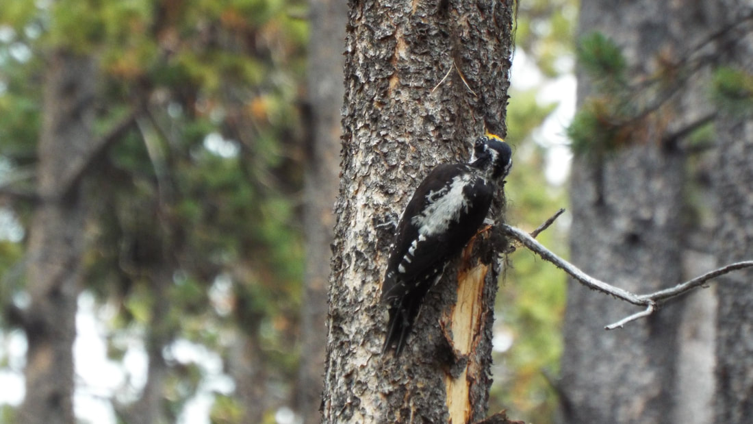 We decided to stop at the Lake General store for a couple of hamburgers and to use the available cell service. On our way back, new signs were posted about a fire that started south between West Thumb basin and Old Faithful. They had closed that road as well. Time to head back to the RV for the night. In the campsite next to us, the man has a custom trailer. Pretty interesting. Spoke to him later, he always wanted to sail but had horrible seasickness. So he decided to build a custom camper with a ship's bell, gauges and a port hole. He was an interesting guy. 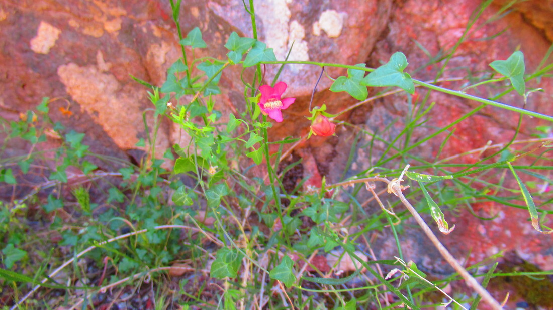
We started the day at 35 degrees. Wow! I thought 35 was cold for August.
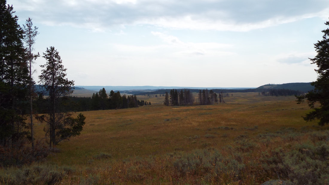
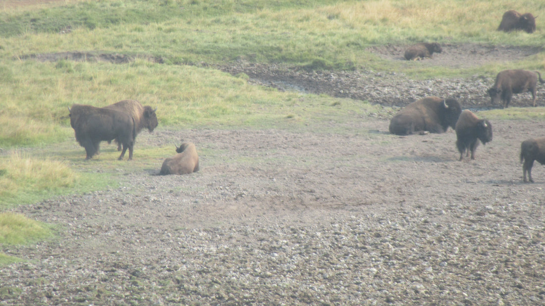
Our plan today was for hikes but the air quality was even worse than yesterday. Instead we will just do the tourist stops and short walks to overlooks or other features. On the way up to the falls, we got caught in another Buffalo traffic jam. They are very common in some areas of the park and one of those is Hayden valley which we have driven though yesterday.
An entire herd was moving down from the hills on the west of the valley. They were taking their sweet time moving down to the river which is to the east of the road.There were young with their mothers and several HUGE bulls. The bulls are not only easy to identify by they are much larger size but also because they are “excited” to be near the females if you get what I mean. Very educational. Eventually the last of the herd moved off the road and we were able to continue. We waited 25 minutes before traffic started moving again.
Our first stop was the north side of the falls. We walked down to the “brink” of the lower falls. It was a bit more of a “walk” than we expected. The decent to the top of the falls is on a trail that switch backs multiple times and drops 600 feet down into the canyon. Of course, the return trip was much much longer than the trip down. At least it seemed to be a lot longer anyway. We did have some beautiful views of the falls. From the top of the falls to the base of its drop is 308 feet but it is common for 60,000 gallons per second to pass over the brink. Wow!
The next stop was Grand View overlook and then the final stop at Inspiration point. It gives some really spectacular views of the canyon.
We found a spot just down the road where we had cell service. Cell service is a rarity in the park and only available in a few small areas. The other one we found is near the north shore general store which we pass each time we drive in from the east entrance.
After some discussion, we decided to drive south to see more thermal features. Before we got there a Buffalo traffic jam stopped everyone on the road. A single bull buffalo was standing in the center of the road looking back and forth at the cars he had stopped. The big boy look pleased with himself. After about 5 minutes, he moved to only block one lane. Buffalo know they have nothing to fear and are the apex animal of the park. Even the predators avoid them. It would be difficult for a pack of wolves to even take down a single adult and no chance at all if it is a small herd. Only a new born buffalo is at any risk.
We arrived at West Thumb which is a caldera inside the larger Yellowstone caldera. Over and over again, we are reminded that this is an active volcano that is just waiting to erupt. The West thumb area has its own features to see. Several of these are actually in the lake's edge. Over 3,000 gallons of hot water pours into the lake at this location. Even with all that, the lake remains 45 degrees even at the warmest part of the summer. After all, the water is entirely snow melt. The activity in the area varies from year to year. Some years the geysers spray high in the air and at other times they barely bubble up two feet.
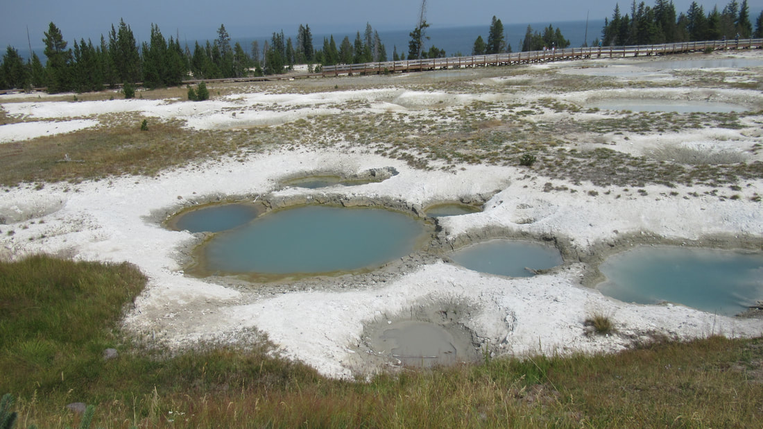
There are paint pots which also look like bubbling mud of different colors. Using the laser thermometer, I got a temp of 140 degrees. As you can see, we are practicing social distancing. The boardwalk is mostly empty. The Blue Bell Pool was very pretty. Not a safe place to put even a toe.
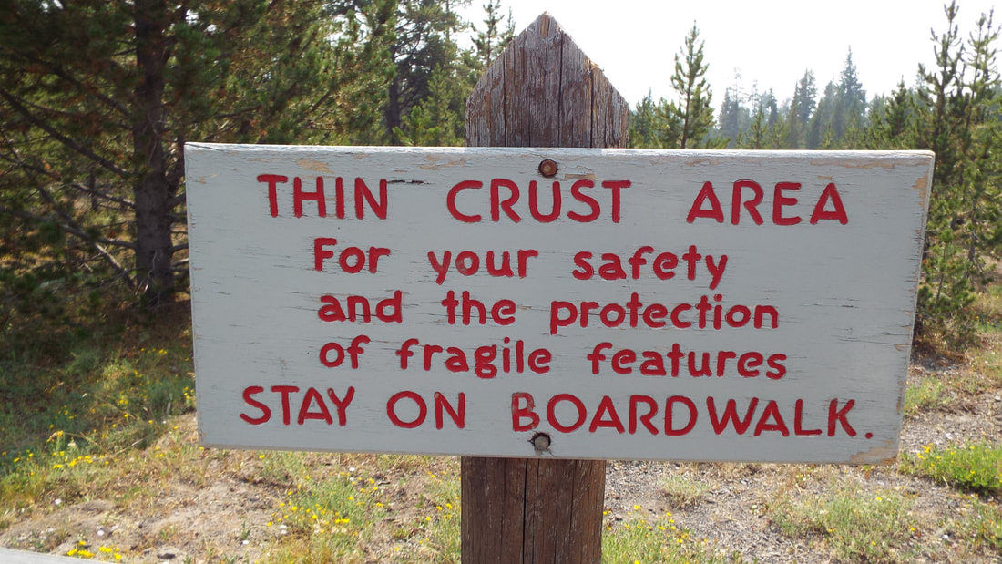
This is not a safe place to step off the board walk.
Lake side spring where two ducks were diving for something to eat along with lots of pots, pools, and a few lake shore geysers. Fishing Cone which is rumored was used to cook fish by the native tribes that have lived in the area for centuries. It is easy to imagine a fish on the hook being dipped into the slowly overflowing cone to cook. I just wonder if the water was safe for food.
Black Pool which is blue? Before 1991, it was black until the water temperature rose and killed the black algae that gave it the black color. Now, it is a pretty light blue and you can see down to the bottom. It Is at 146 degrees.
Abyss Pool also blue but much deeper. At 160 degrees.
We were getting tired and decided to head back to the General Store for cell service and some ice cream.
VIDEO WILL BE INSERTED ABOVE.
We are hoping for better air quality tomorrow.
We started the day at 38 degrees. Wow! Below 40 on August 21st.
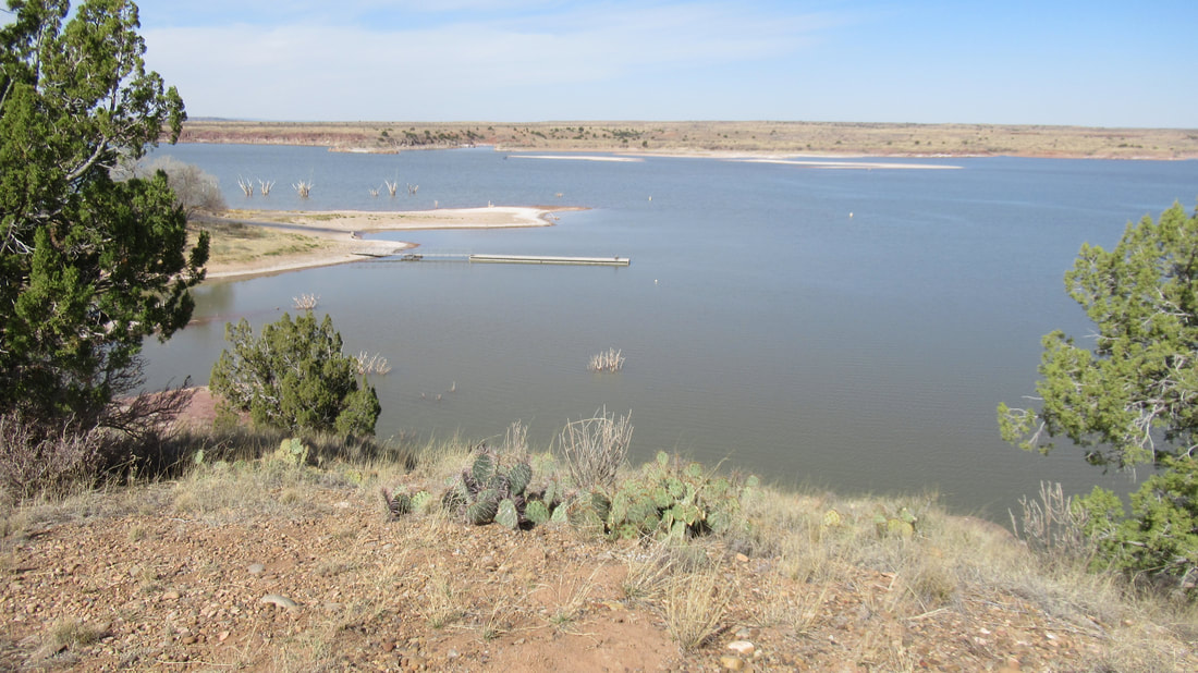
Today, we got an early start but hope to get going even earlier. By 8:30 am, we were headed to the park. The drive to the park entrance is only 3 miles but from there to the Yellowstone lake is another 25 miles. The lake is huge. It is the world's largest alpine lake. It is at an elevation of 7,700 feet with an area of 131 square miles. It has 141 miles of shoreline. It is 14 miles wide and 20 miles long. The deepest measured depth is 410 feet. Many locations of the lake have been surveyed to have underwater geysers. With the smoke, it was impossible to see the far shore. We noticed that there was a haze in the air especially when looking up to the mountain tops around us. When we got to the park, we were told it was smoke from the fires in California. If only we could get them to keep their politics and pollution away from the rest of the country would be far better.
We stopped at an overlook and there were small geysers spitting out into the lake below us. They were little but our first look at the evidence that Yellowstone is still an super volcano below the surface.
After passing some road construction and Fishing Bridge, we came to the shopping center of the park. This includes a large store with everything from camping supplies, groceries, and even a restaurant. Next door is a gas/diesel station and even a vehicle repair.
As we turned north, there were several slowdowns because of Buffalo (still not calling them Bison) traffic jams. 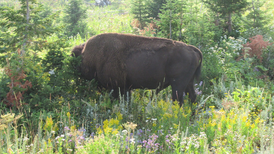
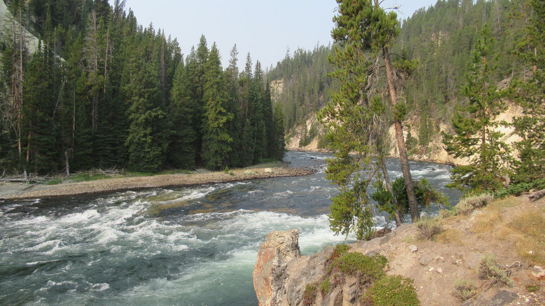
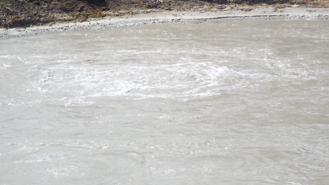
First pullout for us was Le Hardy Rapids. The river from Yellowstone flows North. Yes this is very unusual. It is a pretty river.
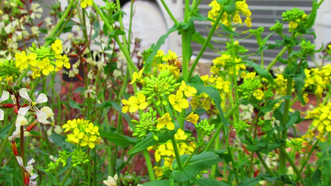
Flowers! (and a butterfly)
Next stop gave overwhelming evidence that we are standing on a volcano.
Mud Volcano is an area where gasses and heat make an area of mud that bubbles and sprays out. There are warnings everywhere along the raised walkways. “Don’t step off” is the primary warning. This is the most acidic area in the park. The ground is very hot and not always a supportive surface. It is likely that stepping off would at least result in burns but very possibly death which might include the body not being able to be recovered. The smell of rotten eggs is impossible to avoid. The gases released include hydrogen sulfide, carbon dioxide, and hot steam. In some locations hot steam and gasses cross the walkways.
Dragon’s Mouth “spring” is a cave that roars and water splashes out every few seconds.
Sour Lake is acidic like battery acid and would burn skin on contact. The water boils with gases released from below the surface. Of course, it stinks.
The next pullout is for Sulfur Calderon. You can guess what that smelled like. It was impressive but even more so was looking at the activity under the river. We could see several places where gasses and hot water was churning to the surface.
Earthquakes are common in the area but we did not feel one while we were there.
We continued north to the area of the upper and lower falls but first we made a quick stop for lunch.
After lunch, we drove to the lower falls. This is also the overlook called Artist point. WOW! The view of the falls was impressive. This time of the year the falls are roaring. On some of the mountain tops, we can see snow but most of it has melted to fill the lake, the river, and make the waterfalls at full force.
What do you think of my more "artsy" photos?
On our return to the campground, we stopped at the upper falls. While not as impressive as the lower falls and the canyon, they were memorable.
VIDEO ABOVE COMING SOON.
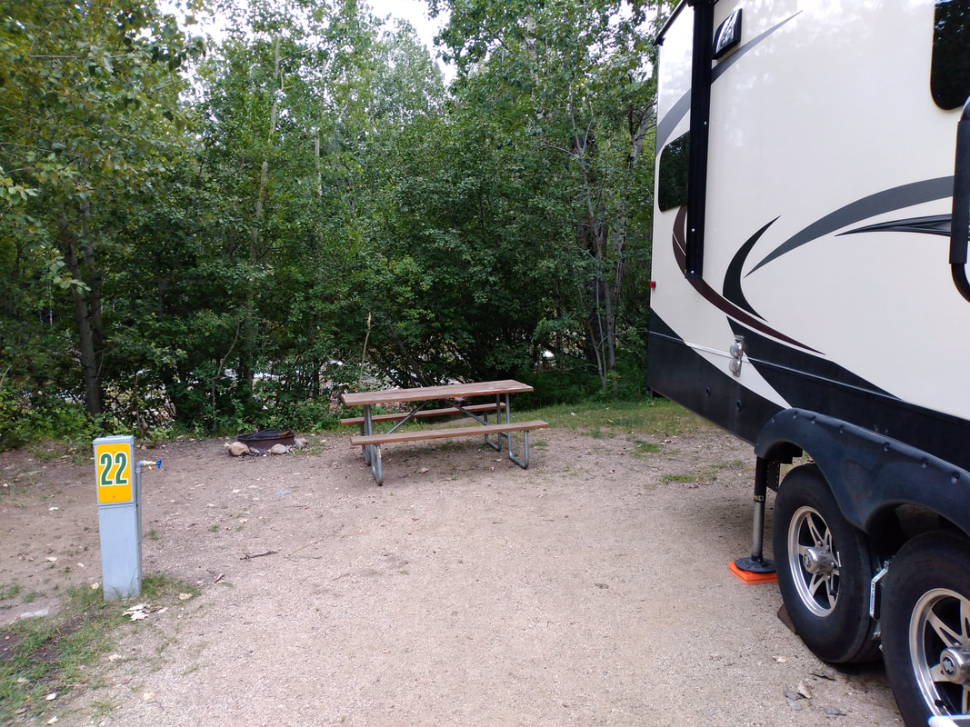
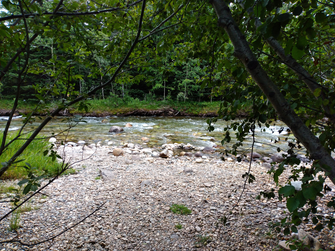
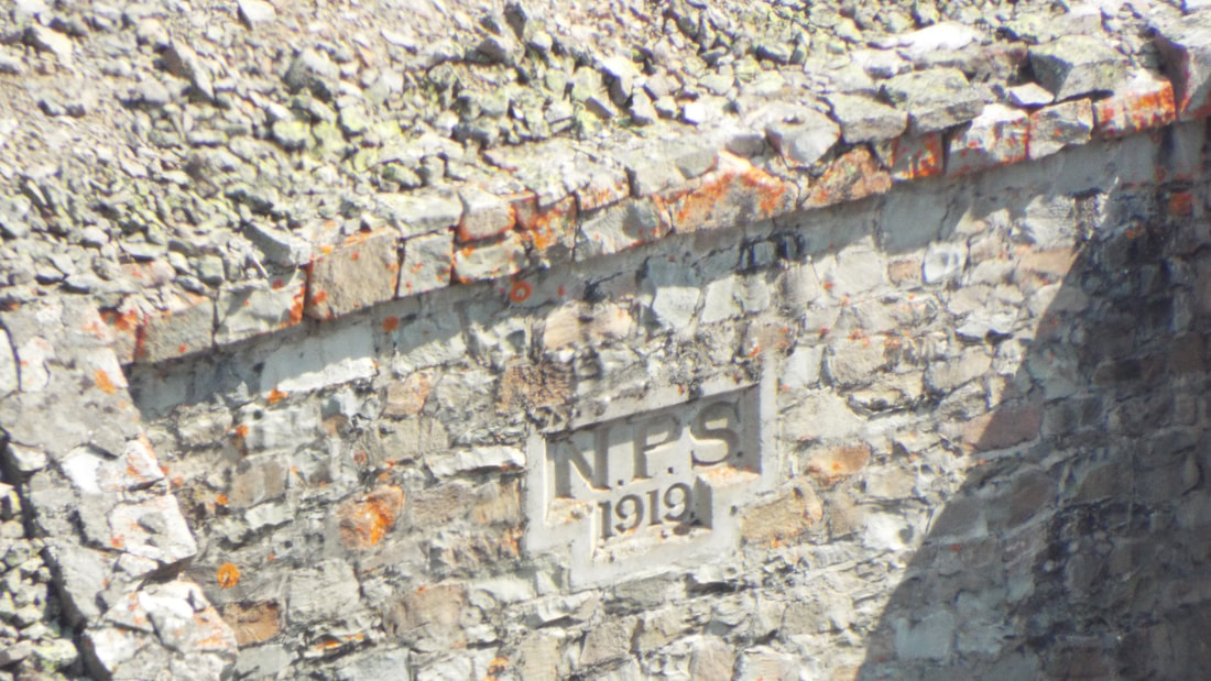
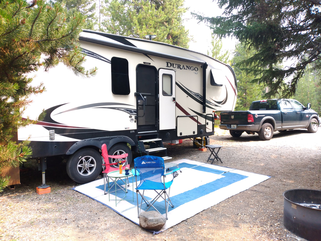
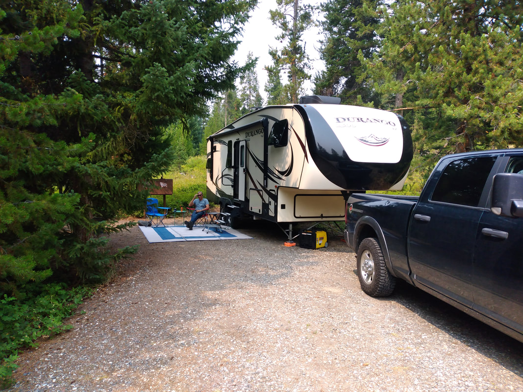
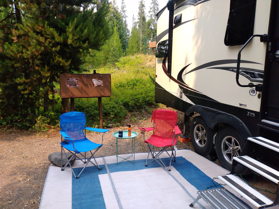
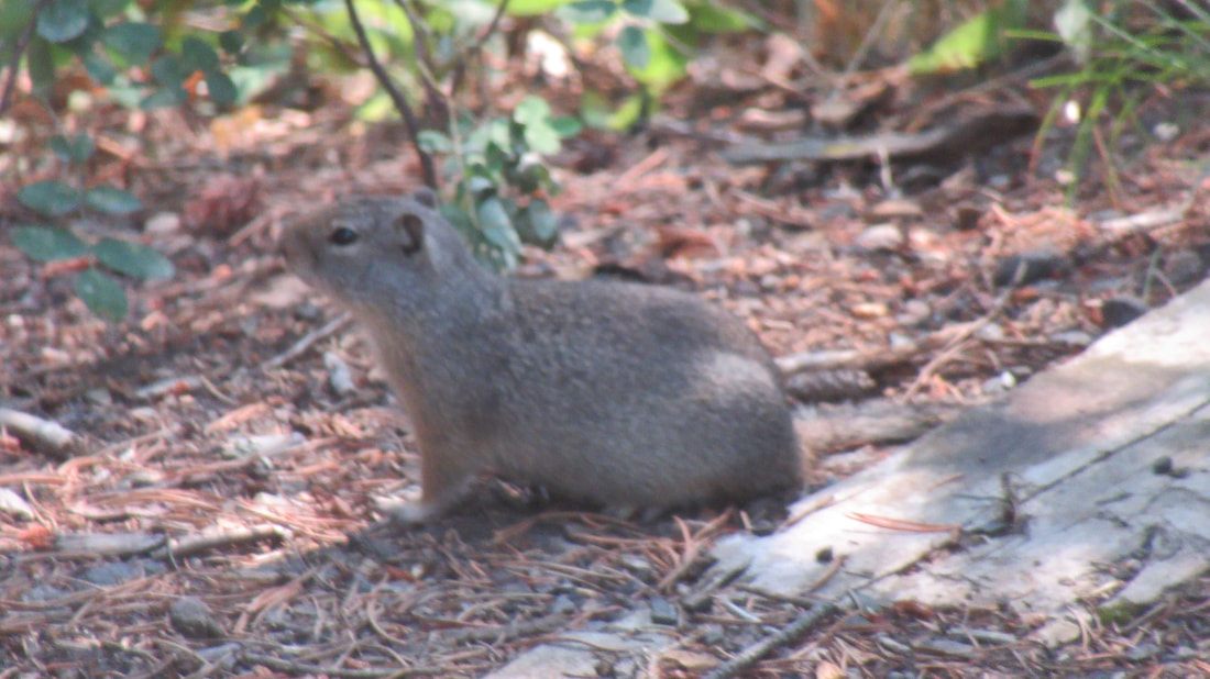
It was a tiring day so we only made two more stops. One at the lake general store because it was the one location we had strong Verizon signal. Two to see a bridge that was part of the original road to the park from the east side. It was built in 1910. Tomorrow we plan to take a few short hikes. We drove up almost to the east entrance to Yellowstone from Cody, Wyoming. The campground is only 3 miles from the park entrance. It is part of the Shoshone National Forest and charges $15 per day with no power or water. Only pit toilets and garbage dumpsters are available. The campground is near the Shoshone river and we hear the river all the time. The sites are well laid out and give 20 or more feet between campers with trees and bushes as buffers. The campground host told us that a bear was seen across the river 3 weeks ago. We will be visiting the East side of Yellowstone for almost a week. There are a few areas in Yellowstone where we will get cell service. When we stop in one of those areas, we will check our email. Otherwise, we get no service at all. Arriving on Thursday, we got the last site available to first-come campers. Site 15 was great. Deep enough for us to fully backing in, was level, and we only have neighboring sites behind and to one side. The other side of the road is the river. Throughout the afternoon and as we approached sunset, there were several rigs that came through looking for a site to stay. 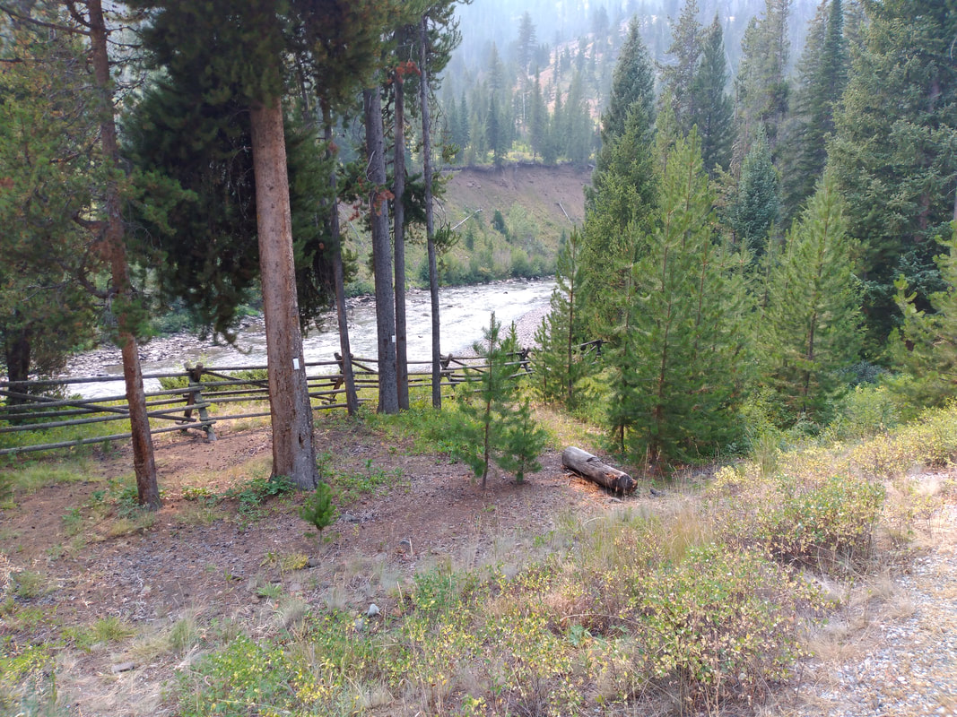 This is a hard sided RV only campground. Bears are known to frequent the area but rarely enter the campground itself. Each site has a bear box to store food if needed though they are primarily used to support campers outdoor grills. I get the impression that the area used to be available to tent campers and that was when the boxes were installed but the rules changed. 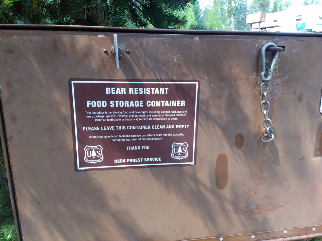 Our site and setup is nice. We even have our spray out in case a bear shows up. 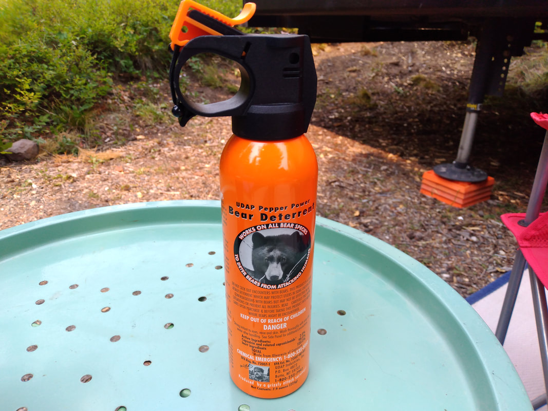 We are getting plenty of sun for our solar panel and it is keeping the batteries charged up through sunset. Our closest neighboring creature is a vole. He was very curious when I whistled for him. |
AuthorWe are a couple who have started on a new adventure... Archives
February 2024
Categories |


 RSS Feed