|
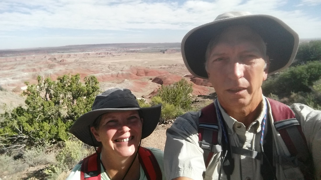
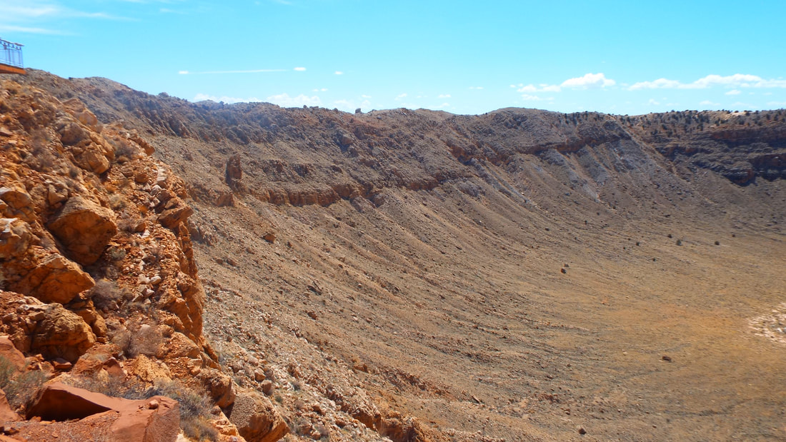
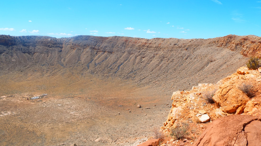
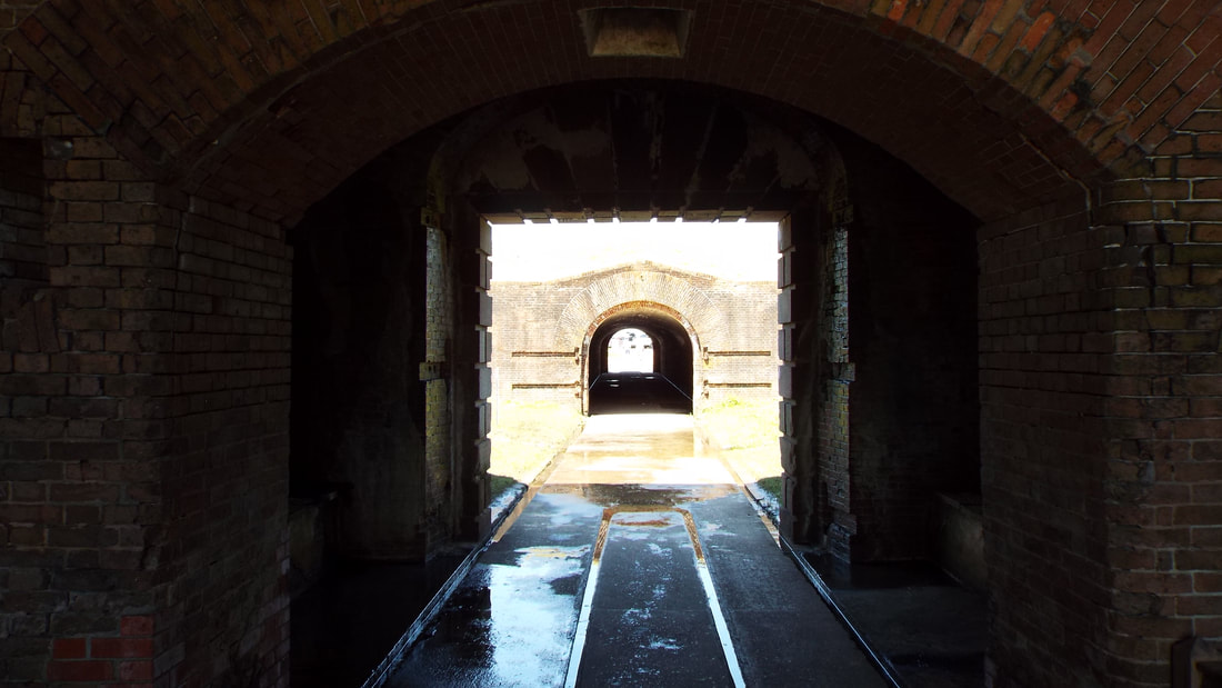
I don't know about everyone else but Meteor Crater was on my bucket list. CHECK! 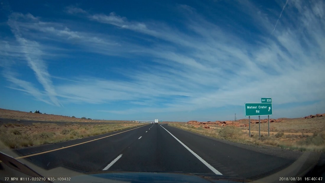  Funny Sign. The crater was amazing. The meteor was only about 150 feet across but when it struck at about 26,000 mph the impact created a 700 foot deep and over 4000 foot across hole in just a few seconds. It exploded into fragments that were scattered for miles in all directions. As our guide put it "We were lucky that the location was so convenient to where the future route 66 and interstate would be located." In the 60's the crater was used for Astronaut training for all of the Apollo moon missions. Mom visited as a little girl before the change in 1968 when the public was no longer allowed to walk all around and into the crater. Now we can only walk on paved paths in an attempt to protect the crater from erosion. 
0 Comments
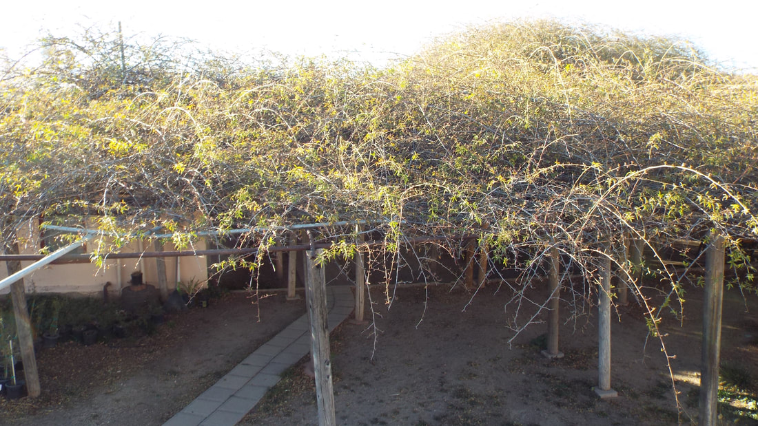
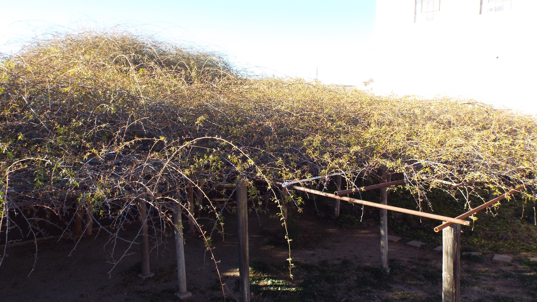
Homolovi State Park is the site of 2 Hopi Indian villages. Our plan is to visit both while we are here. The nearest town is Winslow, Arizona. If that sounds familiar then you like some of the same music we do. The Eagles released a song "Take it easy" in which the town is mentioned. We will be visiting the tribute corner too. Here is the view from our door. Pretty great!  The first sunset here was nice. Trying for a selfie with the sunset in the background. With and without the flash.
We started today with the plan to take another "Off the beaten path" hike and then to see the Petroglyphs and ruins in the park.
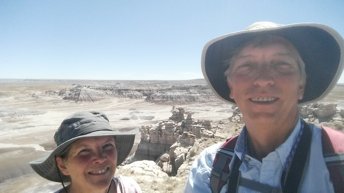
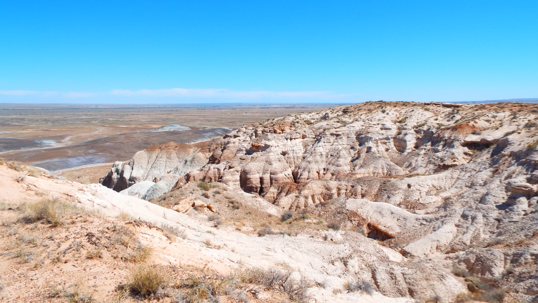
The hike is called the Billings Gap overlook trail and is 2.3 miles along the mesa rim.
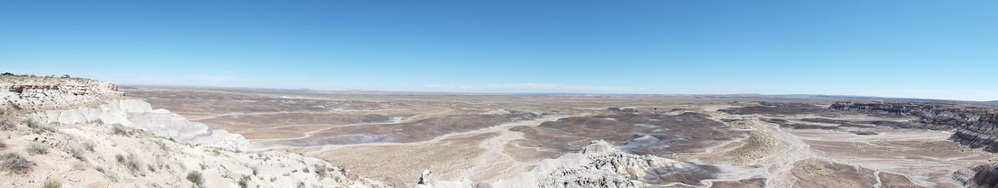
The views along the hike were spectacular.
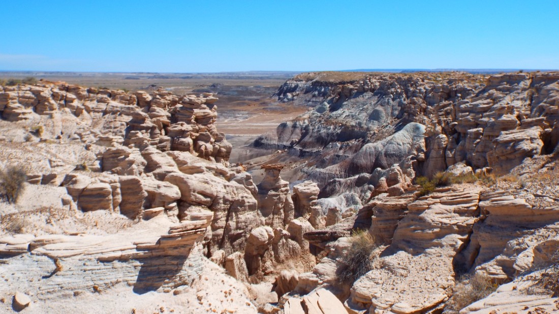
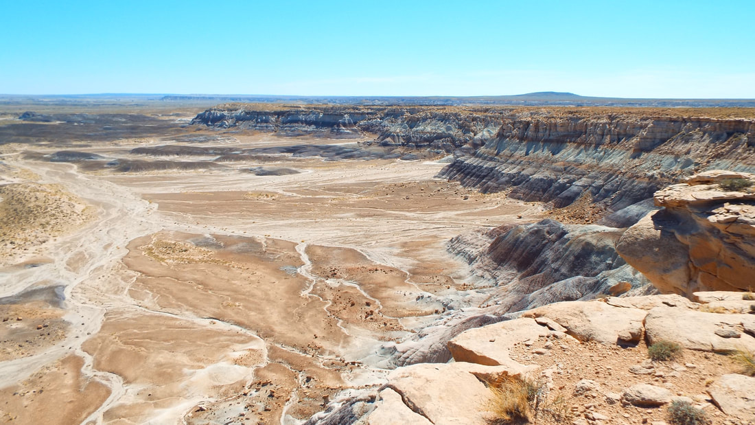
Next, we hiked the Blue Mesa Trail a 1 mile loop down into the canyon and back to the top.
The next stop was Rio Puerco a Pueblo indian settlement dated to around 1250 to 1380 AD. About 200 people lived in the settlement. Most of the ruins are buried but there are some walls that can be seen. Also they left a lot of Petroglyphs on rocks in the area.
Last stop was Newspaper rock. No kidding, this was a place that a lot messages were passed by making Petroglyphs that other travelers could "read".
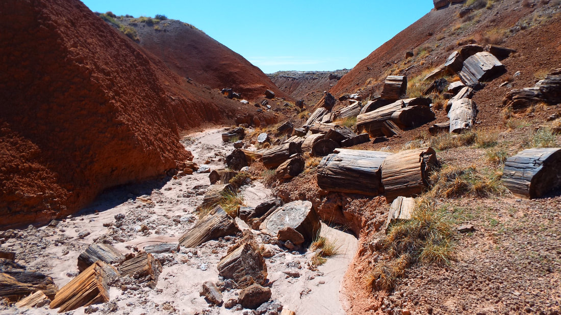
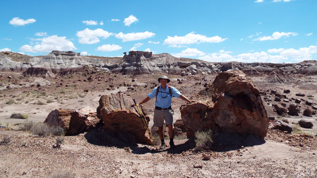
Today we hike into the wilderness to see the Onyx Bridge.
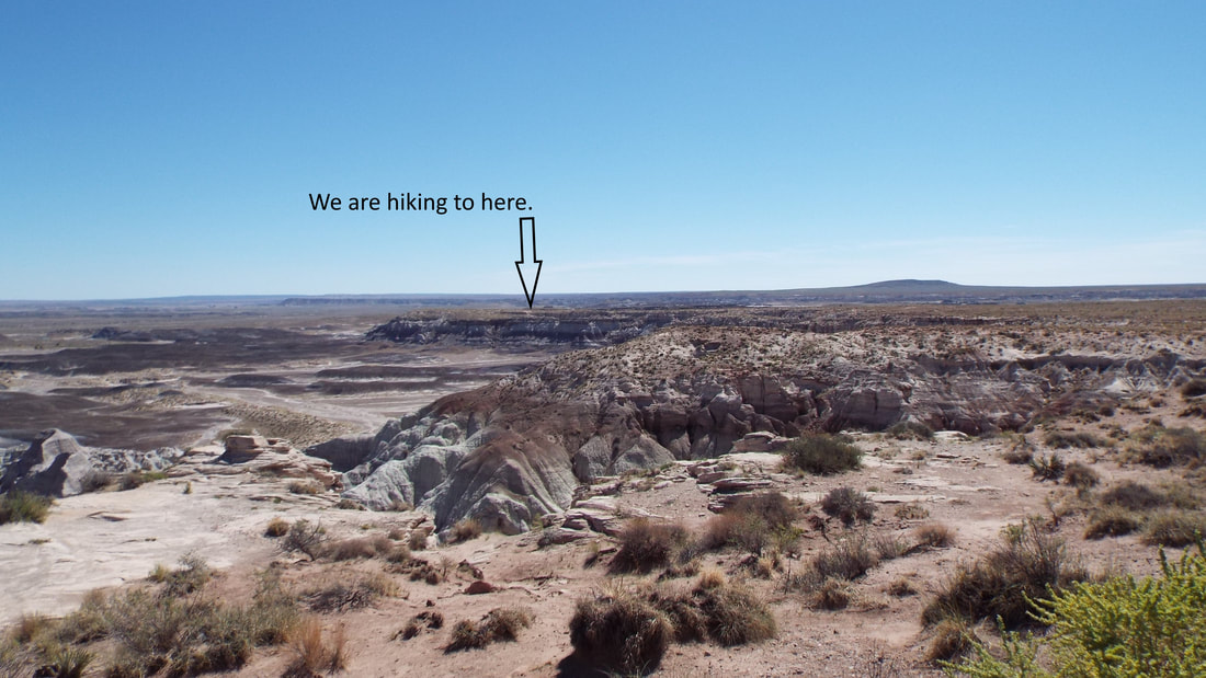
Today, the plan is to hike another "Off the beaten path" hikes. This one is about 4 miles round trip down a mesa, across the open "wilderness" area and washes, and up to an Onyx bridge. The bridge is actually a large petrified log across a wash. It should be a neat hike. Almost all of the hike is unmarked and requires the use of a compass and observing landmarks. Of course, we have our plan, backup plan, emergency plan, and our emergency backup plan just in case.
This is our view before starting the hike. Far out in the distance is our destination just about in the very center of the picture. Yes, it is a bit of a hike.
At the mid way point, it was surprising how far away we are from the starting point.
Yep, it looks like a wilderness.

We reached our turn from the open area to the wash where we will find the bridge. We are surrounded by petrified wood.
Hike up on the ridge and almost there.
Wow!
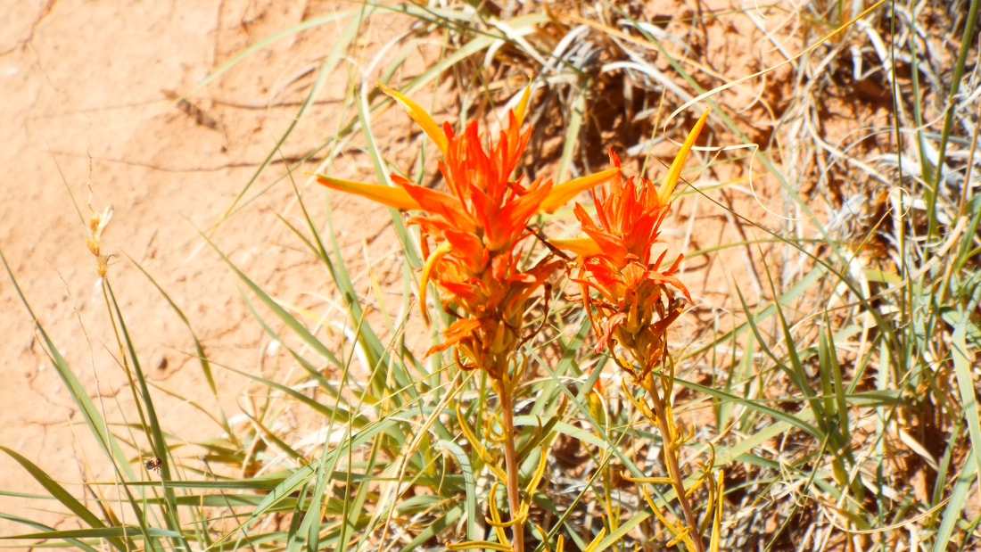
There were not many flowers but the ones I found were amazing.
We stopped at the “Painted Desert Inn” after our hike. It was built in the 1920s as a small inn, cafe, and soda fountain. Originally, it was named the "Stone Tree House". It was built using the local resources. Petrified wood! No kidding. They used petrified wood as the rock and then covered that with mud.
The Fred Harvey company took over management in the 1950's and had "Harvey Girls" oversee the property and work the cafe.
Inside, the building is restored and very nice. The cafe was restored and had the original menus. Several walls had murals painted by native american artists.
We ended the day with ice cream from the soda fountain looking out over the painted desert.
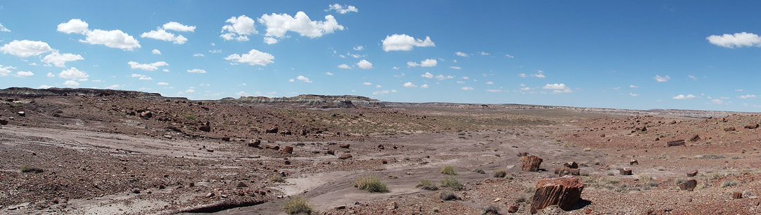
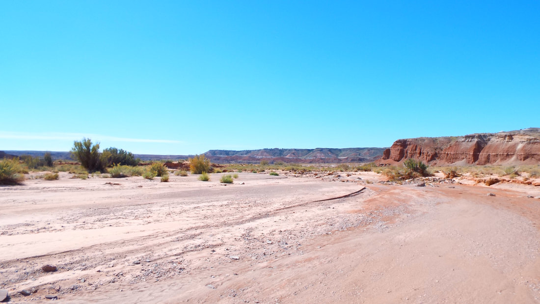
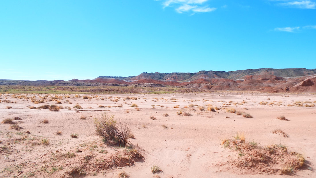
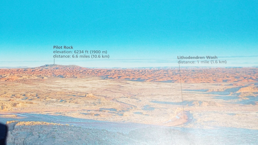
Today we started our visits to the Painted Desert and Petrified Forest National Park.
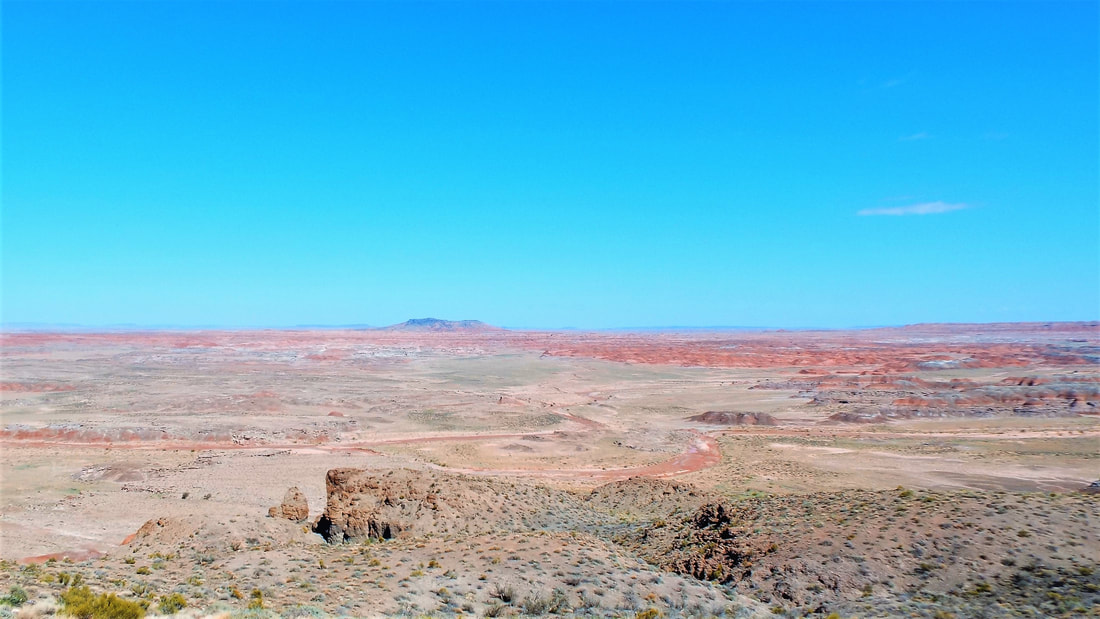
We took a 2.1 mile hike along the rim and you can see a very long way from here.
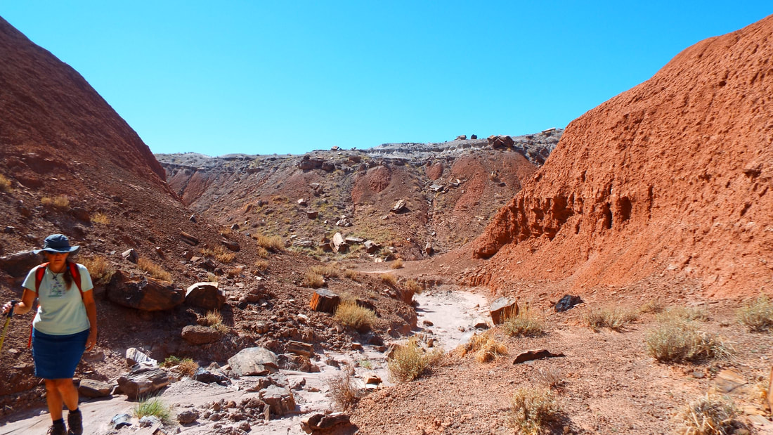
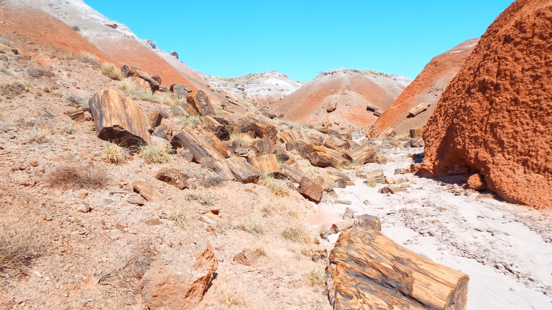
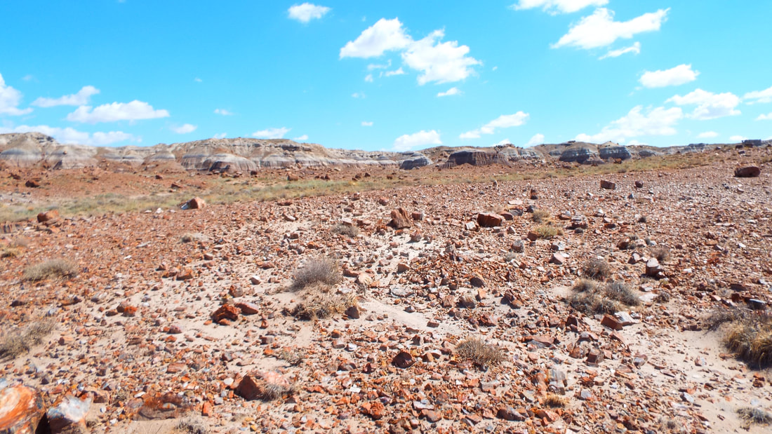
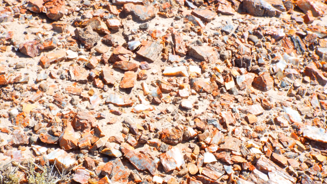
We drove on to our hike for the day which is one of the "Off the Beaten Path Hikes" in this park. The Jasper Forest trail which for us was 2.9 miles and a change in elevation of 187 feet. Part of the trail is the old CCC road built in the 1930’s for people to see a formation called the Eagle's Nest. The formation fell in 1941 and the road was abandoned after that. We loved the hike because it was right through the petrified wood which was everywhere.
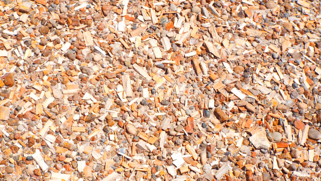
There were large areas with shards of petrified wood.
When I first glanced it looked like someone had spread a bag of wood chips across the ground, but it was all petrified wood which means it feels like rock.
Continuing we found piles and some very interesting logs.
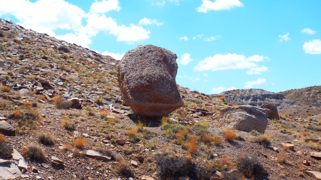
Someday these rocks are going to roll. I bet each is as heavy as our truck and just balanced on a sand pedestals that will fail at some point.
Time to head back to the truck.
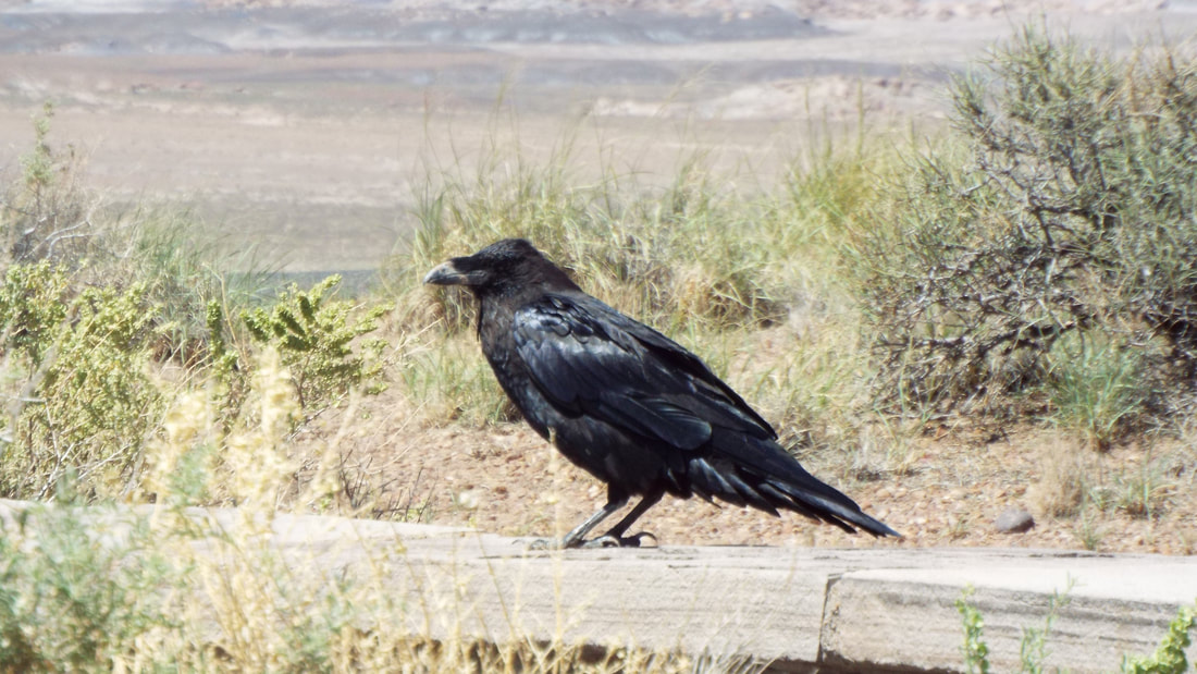
This guy was waiting on the rail near the truck. The ravens out here are HUGE! He is over a foot tall and a wing span of at least 3 feet.
Before leaving the park for the day, we made two more stops.
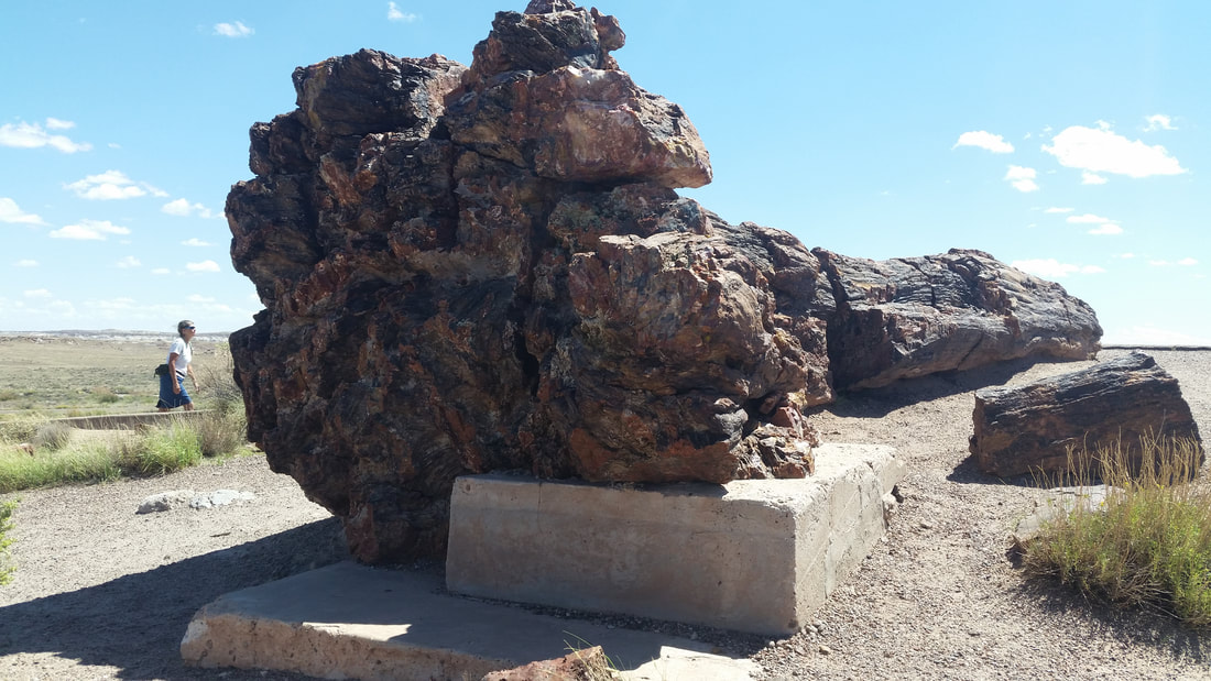
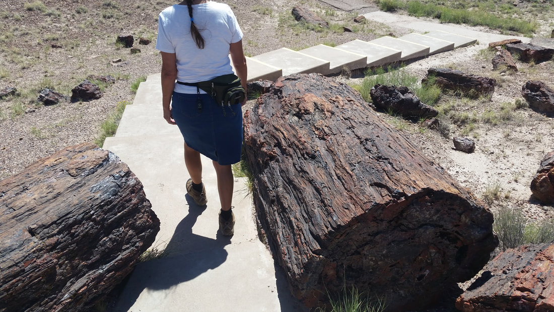
The first was the Crystal Forest trail which is a 9/10s of a mile paved path around some very large petrified logs.
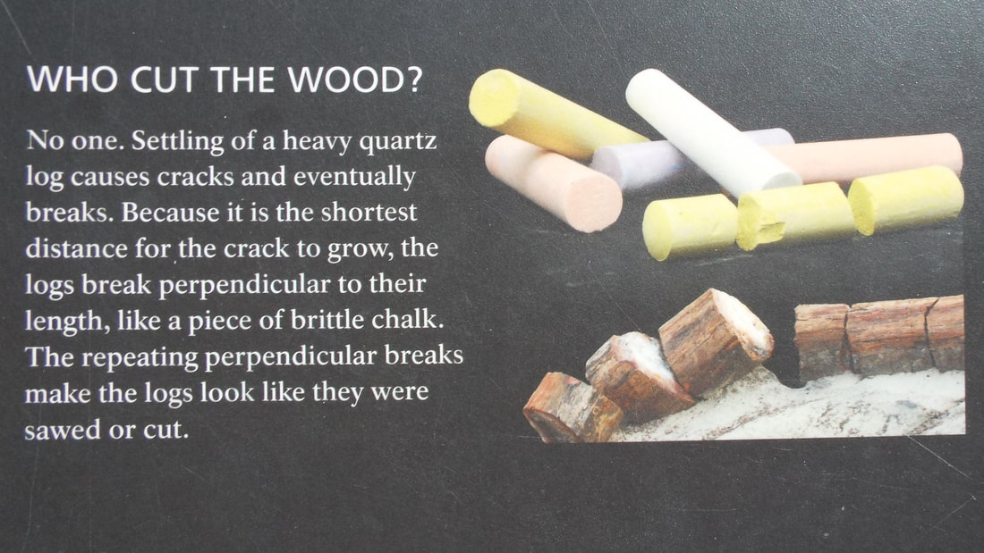
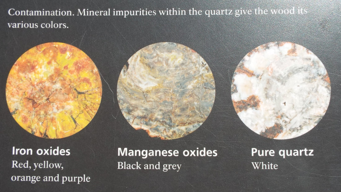
This explains the way the logs are broken over time and the different colors.
Then a quick stop at the visitor center at the other end of the park before heading back to the RV.
They do have some impressive logs here also.
The total of our hikes for today was 6 miles. " A good stretch of the legs", according to the movie "The Quiet Man" with John Wayne and Maureen O'Hara, a favorite movie of ours.
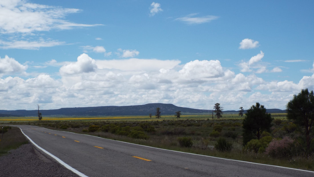
Today we leave New Mexico and head into Arizona. This will be the first time I have ever been in Arizona and Shawna was last here as a small child.
First we have to get out of the Bluewater State Park. It is a bit of a haul out to cross the mountain between there and the interstate.
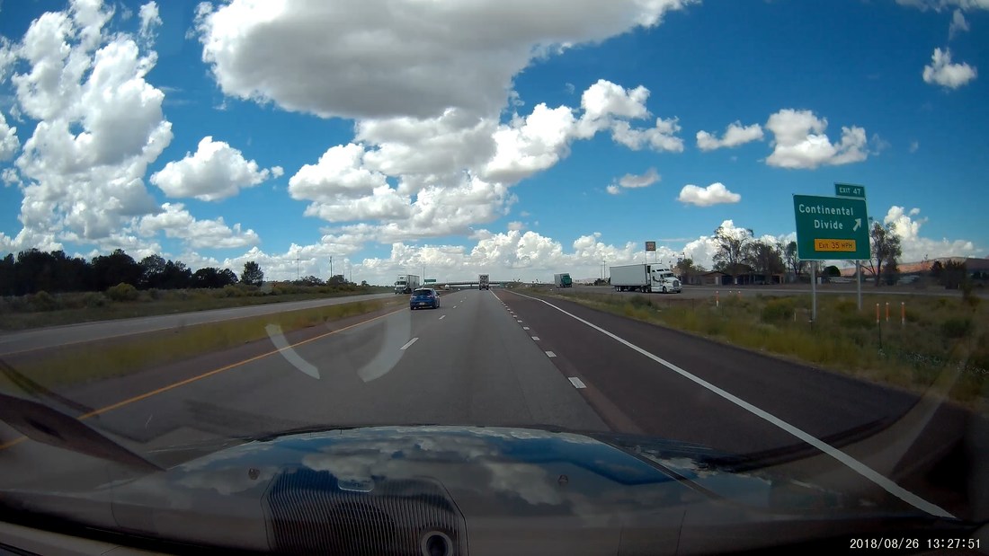
We also had another milestone of crossing the Continental Divide.
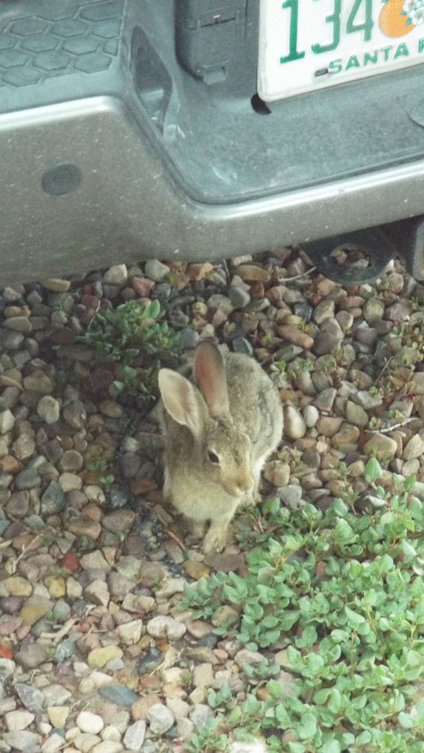
The next stop is near the Petrified Forest National Park and the Painted Desert. After we got set up just west of the park we had a little visitor.
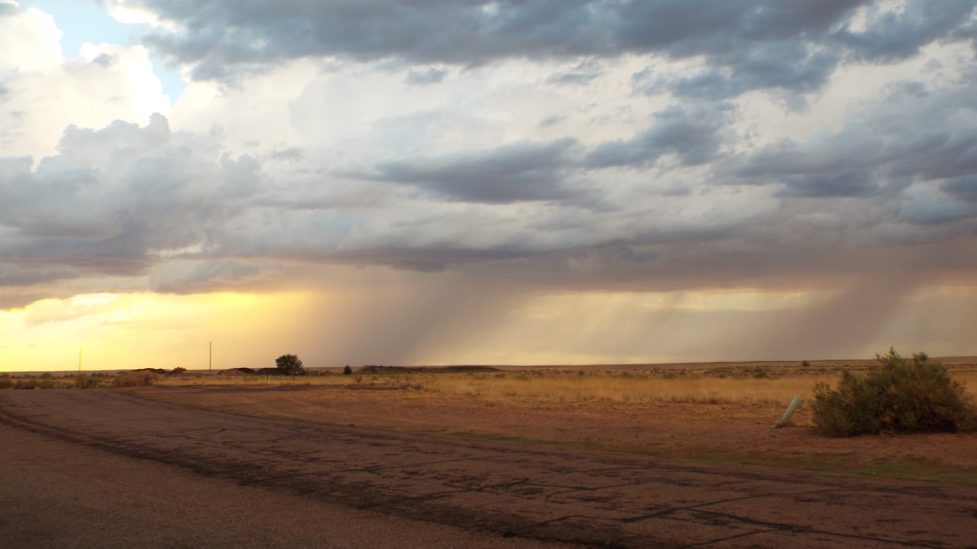
We did not get wet but all around us were storms on the horizon.
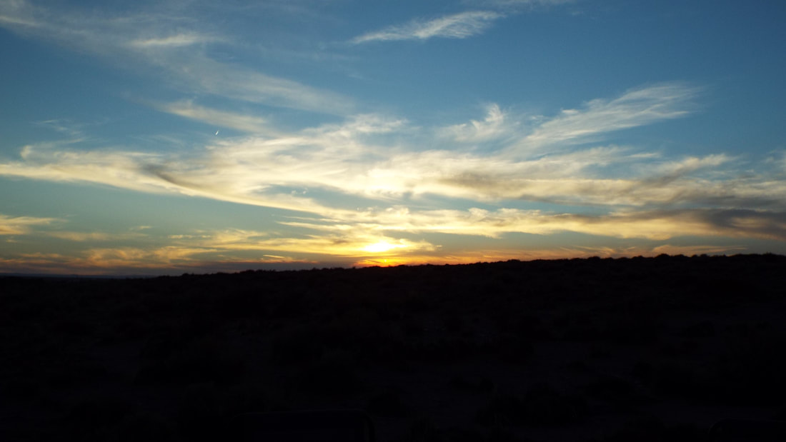
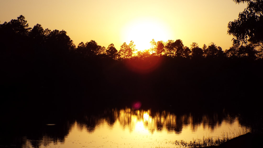
We had a pretty sunset to end the day.
Off for more hikes. Yea, I know gluttons for punishment, but we like to hike and there are some neat things to see near here.
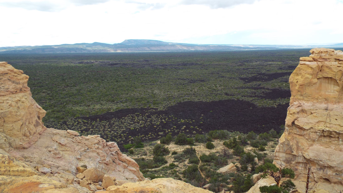
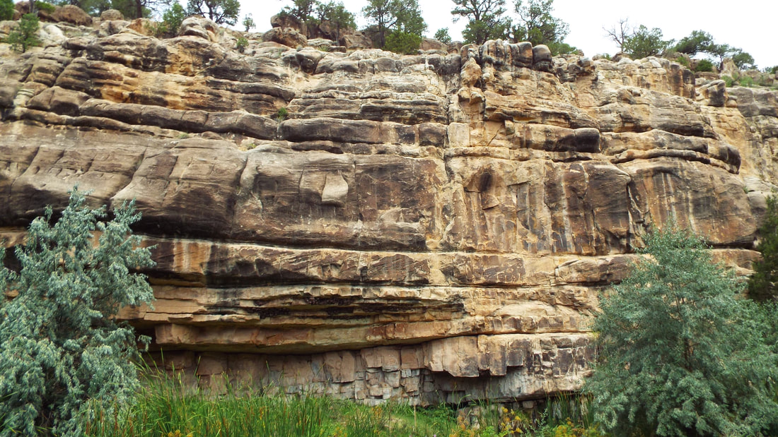
We drove to El Malpais National Monument and decided to continue through the park to the last trail first and come back toward the visitor center as we stopped for each area. Lava Falls was a 1.1 mile hike on the lava flow. So cool! The markers for the trail were cairns (2 foot or taller stacks of lava rocks) from the first few feet of the trail to the end, we followed them to hiked over the lava field. Much of the way, we were stepping over huge cracks that extended 100’s of feet long, 20 or more feet deep, but only a short hop across. All were under 2 feet wide. We are both very glad we bought good boots to protect our feet. The lava was sharp in some places. Hawaiians call that A’a. Maybe from the sound people would make it they walked on it. Ah Ah ah ah… Maybe it should have been called Ow Ow ow ow… ?
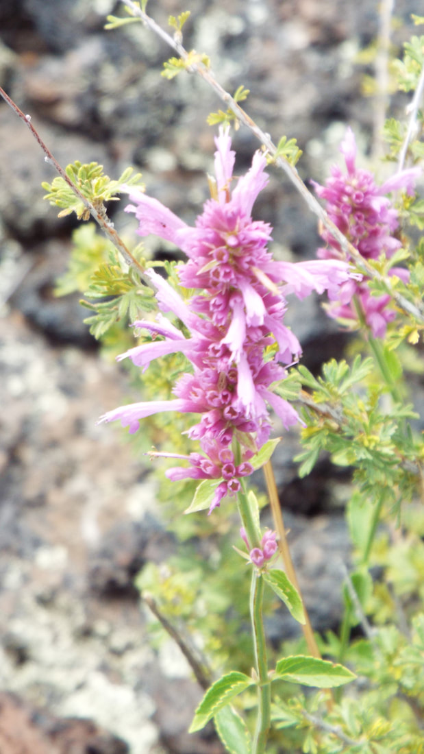
The plants struggle to live on the lava.There are really pretty flowers blooming.
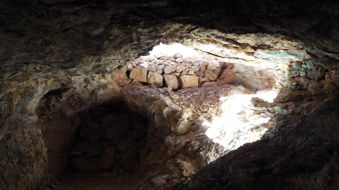
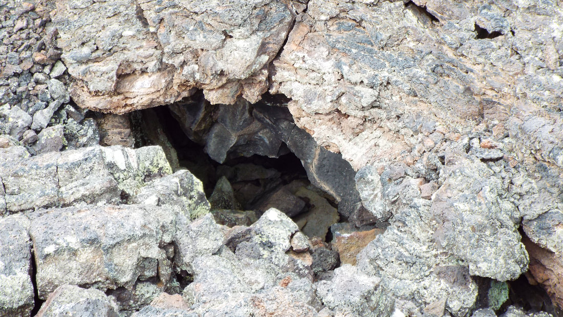
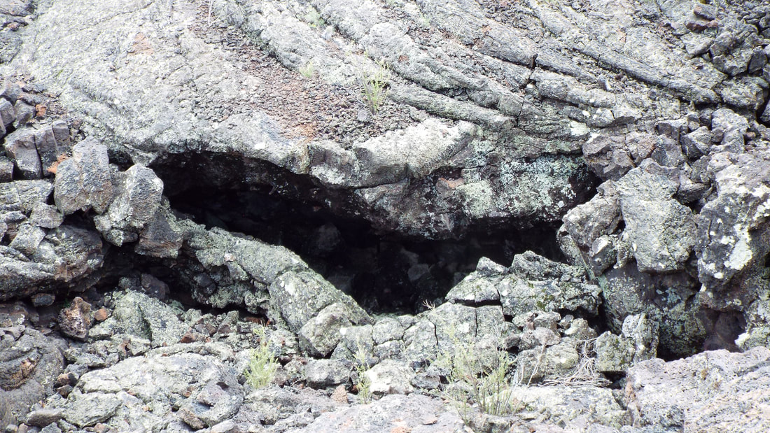
The lava tube openings were everywhere.
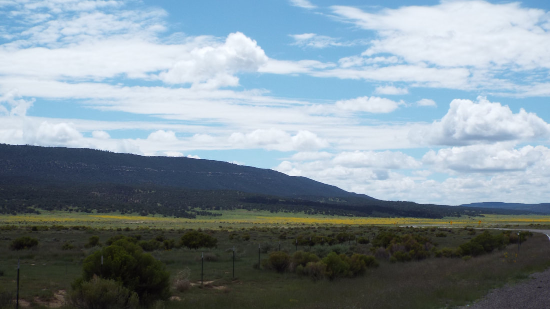
After the lava trail, we drove on to our next hike. The valley we passed through had acres of yellow wild flowers. The pictures do not do it justice.
We also got a picture of the rim we were about to hike up.
The Narrows Rim Trail is over 4.1 miles in total length. We hiked the first mile and were satisfied with the views we got.
So our total hike on that trail was 2.1 miles and an elevation gain of 220 feet. (The Alltrails app is great). It took us 1 hour and 24 minutes. The main reason we stopped short was the weather. We could see rain coming and did not want to miss the last hike we had planned.
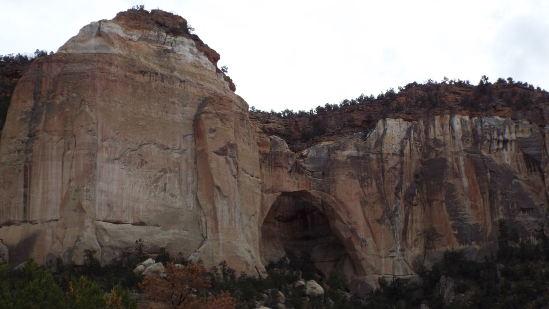
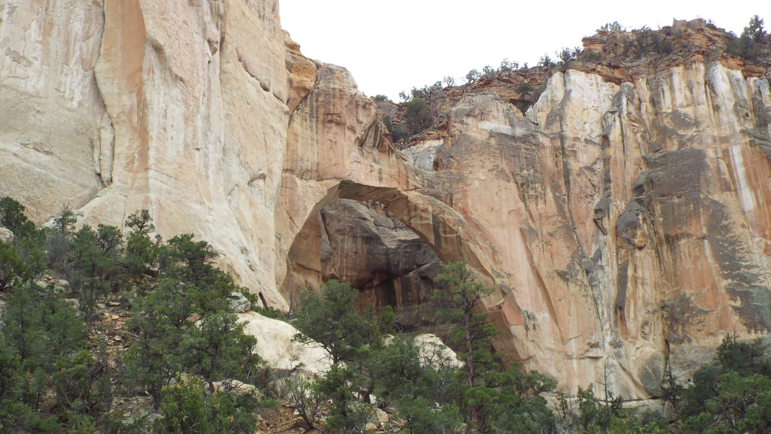
Next was the La Ventana Natural Arch.
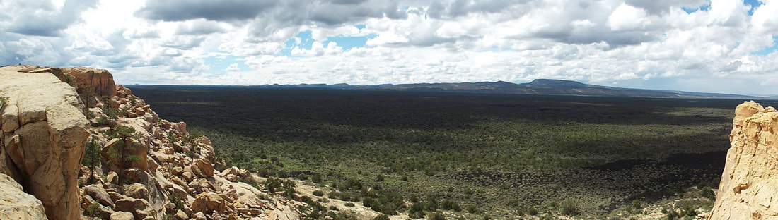
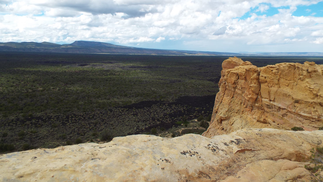
The Sandstone bluffs was our last stop. We drove up to the top and were able walk out to look over the valley below. This was a huge lava field.
When we got back to the campground, I decided to stop and take a picture of the Electric Vehicle charging stations. Jonathan, they even have them here at Bluewater Lake State Park.
We woke to a chilly morning. The temperature in the RV was 68 but outside it was about 50. At 7500 feet elevation, the air is thinner and cooler. It was a nice feeling after so much heat in northeast New Mexico.
Today we hiked the trails at the park. 
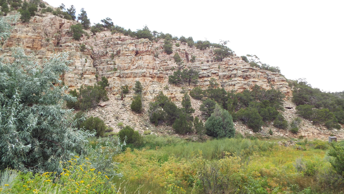
Dam overlook trail plus Lower dam trail plus the Canyon side trail. The trail led us up to the dam overlook. Down the canyon on switchbacks in the trail to the bottom. Then along stream at the bottom to the dam. We left the park for a while as we approached the dam. It seems that a marker we passed was the edge of the State Park, but we just kept going along the trail till we reached the dam. We walked up to the spillway on the back side of the dam on the lower trail.
We were able to see lots of flowers, hummingbirds, a huge blue heron, red squirrels, many different birds, crawfish, and lots of small bees collecting pollen. We saw signs of the wild horses, but they did not show themselves. There were also a lot of deer tracks. Exhausting but great hike.
Along the stream there were many wild flowers and cattails.
Chipmunks and Red Squirrels were in the trees. Several kinds of birds in the valley including hummingbirds, a big Blue Heron and Mud-dobbers working on their nests. There were also crawdads in the stream. I suspect that was what the Heron was eating.
We got to see some great views of the dam from below and in the canyon.
I try to scare away anything that slithers, but I missed a 1-foot garter snake on the trail which gave Shawna a surprise.
Then we hiked back up from the canyon to the campground. 
A total of 4.1 miles an elevation change of 318 feet down and back up from the canyon. Alltrails recorded our hike.
Back to the RV to have lunch, relax, and rest our feet.
 We arrived after a long drive from Sumner Lake State Park. The drive was broken up by stopping for lunch for about 30 minutes and a fuel stop an hour later. We got in the 5th wheel and used the over head vent to pull the hot air out while we had lunch. We relaxed and even read a book.
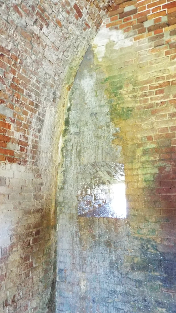
We passed through the Pueblo Indian reservation after Albuquerque. Of course, on both ends of the reservation they had a casino. No sense letting people drive through without giving them an opportunity to fund the tribe. 😉 The drive into the park was “interesting”. Right after leaving the interstate we passed over a cattle guard. The entire area is open range. The road has some steep drops and rises with a few hard switchbacks. The truck did fine bringing us into the park. We are now at 7500 feet in elevation. The air is cool and expected to stay below 75 during our stay. It was so cool during the day and 50 degrees at night that we did not have to use our AC at all. There is a pretty lake that is stocked with rainbow trout, catfish and tiger muskie. A herd of wild horses lives on the property and we hope to see them. They are protected by the Navajo tribe. There are several trails that we can hike. It is very quiet and peaceful. We were able to get one of the last "first come first serve" electric spots. This park has only 35 sites with 30 amp electric. You must fill your water tank up before going to your site. There is no water connections at the sites. The 70 other sites do not have anything but a fire ring and picnic tables. Many had their generators for supplying their own electricity as needed. We decided to stay and extra day here. The park is great and very quiet. We went fishing in the morning. The fish were annoyed but not impressed with our lures. They did tease us by splashing the water every few minutes. After the fishing we decided to go to the Fort. Fort Sumner was used by the government from 1863 to 1868 to oversee the 1,000,000 acre reservation for the Mescalero Apache and Navajo Indians held there. The two tribes were kept separated. The larger group of over 10,000 Navajo were on the same side of the river as the fort. The smaller group of under 900 Apache on the other side. After a few years the Apache decided they would escape and left 9 braves to keep fires burning to fool the troops. The rest of the tribe split up and most were able to escape capture. In 1868 the government released the Navajo and closed the fort. Two years later much of the land and all the buildings were sold to the Maxwell family. The same year 1870s Maxwell's son became friends with Billy the Kid, and it was in the Maxwell house that Billy was killed by Pat Garrett. Billy the Kid is buried in the old military cemetery the Fort. The grave is, ironically, surrounded by what looks like a jail cell. It was placed around the grave to prevent it from being desecrated. The turkeys came to visit again tonight. Tomorrow we leave here for BlueWater State Park which is in the far west side of New Mexico. We are only supposed to have Verizon so call Mom's phone if you need to get to us. I don't think we will have any internet so no posts until we move further west.
|
AuthorWe are a couple who have started on a new adventure... Archives
February 2024
Categories |


 RSS Feed