|
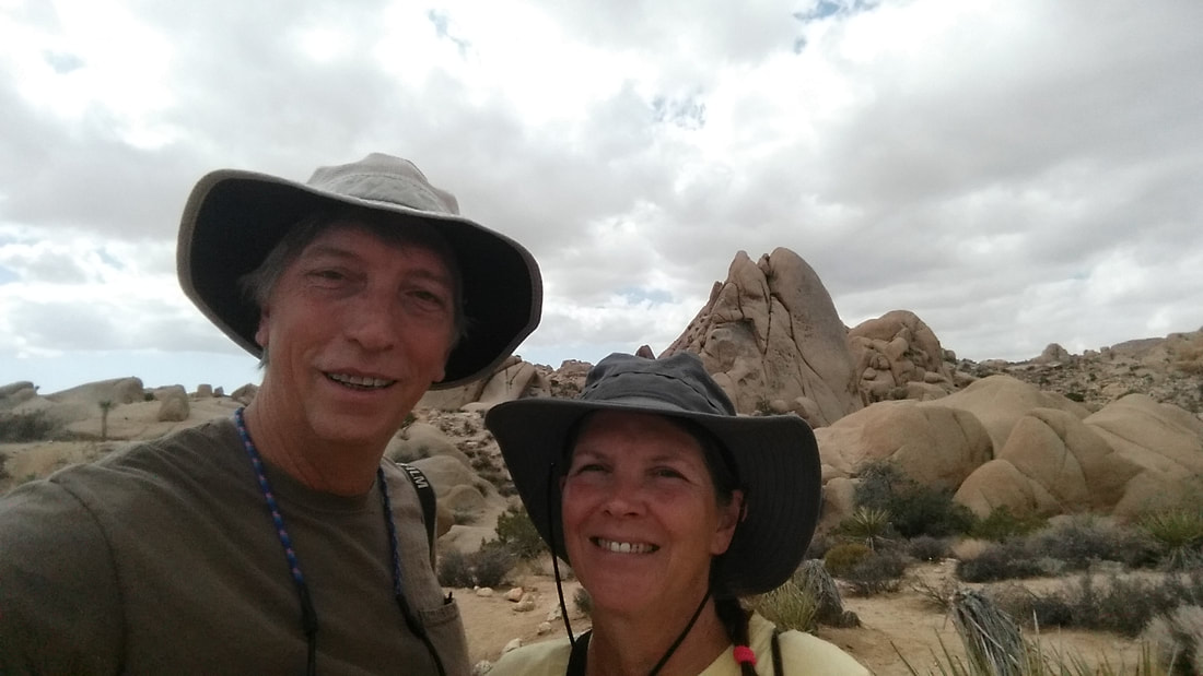
We are really enjoying our visit with Bill and Kelly. There has been lots of talking, playing cards, and beautiful sunsets. 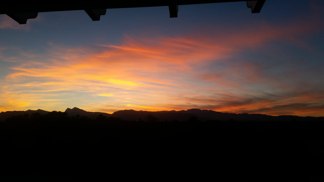 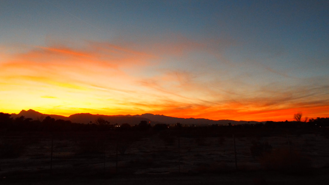 There are several cactus in their backyard and some are blooming. The blooms are very large. The bloom pods before they open look really strange like something from a SciFi movie.
0 Comments
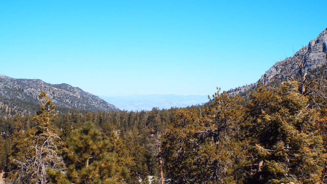
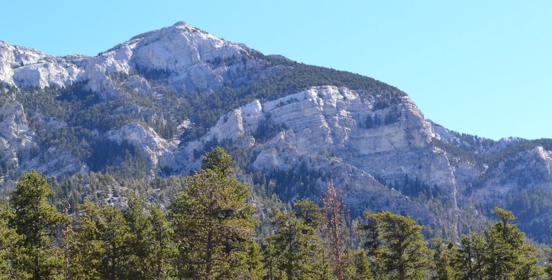
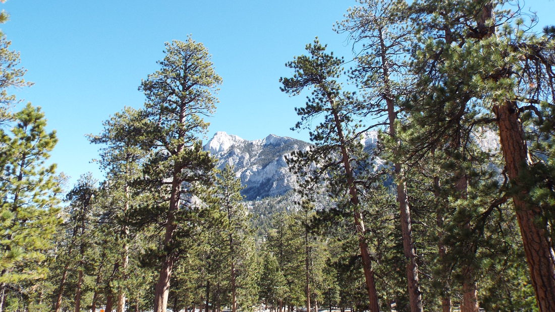
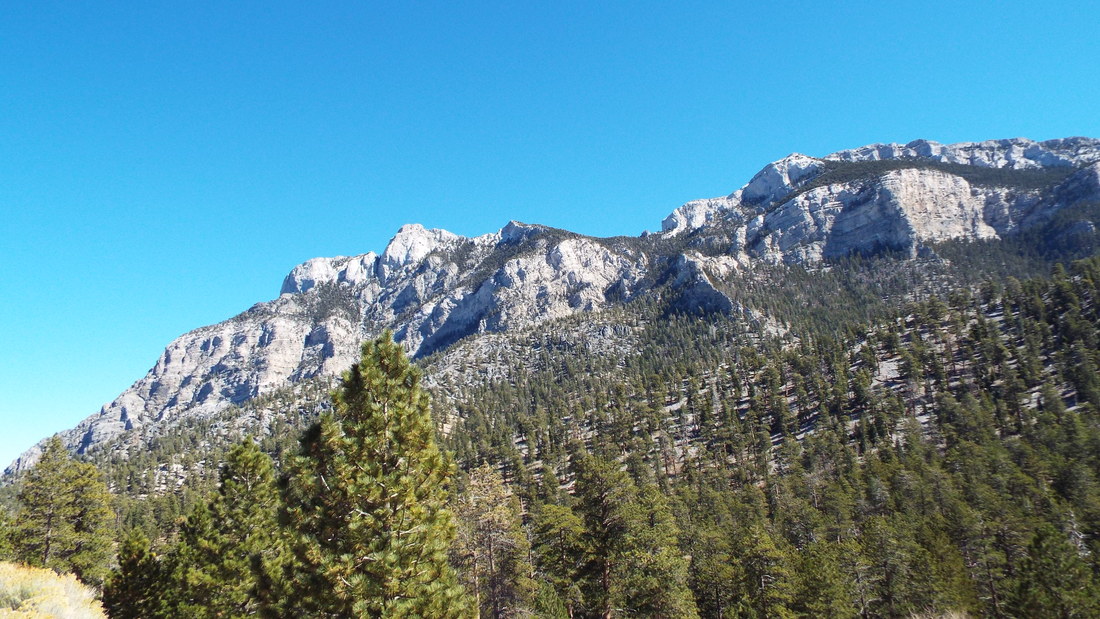
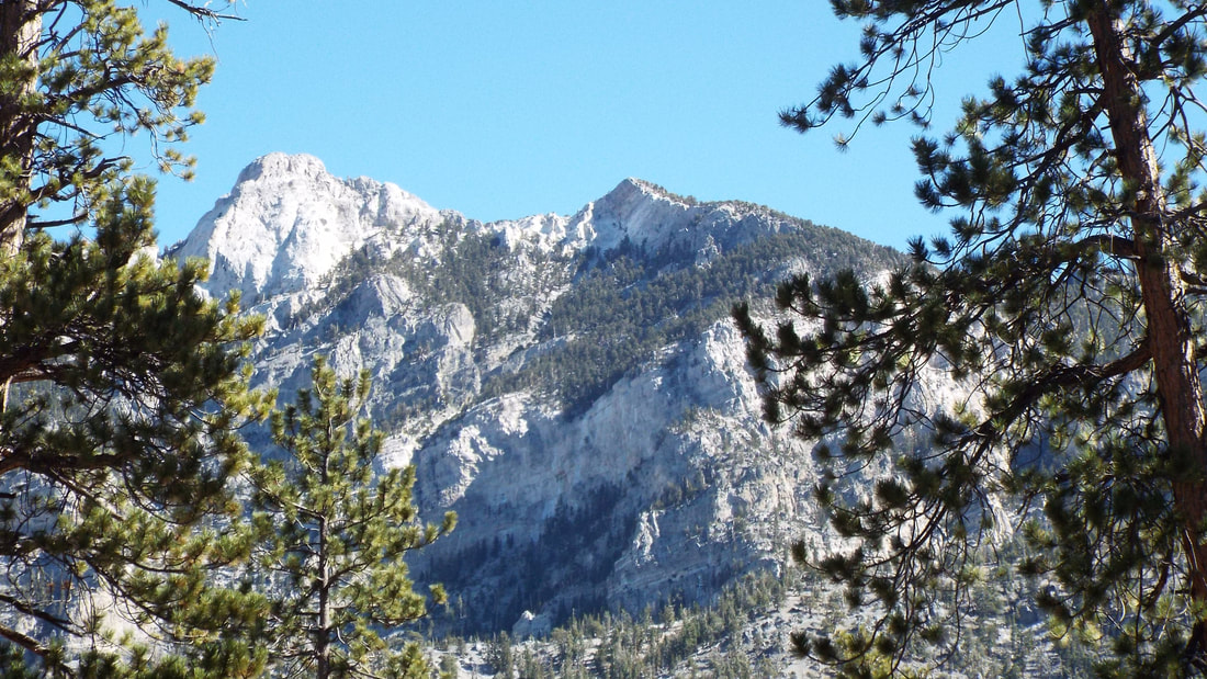
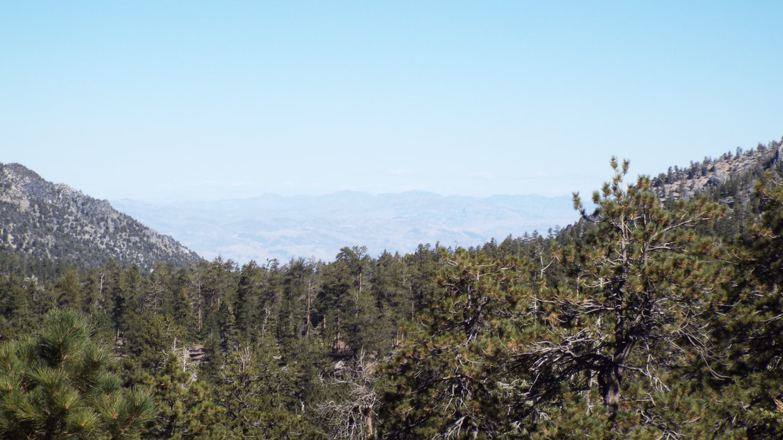
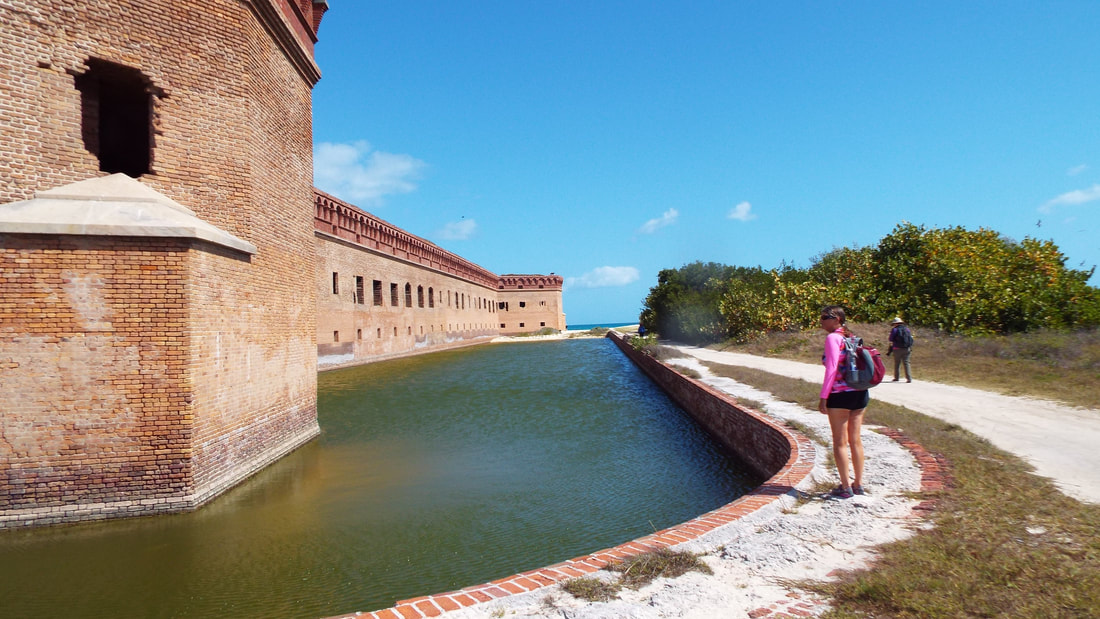
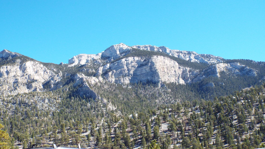
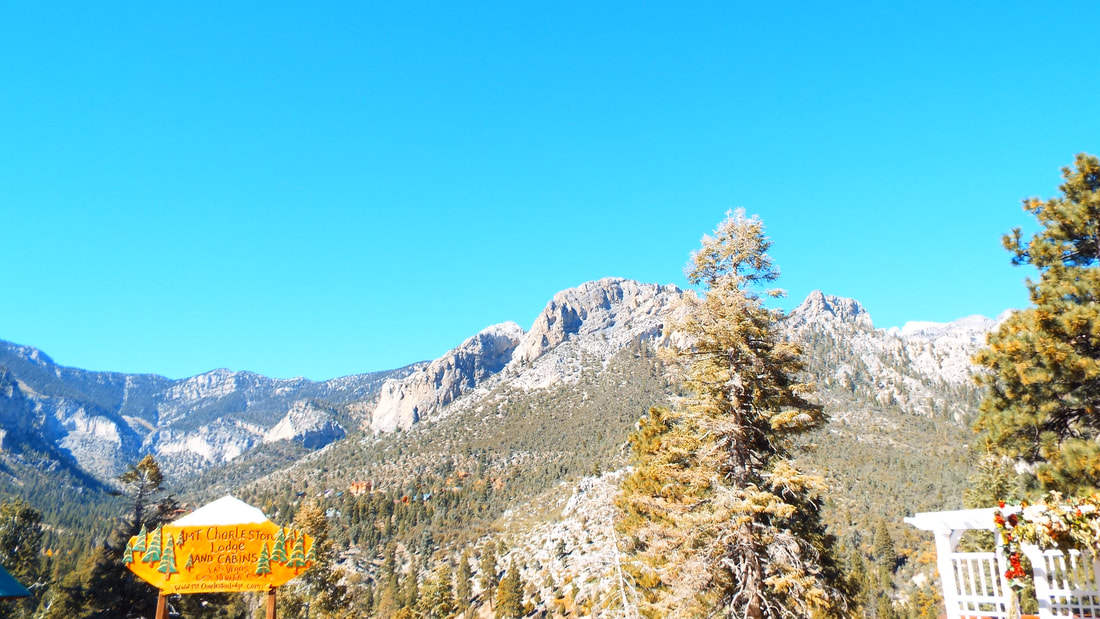
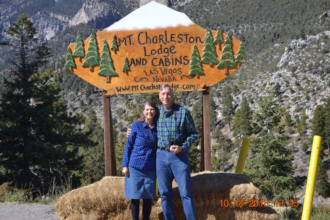
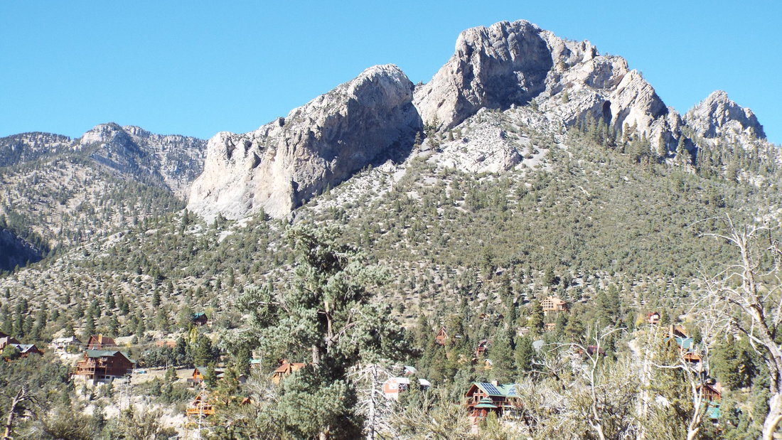
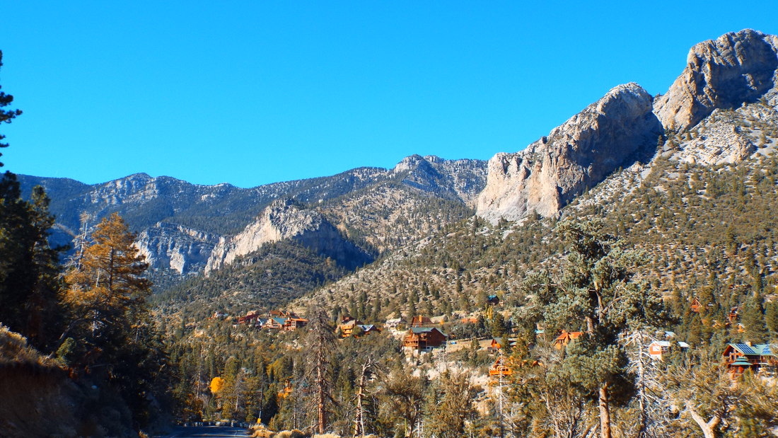
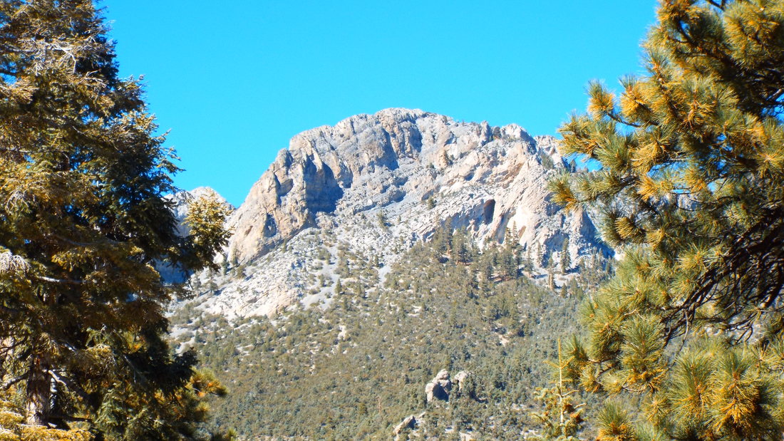
Pahrump is a city to the west of Las Vegas. The name is from a native american word that means "Water Rock" and was given that because of natural springs. Though recently it is known for having places for the oldest profession. We traveled there to have lunch and visit the winery. The Symphony Restaurant has a nice environment for dining and the food was very good. Originally the Pahrump Valley Winery was somewhat alone on the outskirts of town but today it is almost surrounded by homes. The tasting was free and we ended up buying 3 bottles of wine. We are having a blast with our friends. Here are a few pictures. We decided to go up to Mount Charleston. It is the highest mountain near Las Vegas but we were only able to drive to just over 8,000 feet. For lunch we stopped at the Mt Charleston Lodge, it was great with fantastic views of the mountains. Mount Charleston peak is 11,916 ft Griffith Peak is 11,060 feet. Cockscomb Ridge 9,600 feet Our first stop was a meadow. We hoped to see some of the wild horses or donkeys that live in the park. We could see plenty of evidence they had been there recently. On our next stop, this little guy was having lunch near the parking lot. The view down into the valley was not easy to capture on the camera. The next stop we walked a short way to a desert overlook. 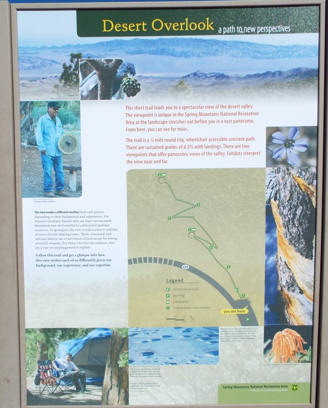   One surprise was the notation on a sign that showed us the location of Jackass Flats which was one of the places that Pappy (Tommy) worked. 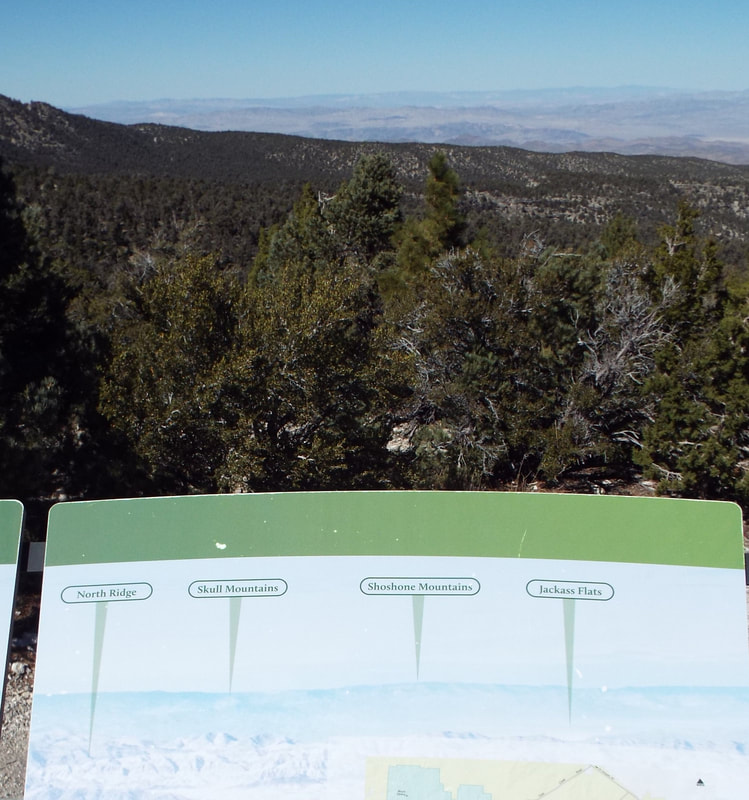 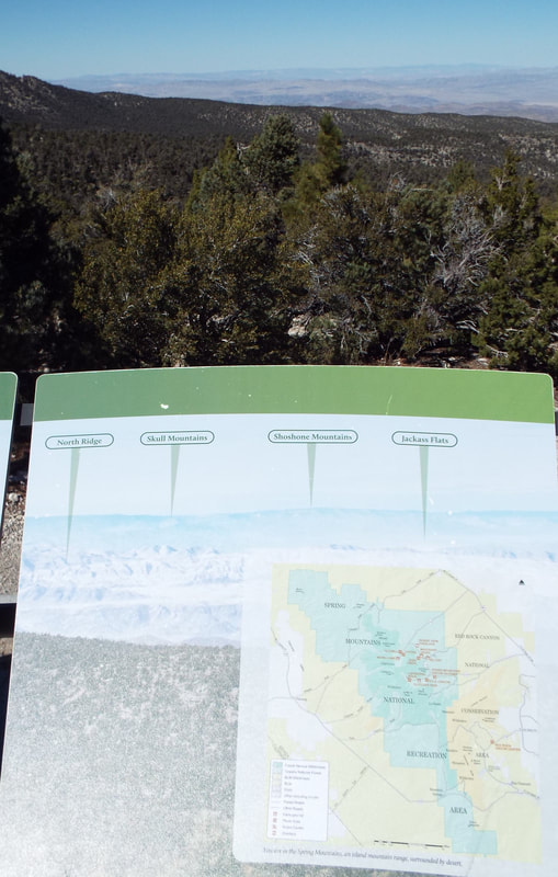  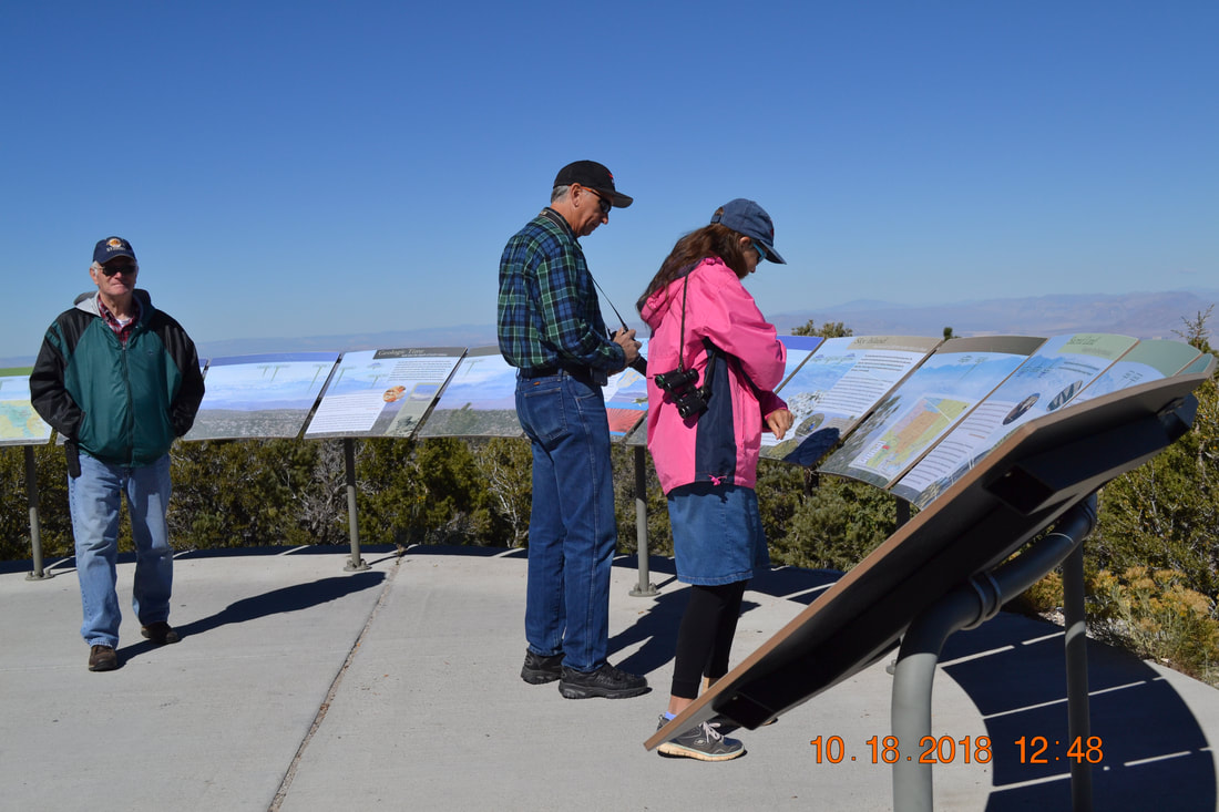 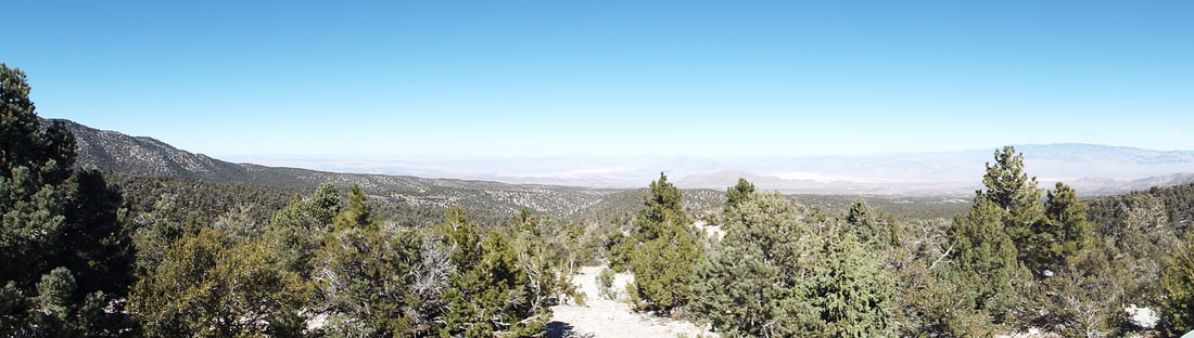 This area on the map shows where the nuclear testing was done.  The temperature difference from where we started the day and the mountains was dramatic. We started in t-shirts and a possible high of 80 and on the mountain we were in flannel and windbreakers with a brisk wind and temperatures below 60 in the shade. 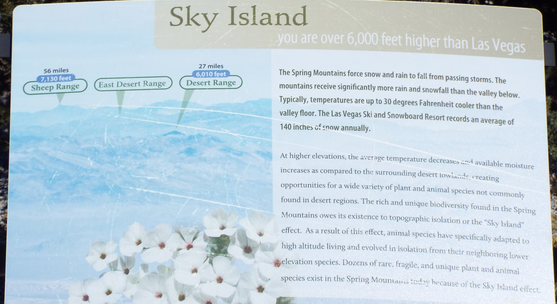 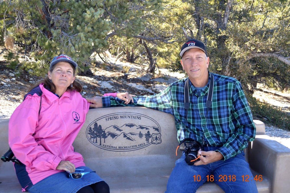 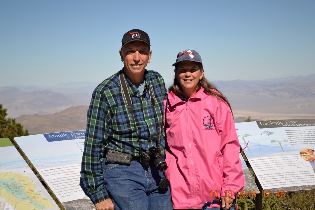 Time for lunch at the lodge where we had a great view of the mountains. We visited the Hoover Dam. It is HUGE!. It is amazing to see that it is still intact after the number of movies in which it was destroyed. Sorry, Matt but I could not find the Transformers. 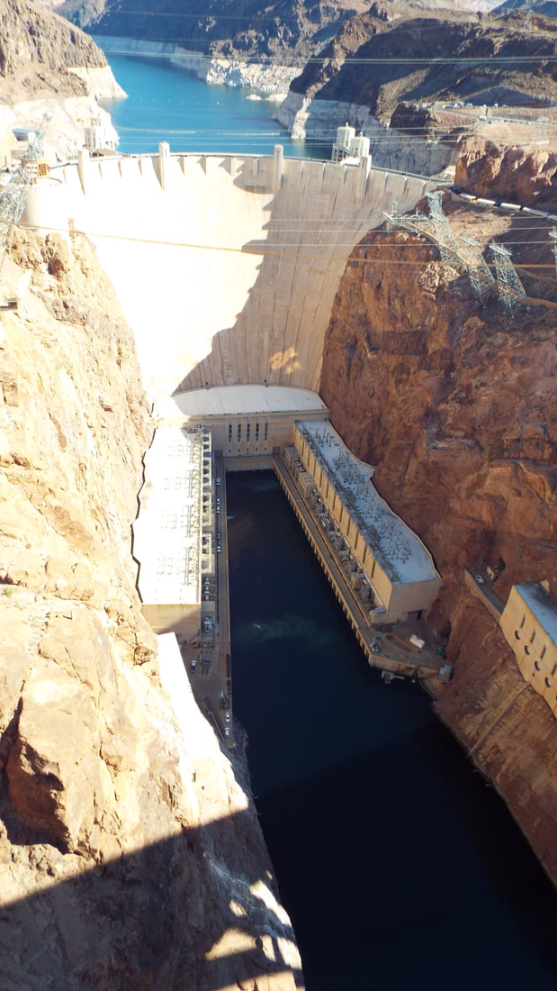 From the new bridge, we were able to get a very good view of the downstream side. 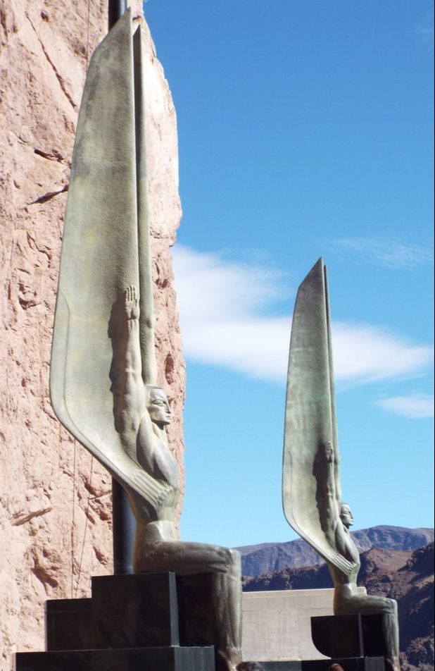 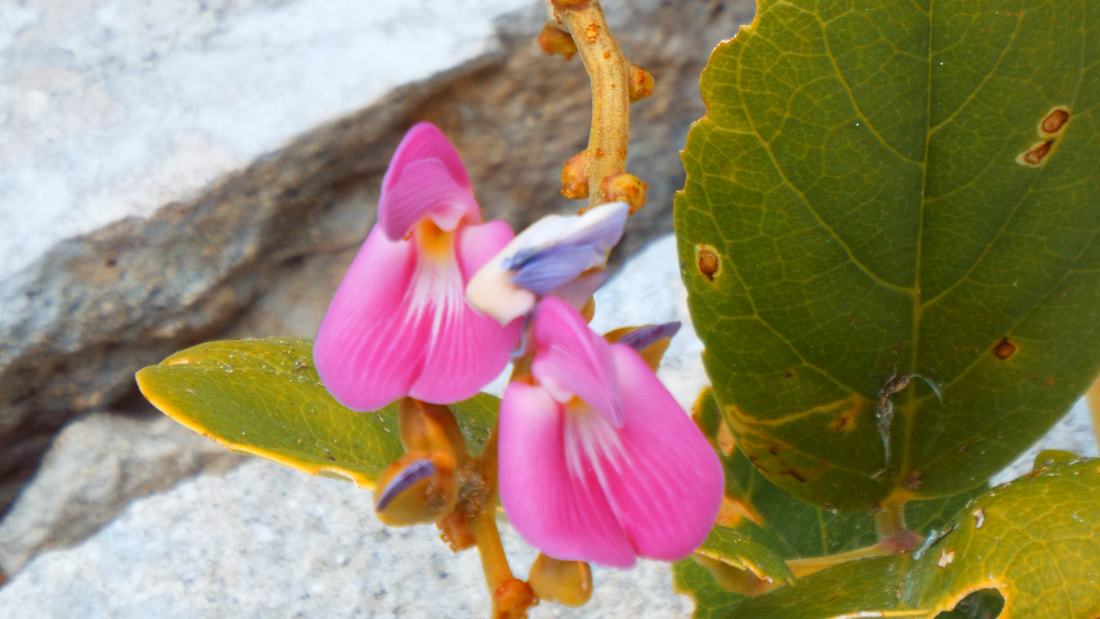 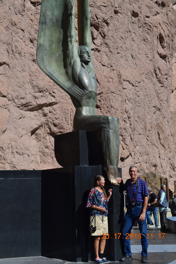 It is amazing that this dam was built in less than 5 years. Two years ahead of schedule. No way it could be built today at all and if it were it would take 25 years minimum to finish. (If ever) A few facts about the dam: Hoover Dam is 726 feet high, 650 feet thick at the bottom, 45 feet thick at the top, and 1,244 feet long. Boulder City was created for the construction workers. Lake Mead is the largest reservoir in the country. A total of 4.36 million cubic yards of concrete was used in all of the construction. That would be enough concrete to build a road long enough to cross the entire country. Sadly at least 100 people died in the construction. The water level of lake Mead is very low right now. The last time the lake was full was 1983. It is currently at almost the lowest level ever.
Most of the water that is released is used for the water supply for about 25 million people in Nevada, Arizona, and California. It was amazing!
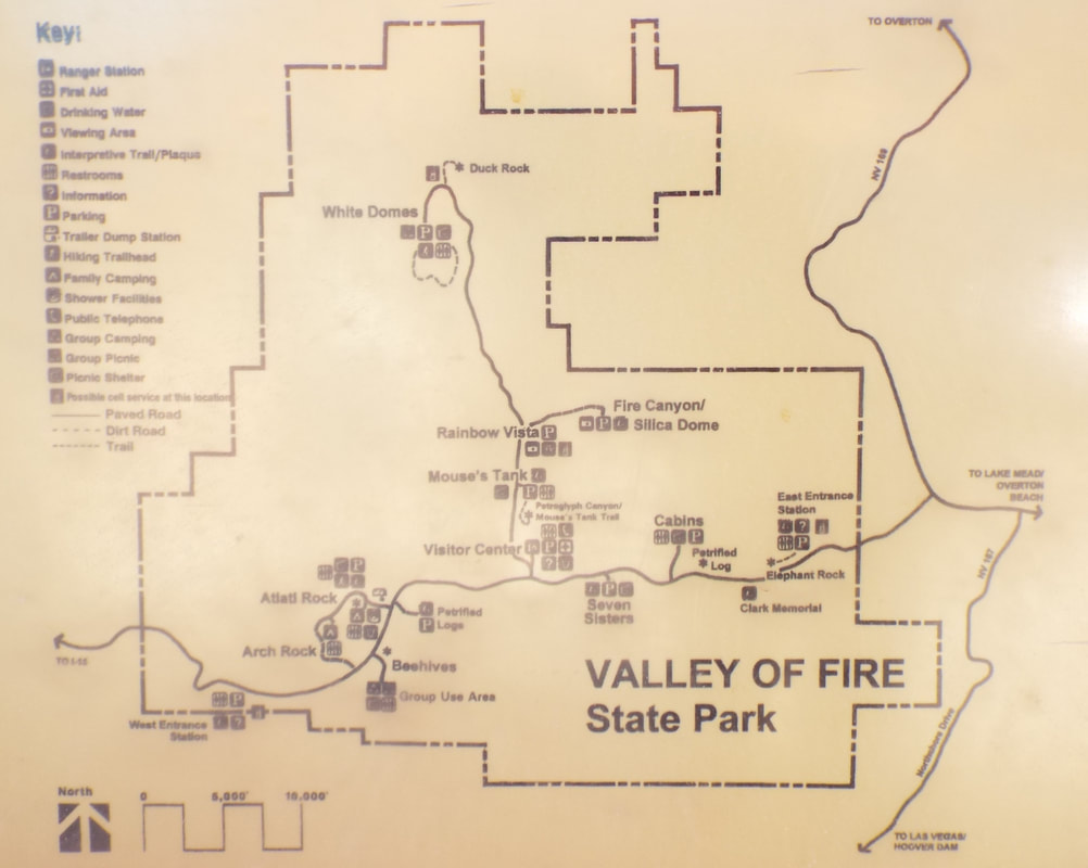
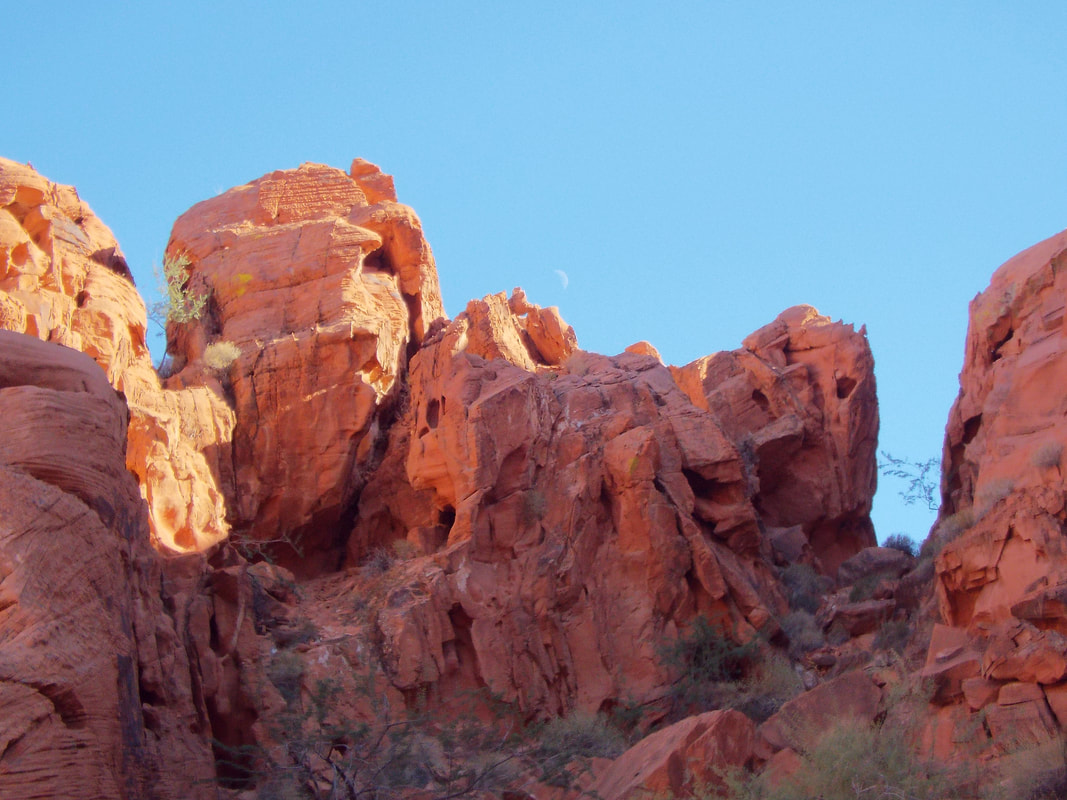
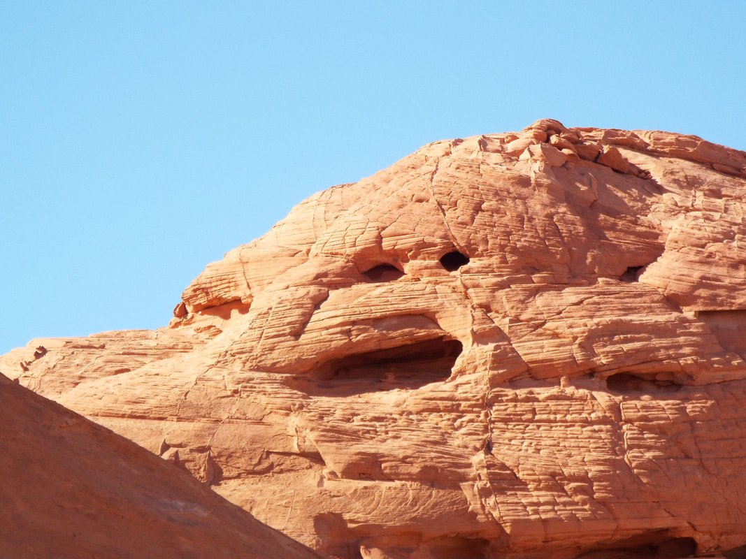
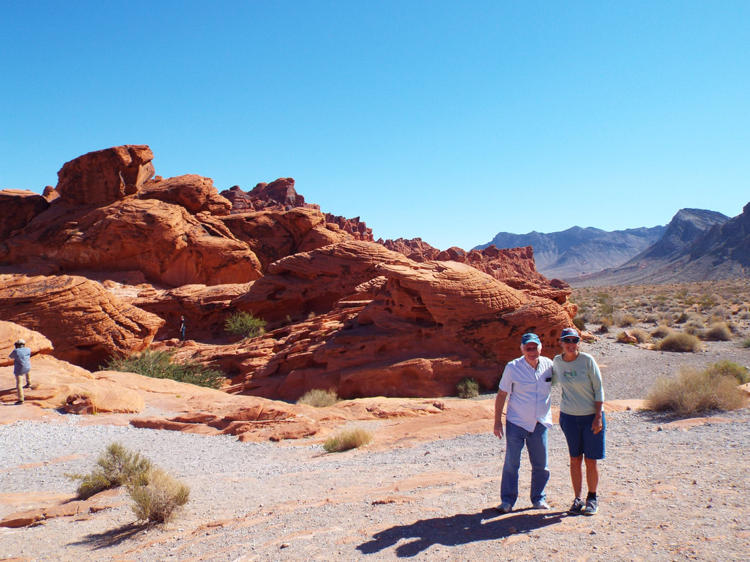
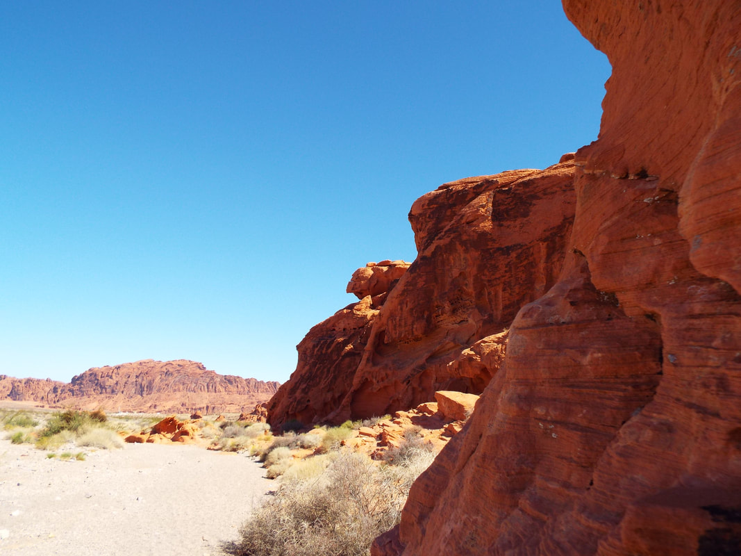
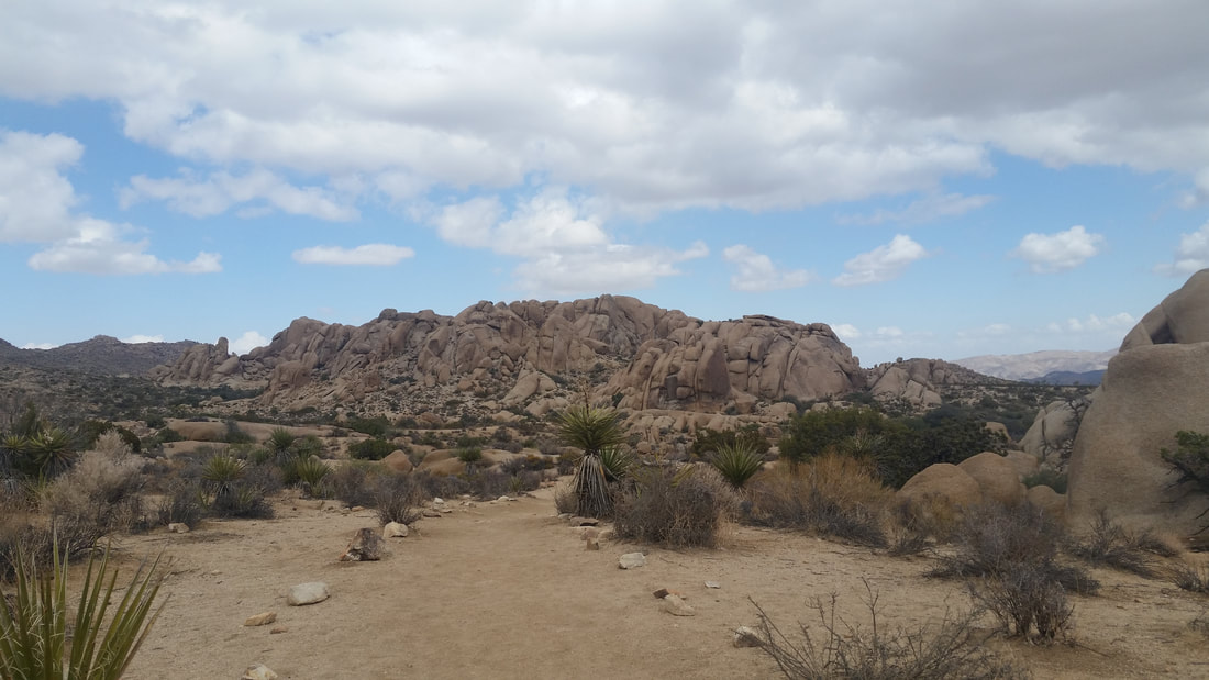
Today we visited the Valley of Fire. It is only a short drive from Bill and Kelly's. The park has some incredible rock formations. We are always interested in seeing the wonders that God placed for us to experience.
The formations with the mixture of color and shapes were incredible. Striking bands of colors and alien looking shapes are common.
The state park is "filming friendly" and has been used for lots of movies and a few tv shows. I understand why. The area is very unusual and has formations that look alien. You may recognise a few of them. Here is the current list.
Ballad of Cable Hogue; Beer; Bells of San Angelo; Billion Dollar Threat; Bite the Bullet; Cherry 2000; Confessions of a Hitman; Duets; Father Hood; The Good Son; Helldorado; Hell’s Angels ’69; The Hitcher; Iron Eagle; Kiss of Fire; Love Among Thieves; Mission: Africa; Nightwing; One Million B.C.; The Professionals; Return of the Man from U.N.C.L.E.; Roadside Prophets; Seven Ways from Sundown; Sheriff of Las Vegas; Solar Crisis; The Stalking Moon; The Stand; Star Trek Generations; They Ran for Their Lives; Viva Las Vegas; Airwolf; Total Recall; Criss Angel Mindfreak; Domino; Transformers 
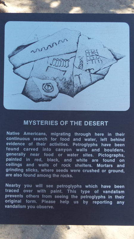
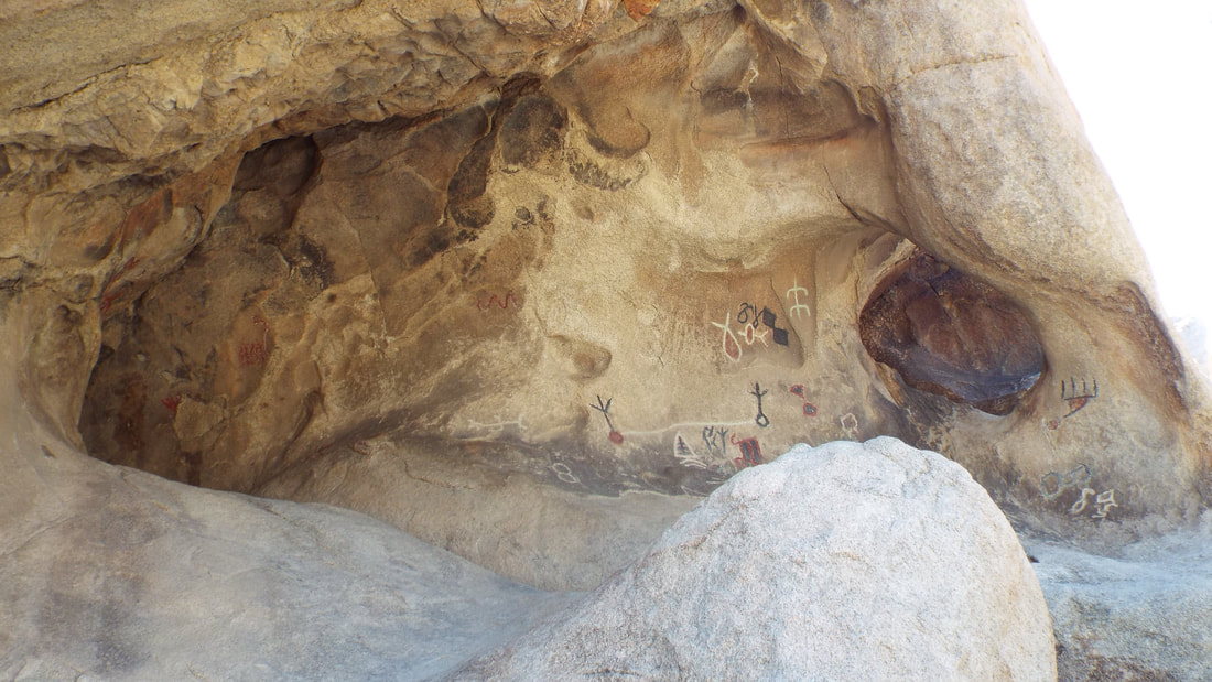
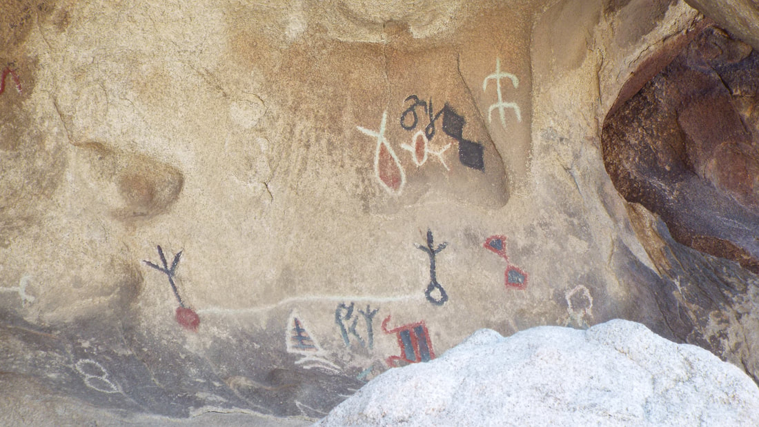
A lot of petroglyphs are in the park.
Hey! Does anyone else see a dog?
We also stopped at a group of formations called the seven sisters.
The trip is even more fun because we share it with friends.
Does anyone see a lion or monkey head? With a tuft of hair on top?
Or a face in this one?
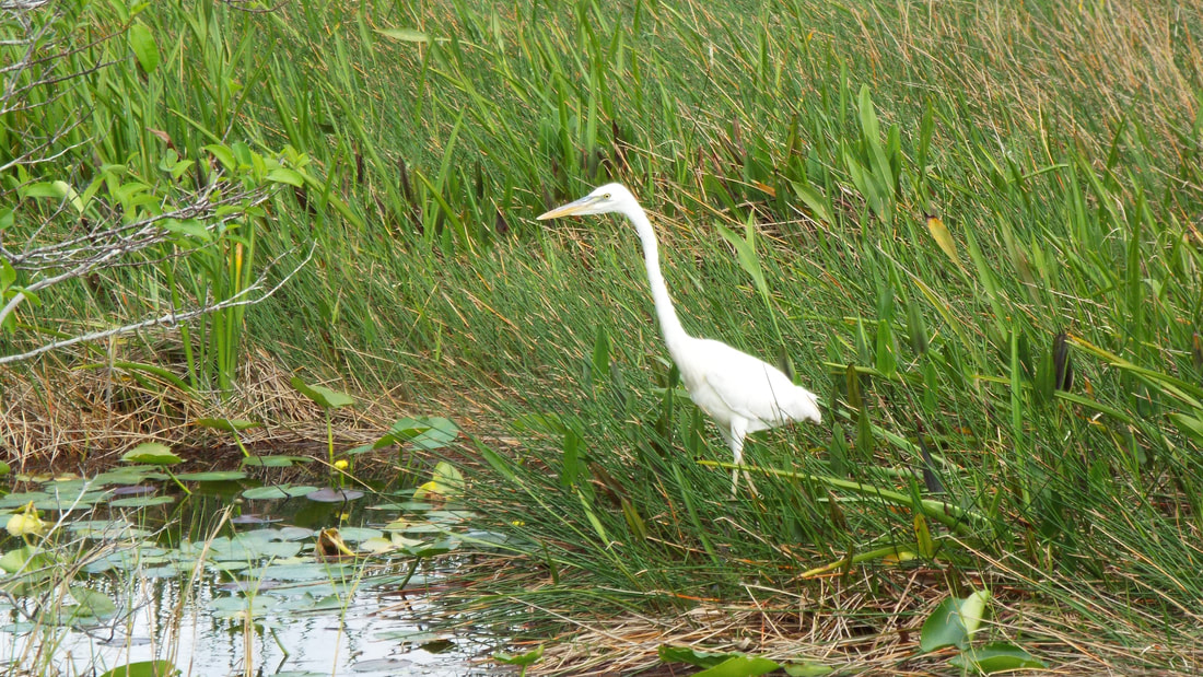
There were Bighorn sheep right beside the road. A male and three females.
These are a few pictures of our campsite. It was a bit unlevel but we were able to compensate with blocks and pads to get to level. 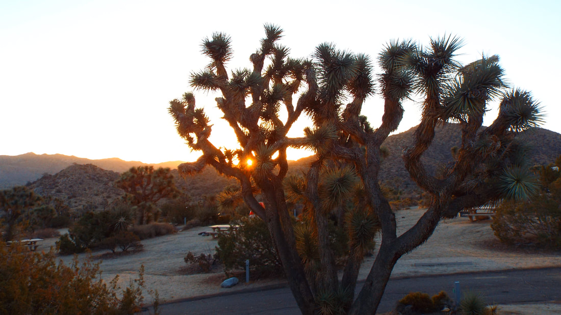
We had a very pretty sunrise. Then these two started running around the RV.
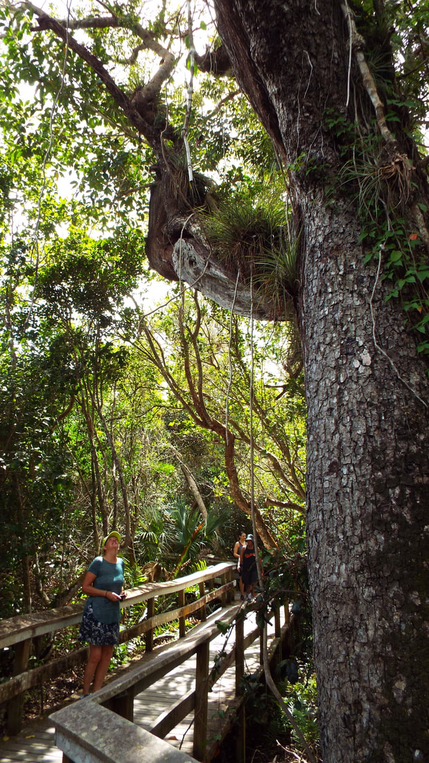
We started today by stopping at the visitor center and taking a guided walk with a Ranger.
The oasis is the source of the name of the area "Twentynine Palms". 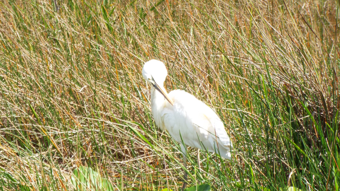
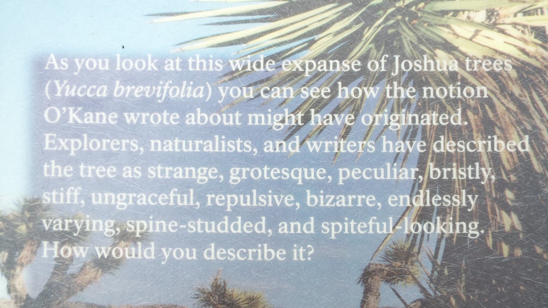
An exhibit gave some very good details on the development of the Joshua Trees.
Today we take our last trip into the park for some hiking and scenic views.
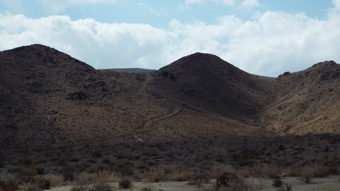
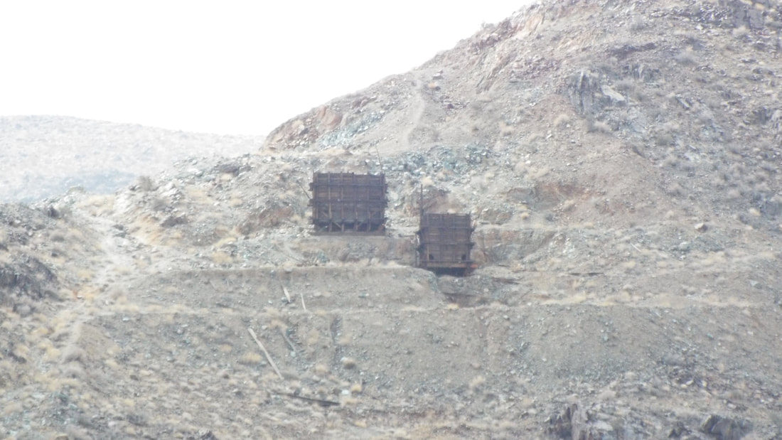
The next pullout was for a Gold mine then a Lead mine and finally a Copper mine. This is bizzare for a mine called the "Silver Bell" since silver was not mined here.
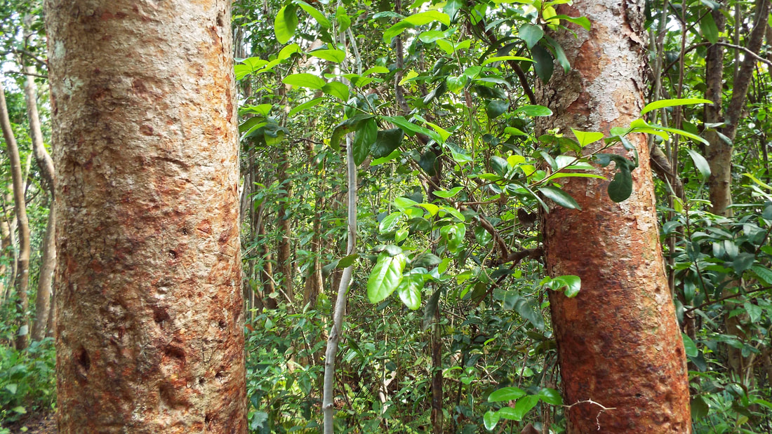
Next we drove to the center of the park. The area has a different collection of plants. It is still a desert but the elevation is different.
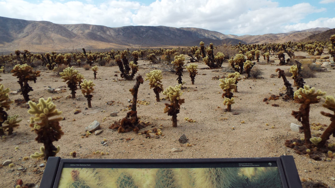
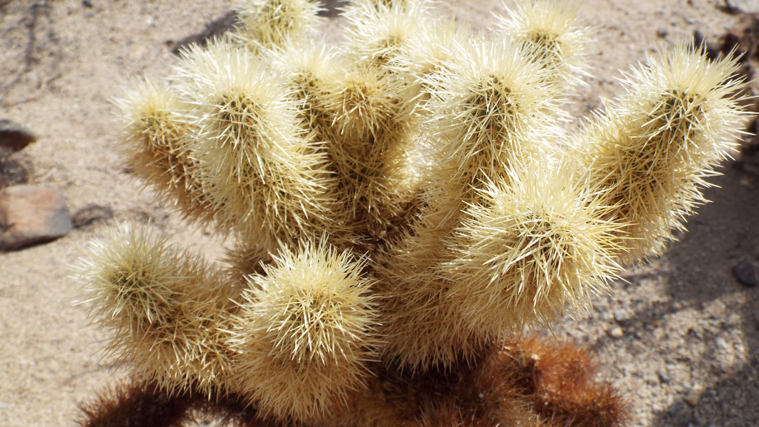
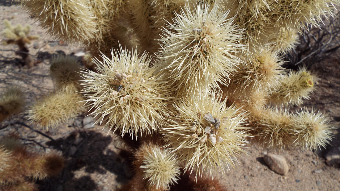
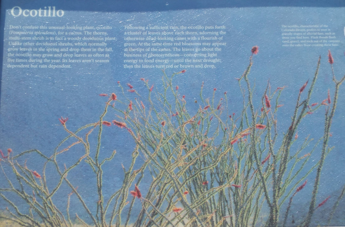
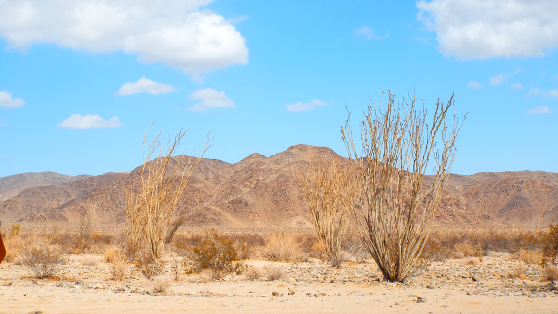
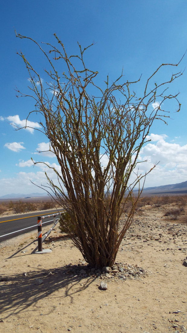
Our next stop was far down in the valley where there is a Cholla Cactus Garden and a Ocotillo Patch. The Cholla are down right dangerous and are nicknamed the jumping cactus.
The Ocotillo are very different from the other cactus.
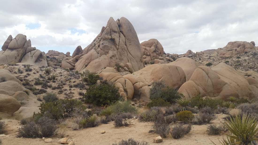
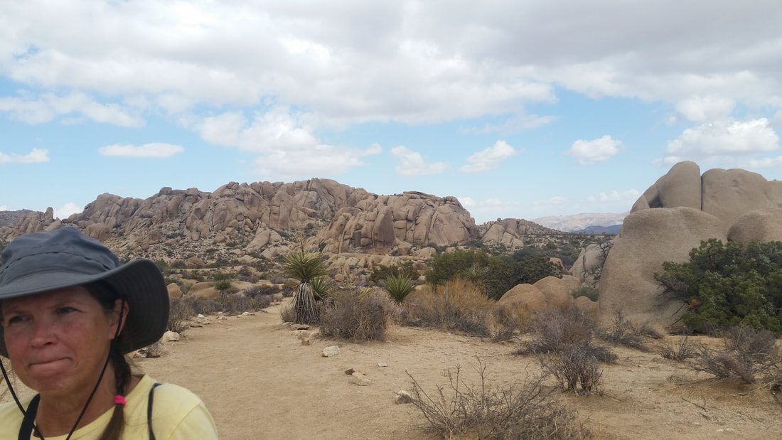
On the way back to the campsite, we stopped off at some interesting formations.
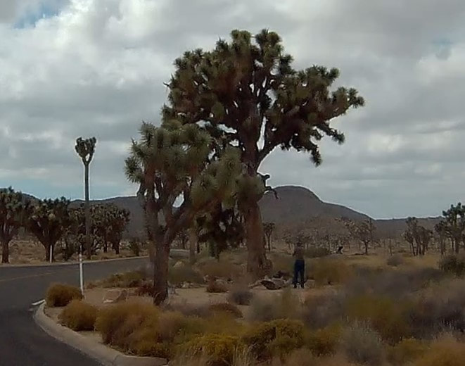
On the way to the exit from the park, we passed this huge Joshua tree and I just had to stop and take a few pictures. Obviously this was a very old tree.
To give a better perspective of the size of the tree, here is a picture from the dash cam of me walking up to take pictures.
Sitting on the couch and reading books from our tablets a thought came to us. We are "camping" with almost every comfort but with no connection to power, water, or sewer. Our RV is completely self sufficient for short periods of time. We have heat, hot water, a refrigerator (that works on propane), propane stove and oven, 12 volt fans, lights, and our own water with pump, and an air bed to sleep.
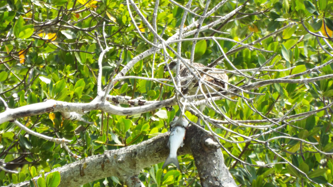
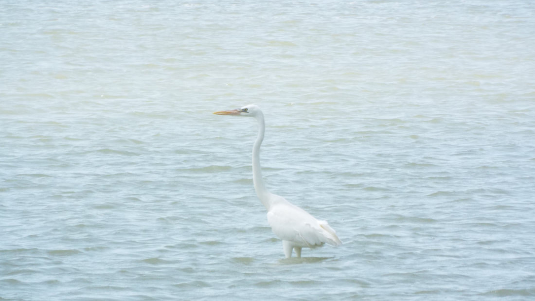
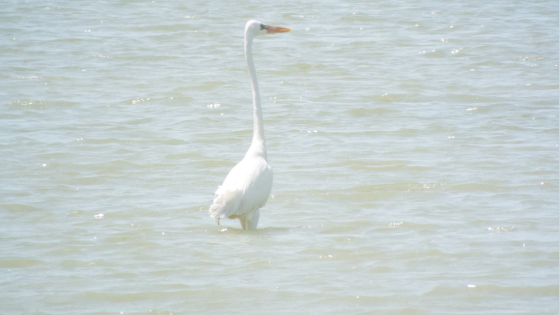
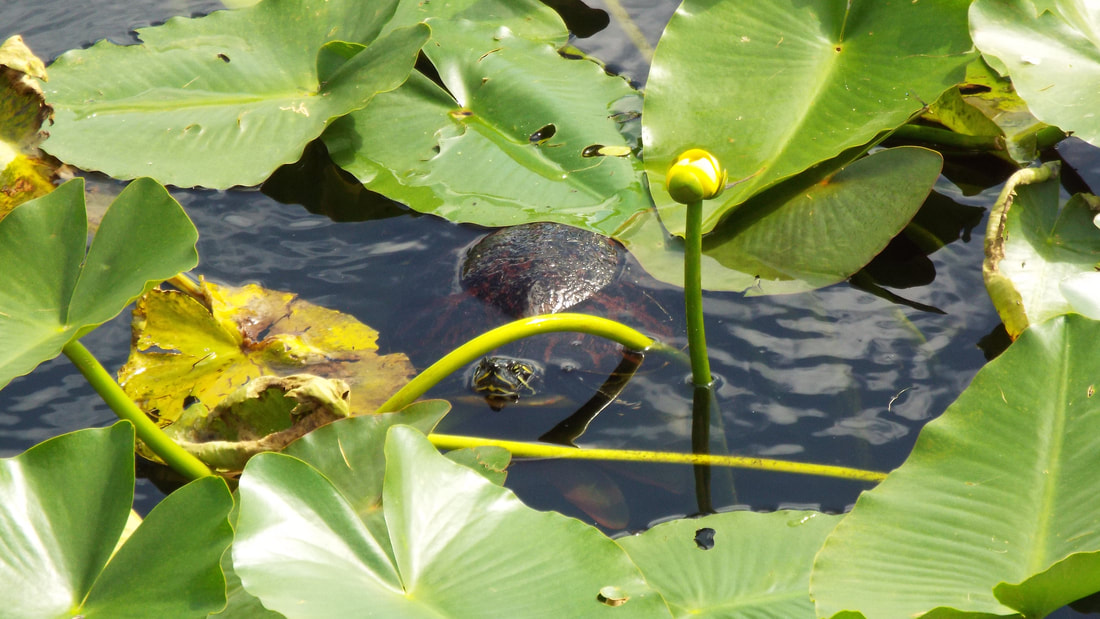
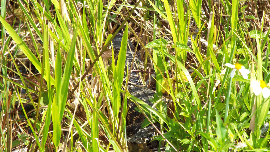
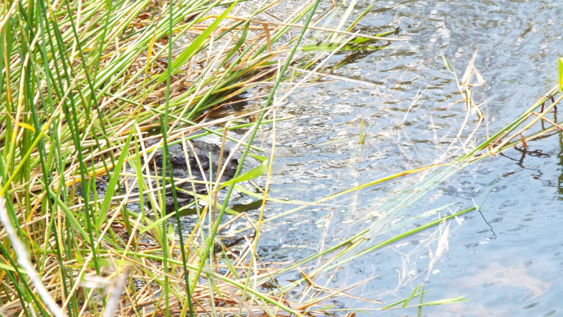
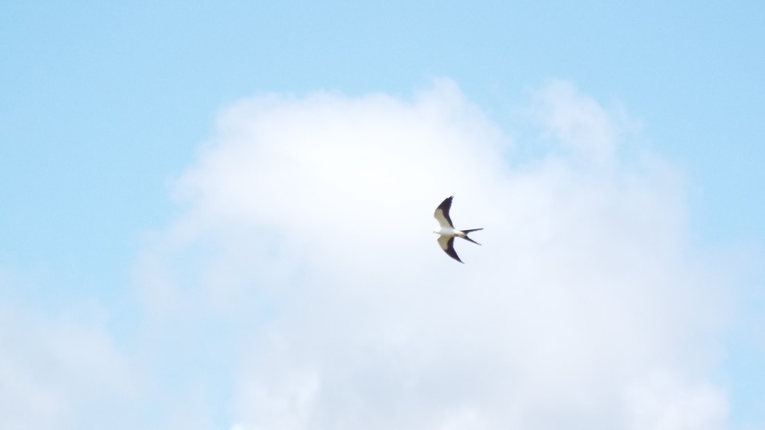
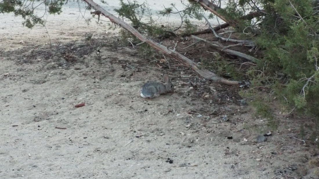
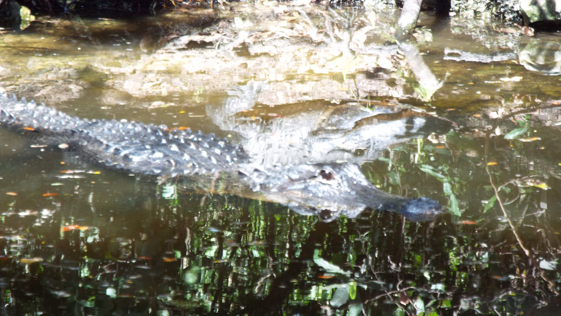
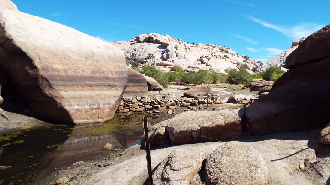
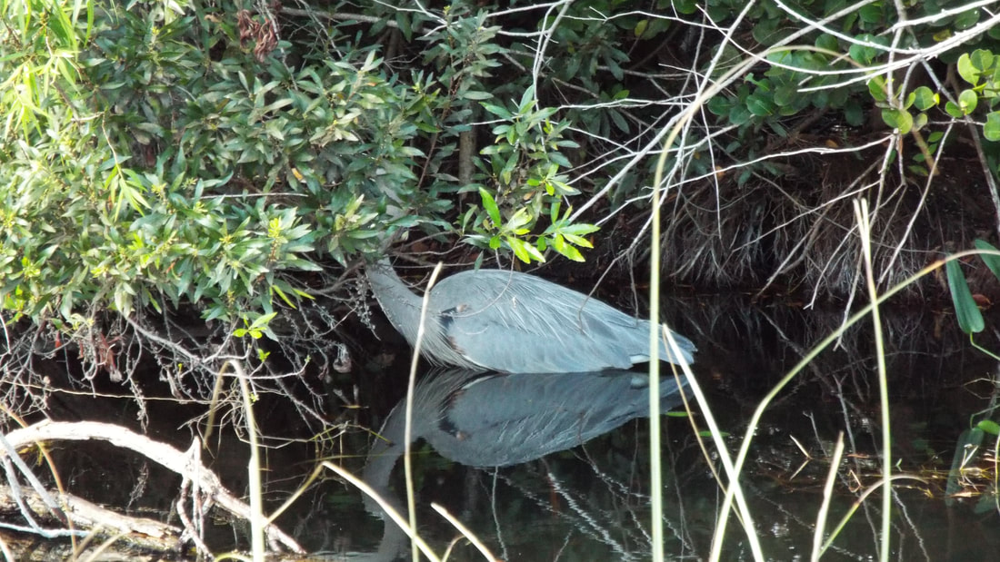
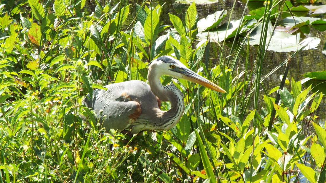
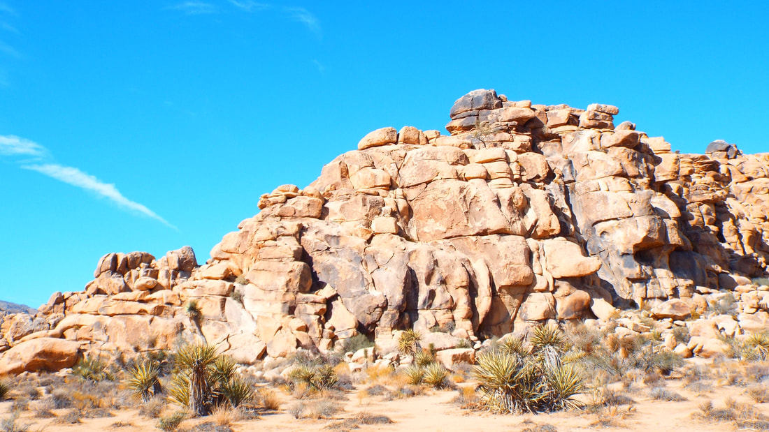
We thought back to the days when we were in scouts. We both loved it but it was with some lack of comforts. Camping out in the weather. In tents and sleeping bags. Lighting was a campfire, flashlight, or coleman lantern. Cooking over an open fire and hoping no one would be careless and kick sand in the food. Dealing with bugs. Waking at the crack of dawn because a bird decided that the tent pole was the perfect location to announce that the day was beginning. Being freezing cold till the fire was started. Packing everything needed in, hopefully not forgetting anything important, and packing it all back out. Wow! Having our new version of camping is really great.! We are staying in the Black Rock Campground on the north side of the national park. The campground road stops just inside the park so we have to drive out and enter the park at the north entrance farther down the road. The plants and geology is so different here. At different points in the park we are at different types of desert. Elevation makes a lot of difference on the plants that live at each level. As we drove we could see the change in what plants were growing at each level. 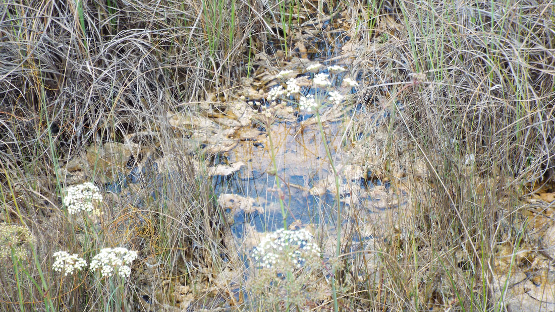 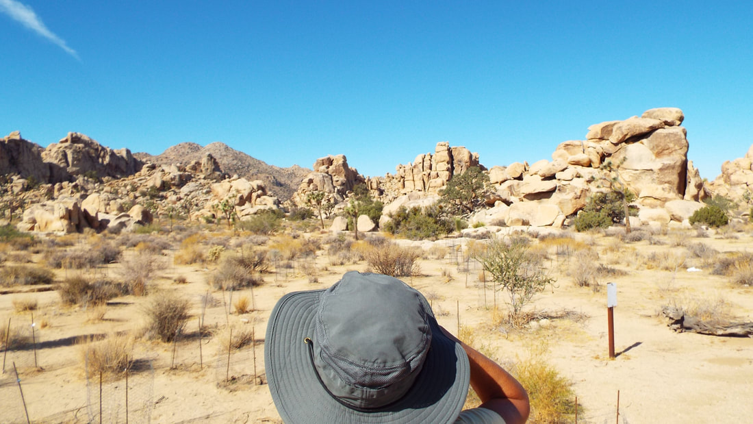 We hiked to Barker Dam. It is one of only a couple of areas where water flows enough to make a small pond if a dam was built. The pond almost dries up during the dry season of the year but is completely full at other times. 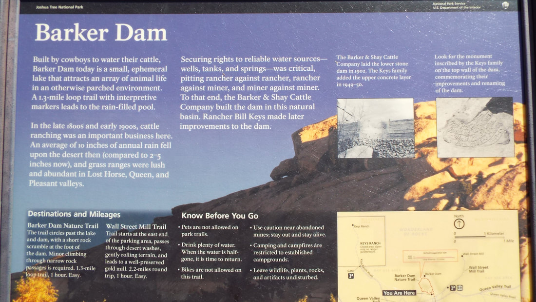 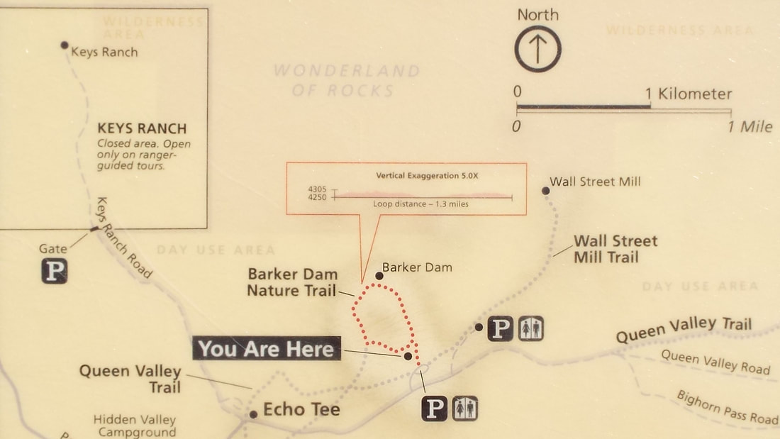  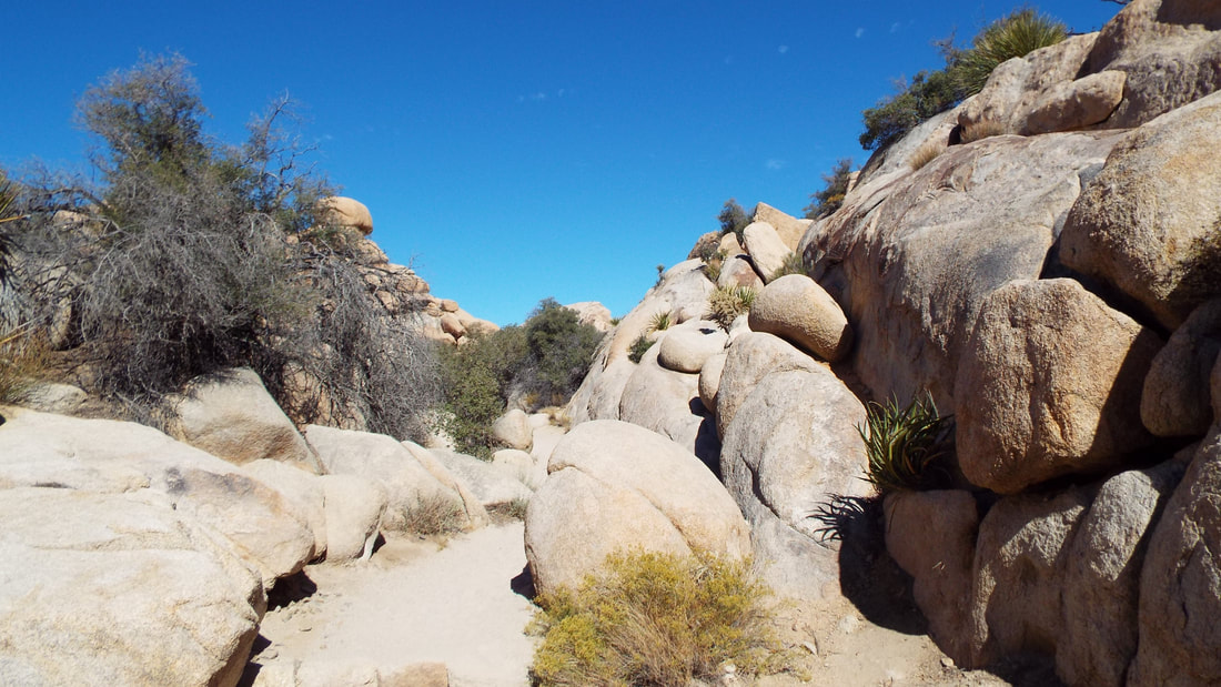 This is a "Beavertail" cactus. 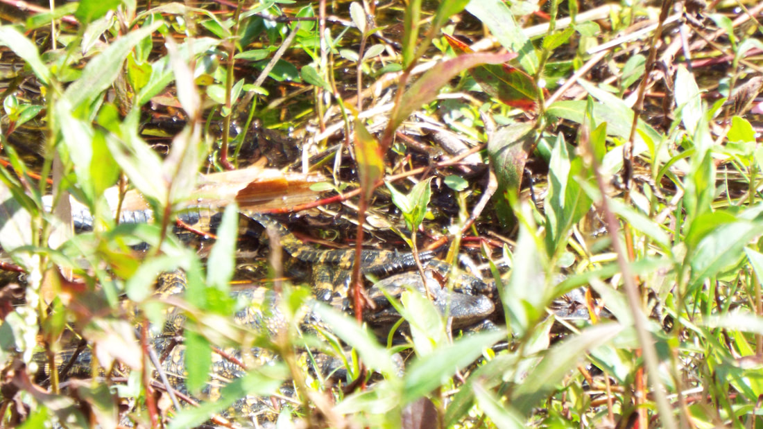 Not only are there interesting cactus but a few flowers were hiding between the boulders. 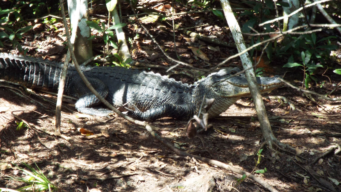 A little while later we reached the dam. Soon after the dam, we were able to see petroglyphs. In the recent past people decided to trace or paint over the glyphs. The goal was to make them easy to see but the problem is the actual glyphs are now covered and only the paint can be seen. Speak on being seen. Can you see the animal in this picture? It was well hidden when not moving. 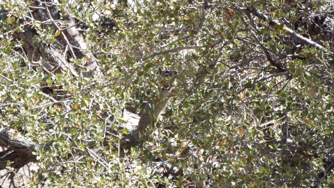 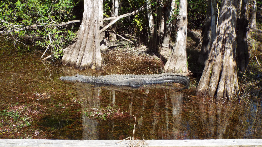 Being well hidden is great when you are the prefered dinner choice of hawks. The mountains here are in several stages of change. Some are covered in gravel and sand. Others start to show the underlying rock structures. And then there are those that have been completely exposed. It is interesting knowing that the park changes over time and areas that are covered today will be exposed in the future. Of course we selected a really pretty spot for lunch. Why not? 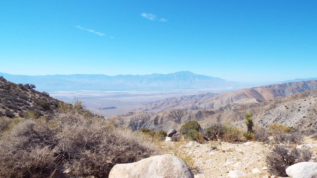  We drove up to the highest accessible point in the park, Keys View, at 5,185 feet. There were great views of the valleys below and it was a very nice place to have lunch. The chipmunks were determined that we would feed them. I am sure this is from experience with others who visit this part of the park. If we sat still they would come right up to us which was a little unnerving. We headed back down and then stopped at several impressive formations.  It is obvious how "Hanging rock" got its name. At any time that bolder could slide off and the site would have to get renamed. The boulder is the size of a small house and weighs many tons. Look close and you can see to people sitting to the right.  There are interesting plants and a few animals that showed themselves. The last hike of the day was through the Hidden Valley. This had been used for corralling cattle. The narrow opening into a grassy valley that was surrounded by rock was perfect to keep the animals from roaming. Today there is very little grass in what was a 55 acre meadow.   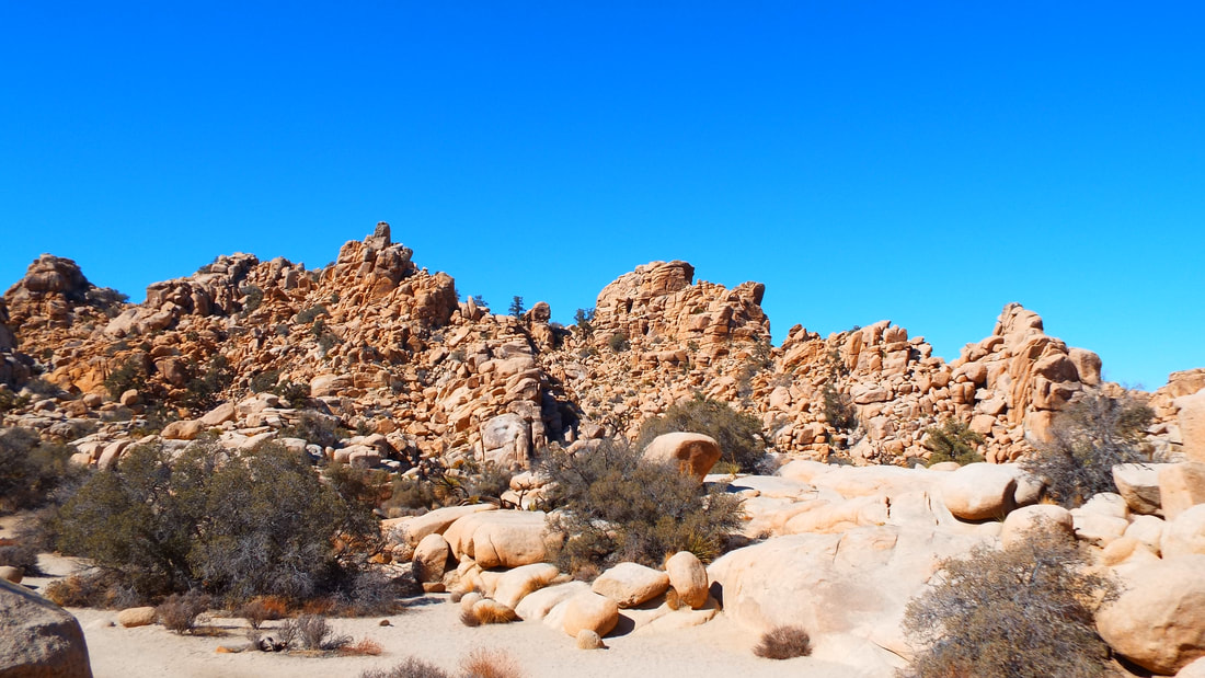      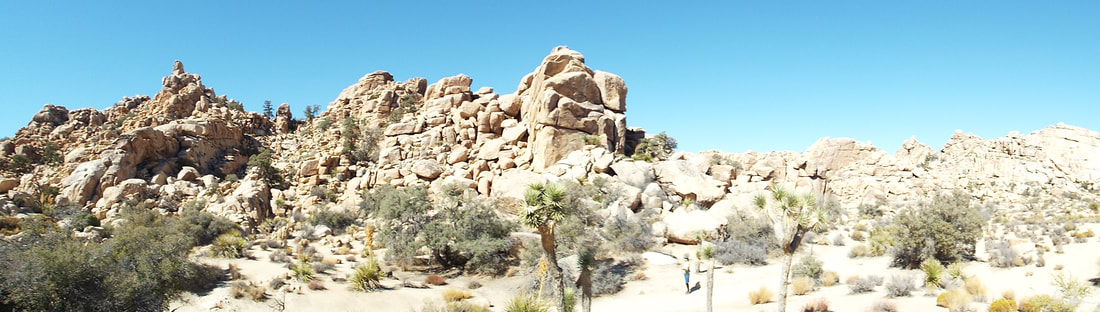 |
AuthorWe are a couple who have started on a new adventure... Archives
February 2024
Categories |


 RSS Feed