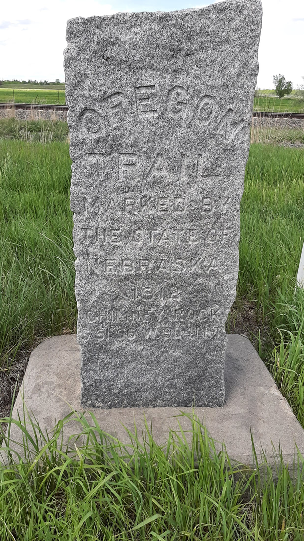
 Our original plan was to stay at the free camping area at a town near Chimney Rock. Yes, a lot of small towns in the west have free RV camping and most include power and water. The idea is that if you stay in town you will spend more money than it cost to have you stay. We arrived and backed in then I checked the power and water. No power. No water. Shawna called the contact number posted for the town and they said the state rules related to the virus required they turn off those utilities but we could stay anyway?! Sometimes the rules don't make any sense. The backup plan was to go to the RV park directly north of the landmark. Yes, we really do have a plan, backup plan, emergency plan, and emergency backup plan. Our view from the dinner table is incredible. 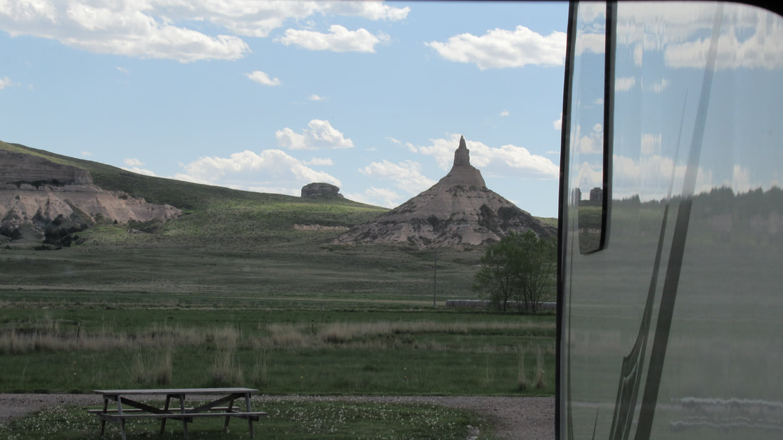 Warning the following could be considered a history lesson. Each April from 1841 to 1869 thousands of people gathered around Independence, Missouri where the train tracks ended. Next they purchased a sturdy wagon, oxen to pull it, along with food, clothes, and weapons. Unlike what most see in movies very few used mules and almost no one used horses to pull supply wagons. The plan was to gather about $30,000 of supplies (based on current value of money) to make the trip and hopefully arrive near the west coast before winter. Imagine starting a trip knowing that you would not arrive for several months. Now think about this, only toddlers and the elderly road in the wagons. Everyone else WALKED. Yes, they walked across part of Missouri and Kansas. and all of Nebraska, Wyoming, Idaho, and Oregon. Almost all of those who took the trip purchased "The Emigrant’s Guide" a book that gave details on how to prepare, the expected time it would take to make the trip, what supplies to take and what they should cost, and included maps with landmarks along the route. Remember this was a trail crossing almost the entire country with no markers other than ruts in the ground. It was actually common for people to get lost and take days refinding the trail. The Chimney Rock landmark was very important to those traveling west on the Oregon Trail. Chimney Rock was so distinctive that all who saw it knew they were on the right path and headed the right direction. I am sure a many a family was relieved to know they were not lost but on the right path. Travelers could look to the west from this point and see Scotts Bluff which was the 1/3 way point of the trail. It is estimated that as many as 500,000 people passed this way. It is hard to imagine how busy this area was during that time. It is guaranteed that there were some days more people slept in view of the landmark back then than they do today. 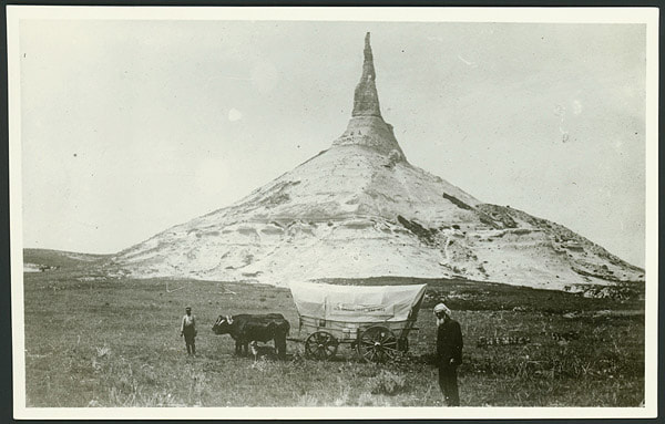 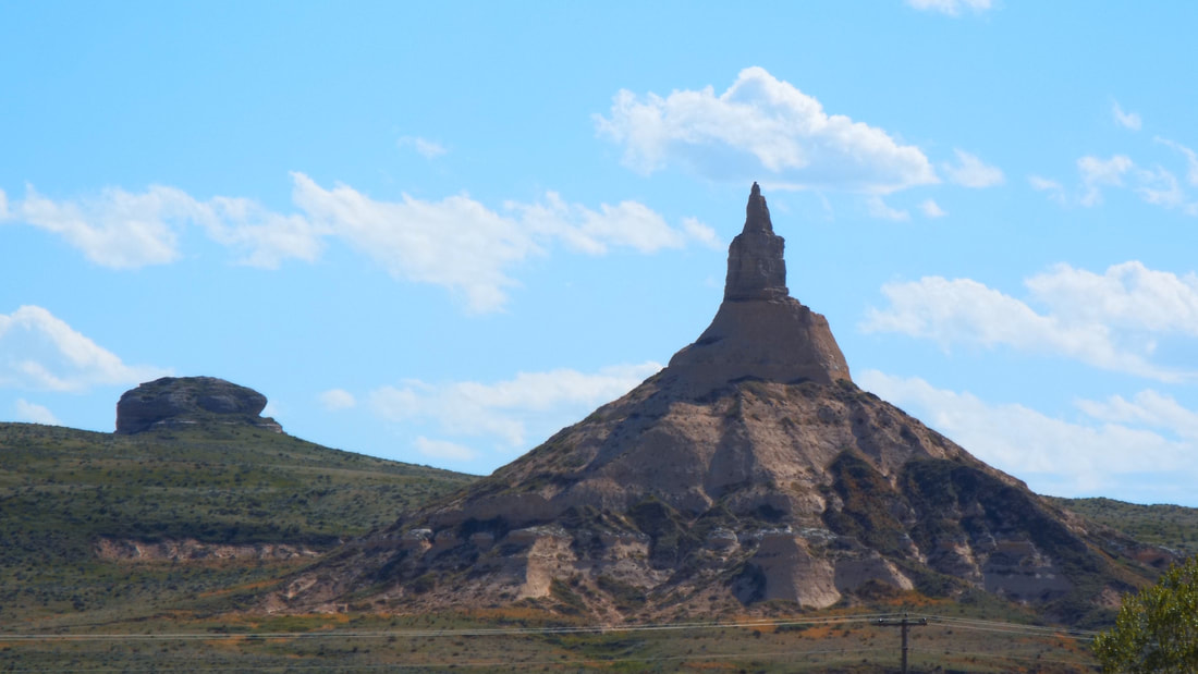 In the last few years that the Oregon Trail was used, the Pony Express used the same route to deliver mail. The use of the Oregon Trail and Pony Express ended when the transcontinental railroad system was developed west of this location. 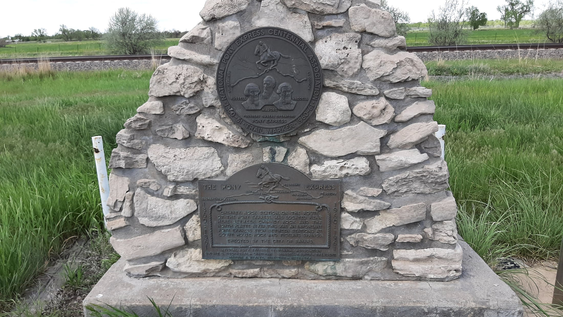 End History lesson and begin Geology lesson. The hills and bluffs in this area are composed of layers of Brule clay, volcanic ash and Arikaree sandstone. Usually this type of clay mixture erodes to form relatively smooth sides in all directions. In a few cases the rain erodes faster on one side creating a bluff such as Scotts Bluff with sheer sides. Chimney Rock is the only location where the clay eroded to leave a center spire giving us the landmark. The earliest written records tell that the spire was much taller. It is estimated from that information that the center spire was about 120 feet tall during the western migration. Modern surveys show that the center spire has lost much of its height and is 325 feet from tip to base. The "Chimney" is struck by lightning every year and portions fall away. From one side it appears to be a sharp point but from others it still appears in a chimney shape. The only thing that is guaranteed is that the shape will change every year and that it will eventually no longer look like more than an inverted cone. Some day the name may be changed to a funnel as it is quickly taking that shape. End Geology lesson. At night the landmark is lighted by green spot lights.  Of course I found that the old game Oregon Trail is available online to play for free.
https://archive.org/details/msdos_Oregon_Trail_The_1990 Fun but VERY dated.
0 Comments
Leave a Reply. |
AuthorWe are a couple who have started on a new adventure... Archives
February 2024
Categories |
 RSS Feed