|
The hike today is 4.2 miles with and elevation change of 626 feet. We drove into Custer State Park but at first had some problems finding the Trailhead. There is no marker on the road. We asked at a small store near where we thought it started and they gave us directions to the parking area we should use. The trailhead is behind an old building that was about 100 yards of the main road. I am really surprised anyone even hikes this trail it is so hidden. 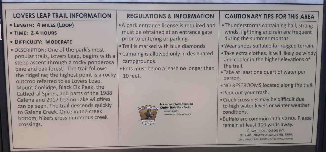  We chose to go clockwise which made the first part of the trail very steep uphill but the last portion relatively flat and downhill. When we reached the "leap" it was a bit of a scramble to the top. The view was great. 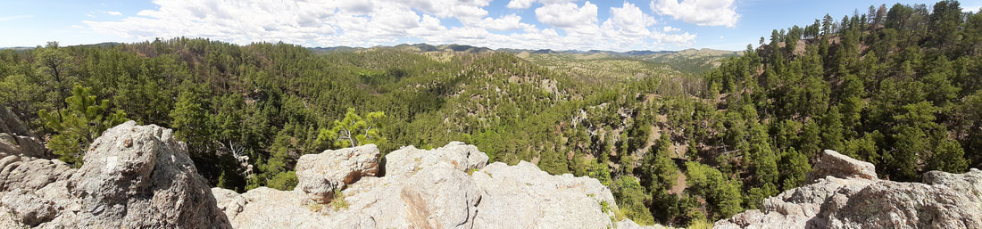 A sign at the leap was very thought provoking. 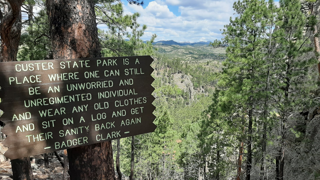 The last part of the hike was along a creek. We crossed on rocks or small bridges a dozen times. We passed several places where buffalo had been through the area including scraping on trees. Pants were required because poison ivy grows along portions of the trail.
It was a fun hike.
0 Comments
Leave a Reply. |
AuthorWe are a couple who have started on a new adventure... Archives
February 2024
Categories |
 RSS Feed