|
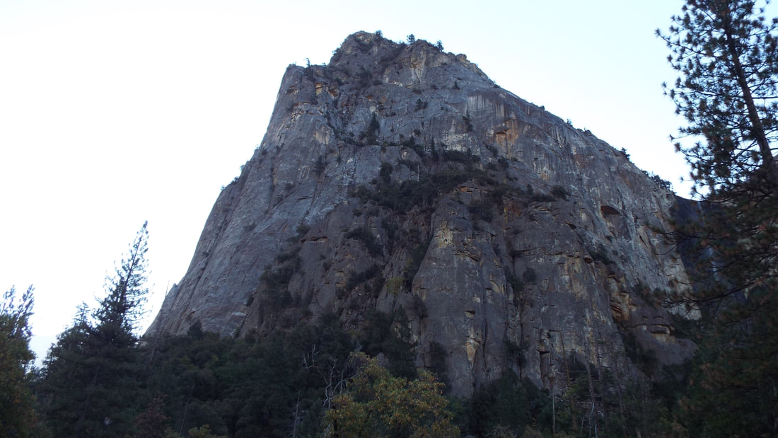
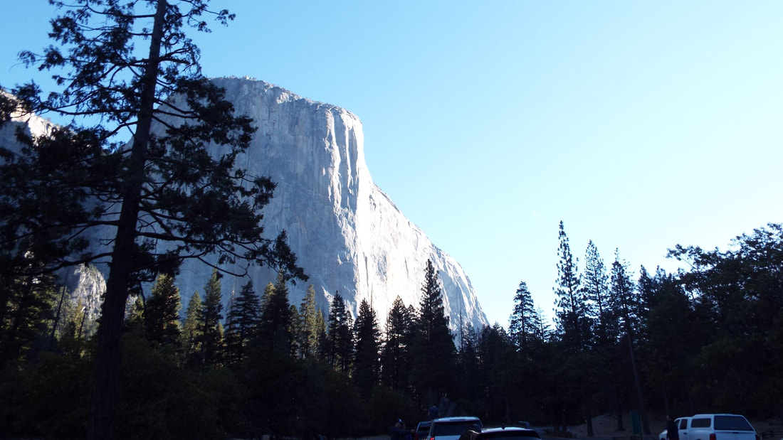
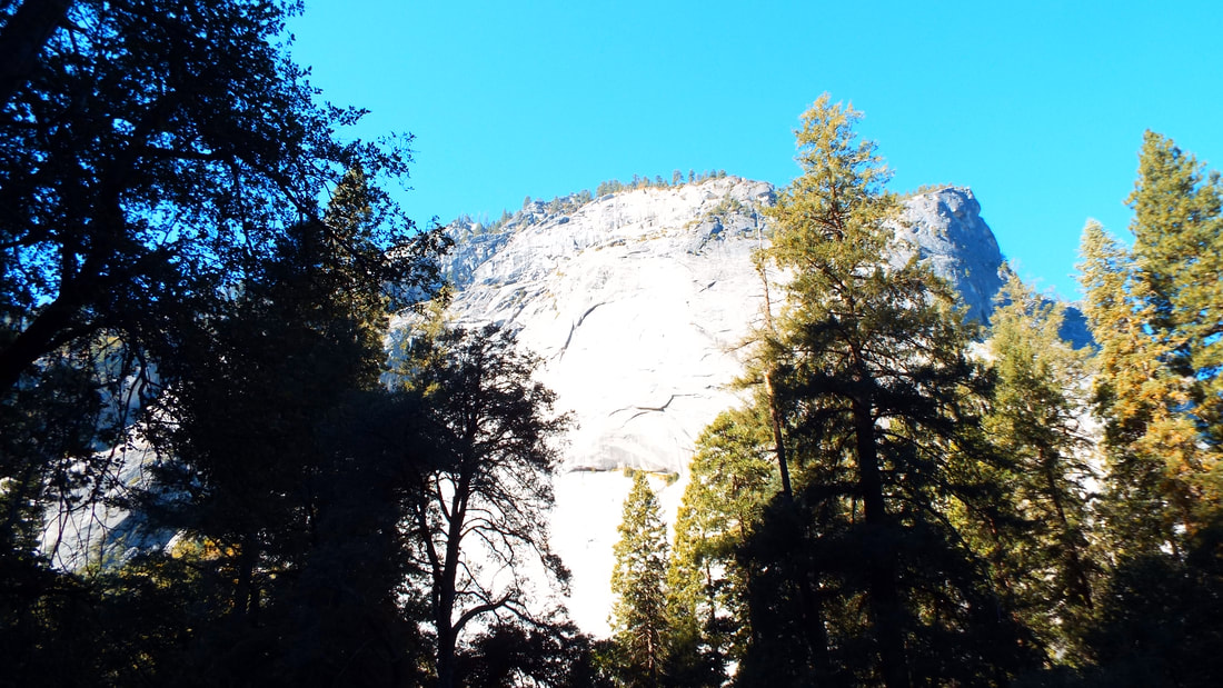
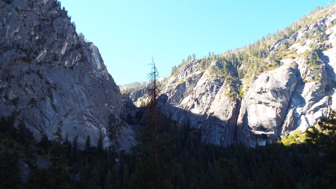
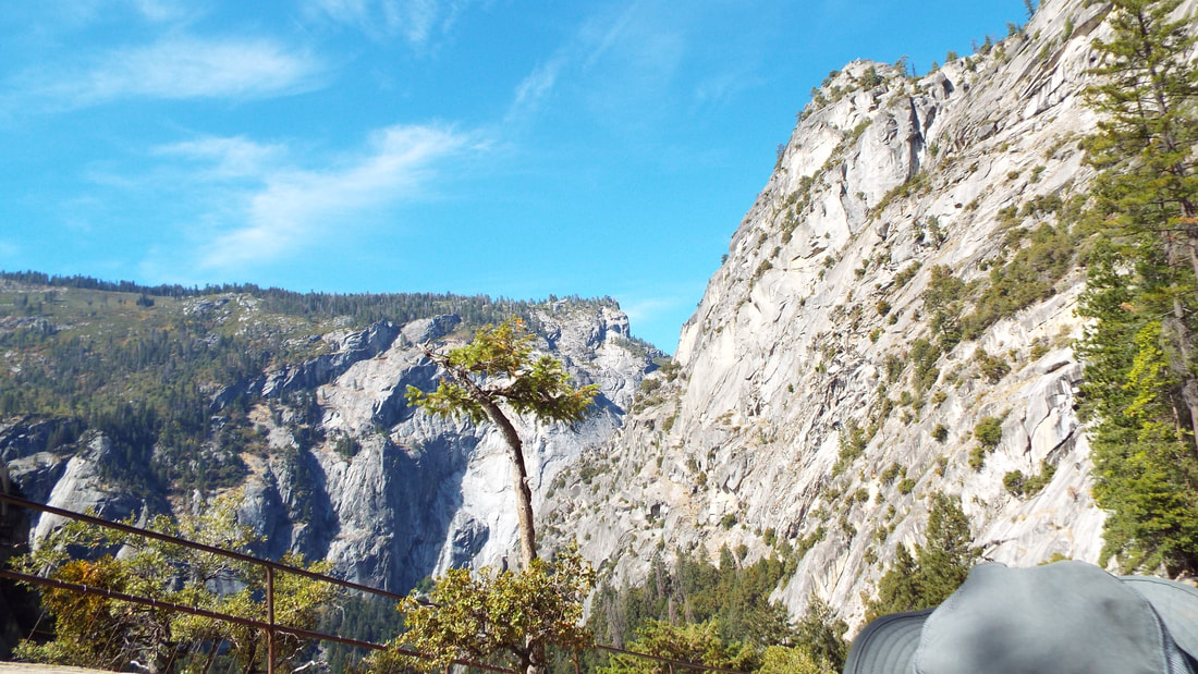
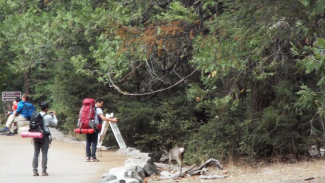
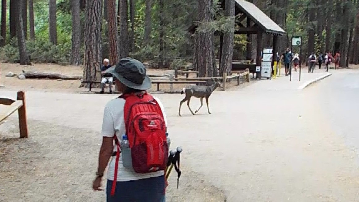
We started by waking very early in the morning. It was a bit chilly at 38 degrees. After a warm breakfast we were off to the park. We had been warned that if we did not arrive in the park by 8am we may not be able to find a place to park. From the RV park to the entrance was an hour drive. So we were up, packed, and out the door before 7am. The drive to Yosemite is great. Large valleys with rolling hills. Most with trees but several places were damaged from the fires with enormous trees that had burned both standing or fallen and the ground gray with ash for 1,000s of acres. Just around a bend of the road, we would be back in thick undamaged forest. The view of Yosemite for the first time was amazing. The drive in passes through thick forests and along deep drops into valleys. Then you pass through several tunnels and one of them ends with your first view of El Capitan and Half Dome in the distance. 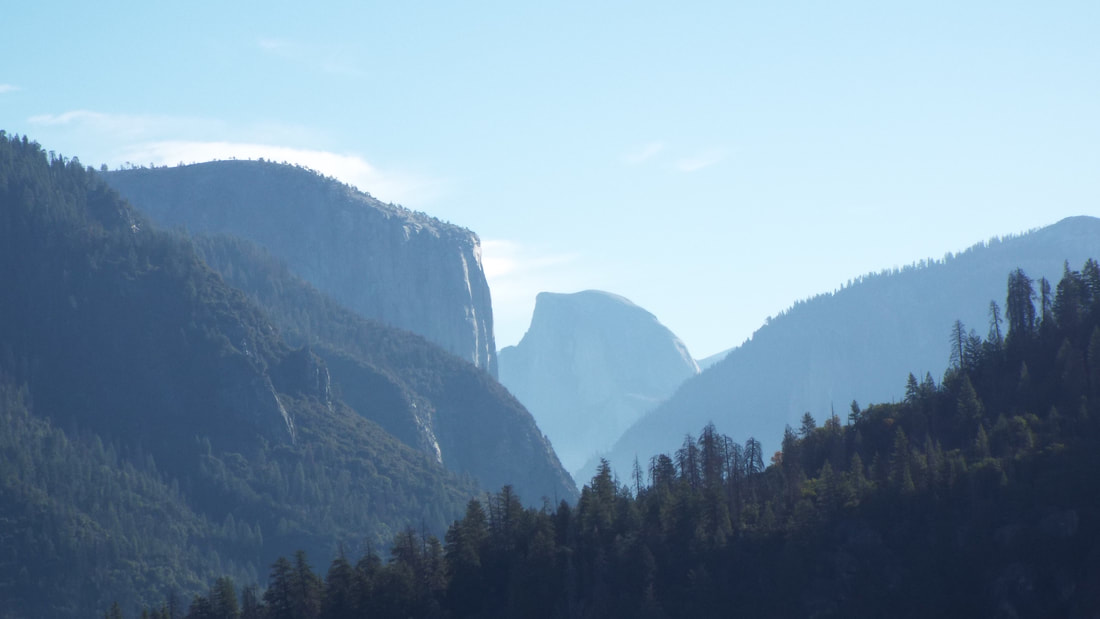 The Yosemite valley is stunning. To look up at granite cliffs thousands of feet high is difficult to describe and made us just stare. The road runs the length of the valley. El Capitan is an impressive mountain. It is a enormous unbroken rock and just over 3,000 feet above the valley floor to the top. 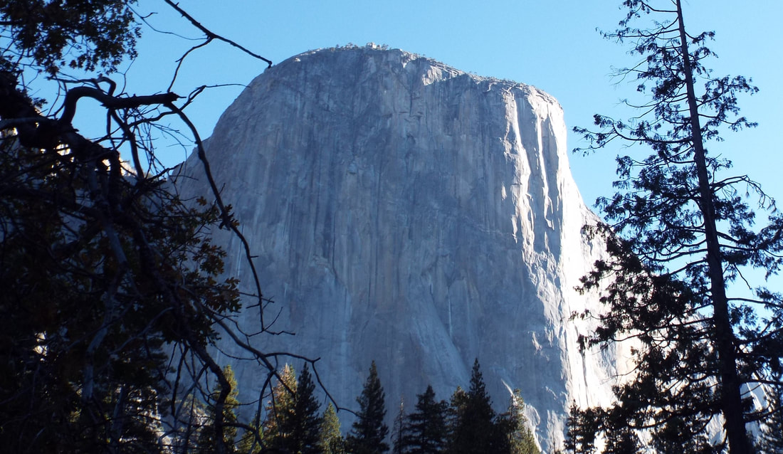 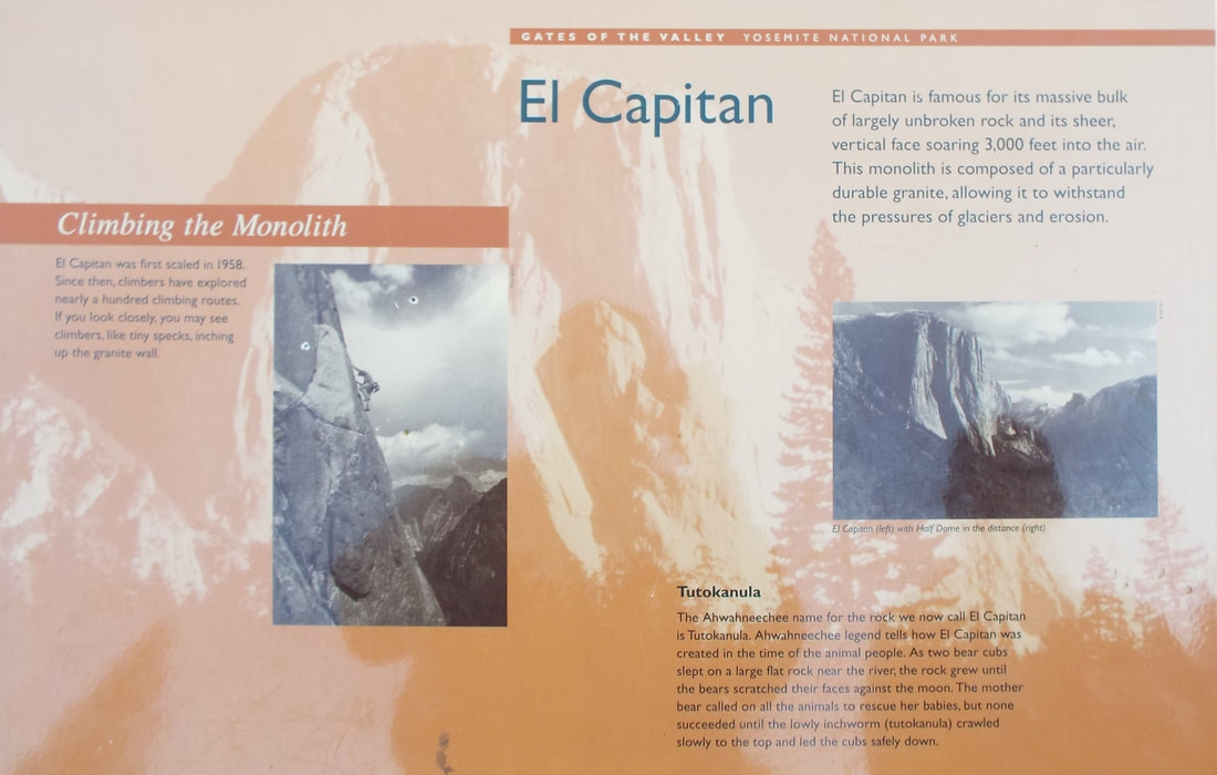 We then passed Bridalveil falls. All the falls are small in the autumn. It was still impressive. The falls drop 620 feet. Water drops so far that is seems to sway back and forth as it drops. 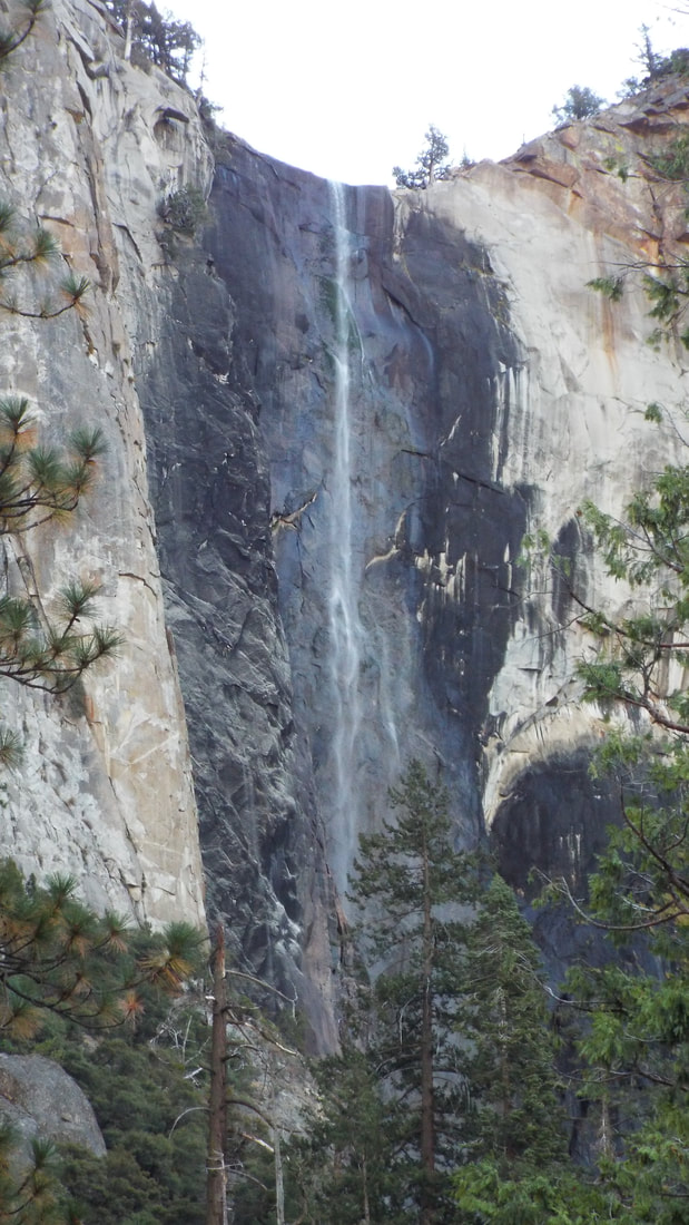 We reached the parking area for our hike and this was what greeted us at the entrance.  In some ways the bears are smarter than the humans visiting the park. They have learned to recognize food packages and how to pull a door open. If they see something interesting or smell food they will tear open the door. Today we focused on a long hike to Vernal and Nevada falls. 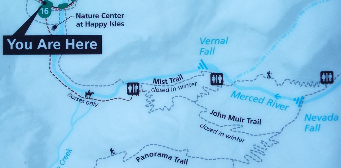 From the parking lot, we hike Mist trail to the top and then back down John Muir Trail. At first the trail is paved and a continuous steep climb of 400 feet in elevation gain for the first 8/10th of a mile. Beyond that the trail is steeper and less established. 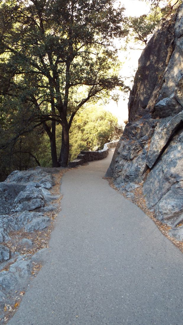 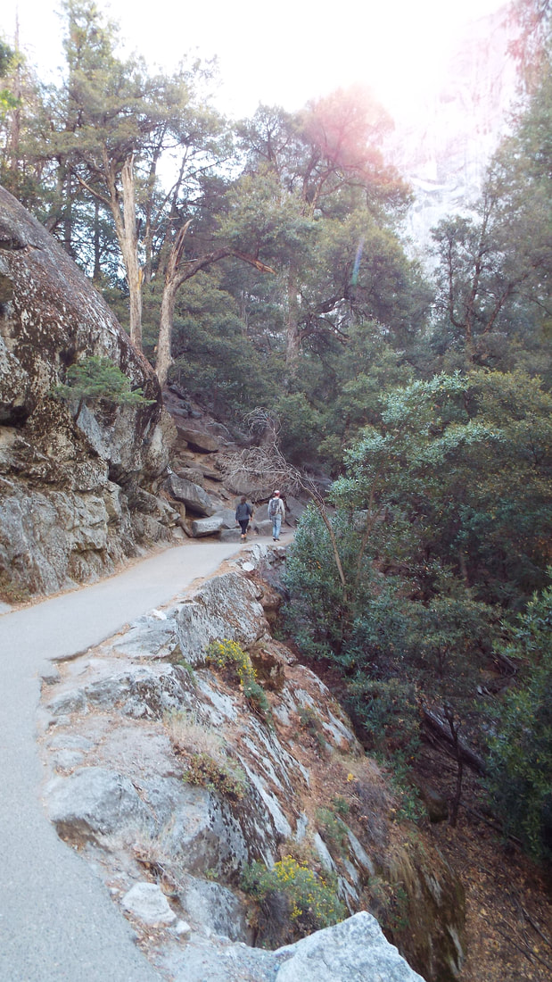 By the time we got to Vernal falls the climb was another 1,000 feet of elevation gain. Then on to Nevada falls for another 2,000 feet of elevation gain. The total length of the regular trail to the top is 3.4 miles and a total gain of 3,400 feet. But instead of the 6.8 miles of the regular route the total for us was 9.4 miles because we took the John Muir trail down. Our phone Alltrails app showed that the total of elevation changes, going up and down rises and falls on switchbacks, was 10,216 feet. The highest point is on the top of the Nevada falls and is 5,907 feet of altitude. Vernal falls drops 317 feet. Nevada falls drops almost twice as far at 594 feet. Along the hike we had some incredible views. 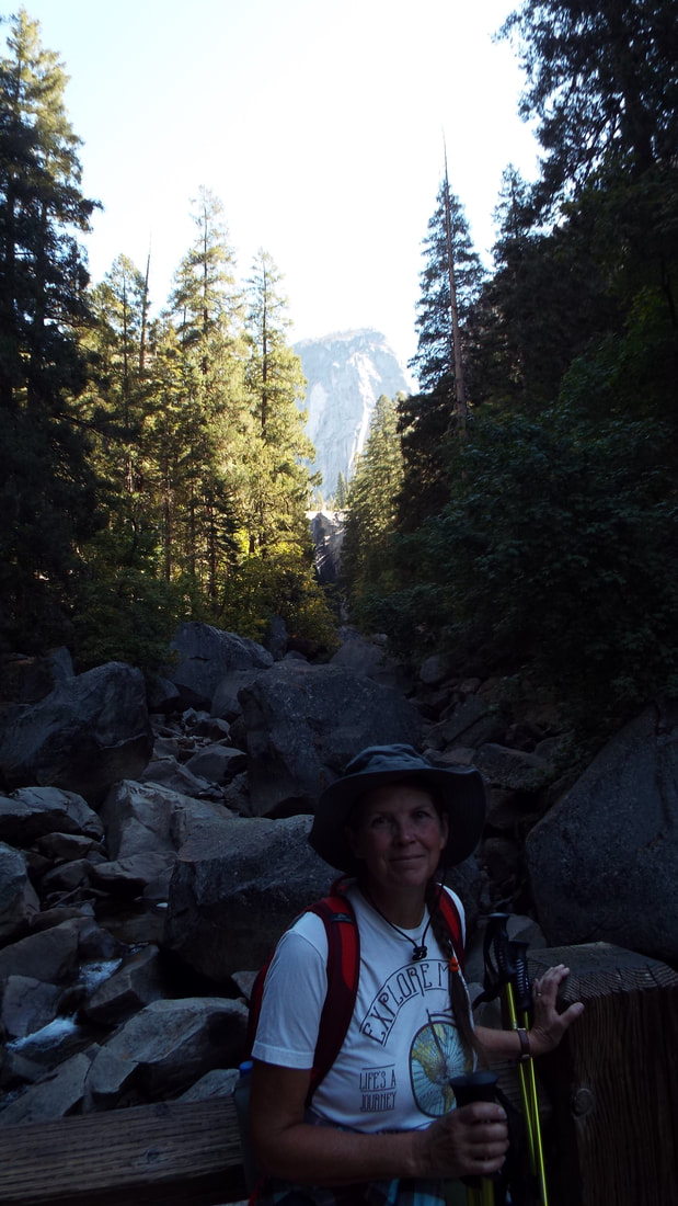 The trail is very different from the paved less than 1 mile. In total the hike is up 600 granite steps and up steep grades of gravel and rocks. 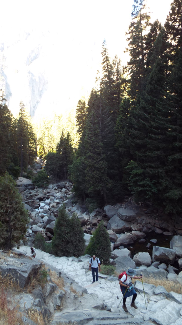 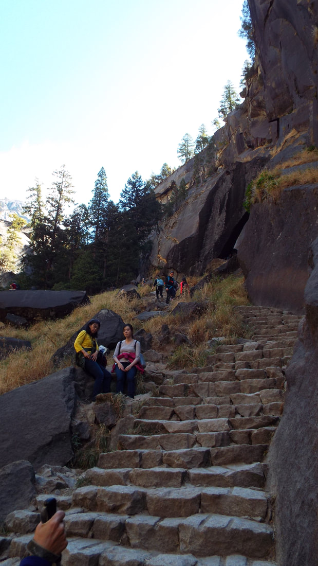 The trail became progressively harder. 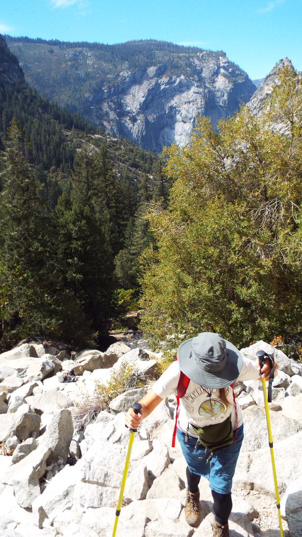 Lets zoom in to show just how far we had already climbed and how busy the trails are here. Our first views of Vernal Falls was impressive. Two people can be seen at the bottom of the 3rd photo. It will give you an idea of the size of these falls. The view from the top of the falls was impressive. It was our view while we had lunch. 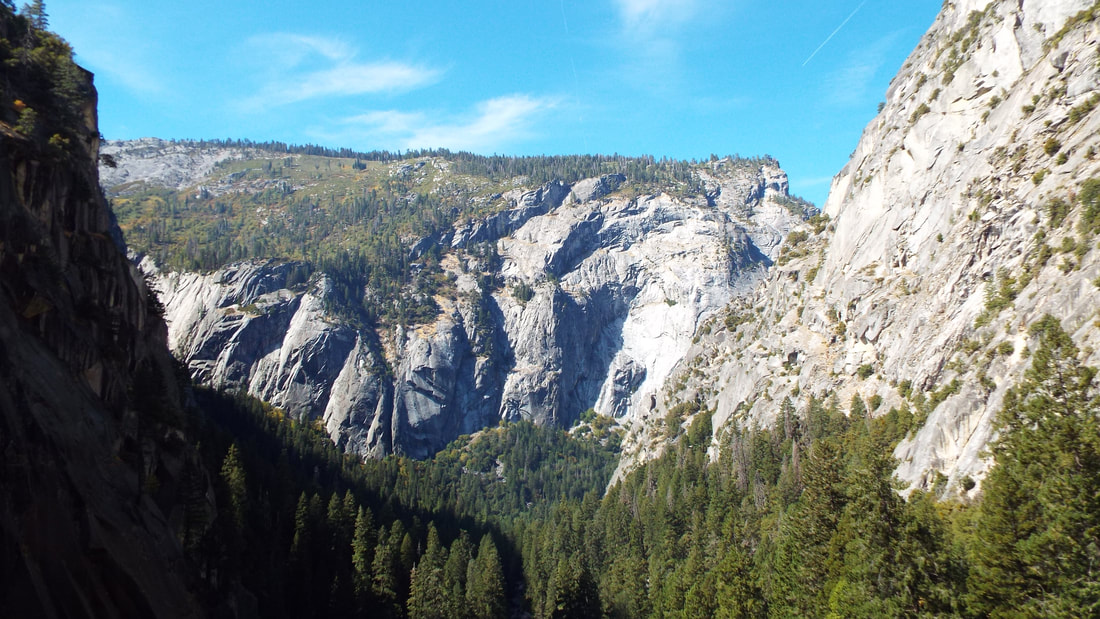 During lunch we were pestered by this squirrel. Obviously people had been feeding him and his friends who were also coming up to people. He was not happy that we did not feed him anything. 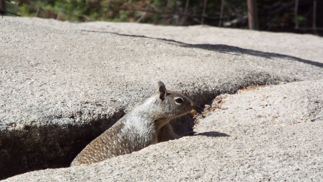 All the wildlife we found on the hike were unafraid of people. Our first view of Nevada Falls was from directly below Liberty Cap a 7076 foot mountain. 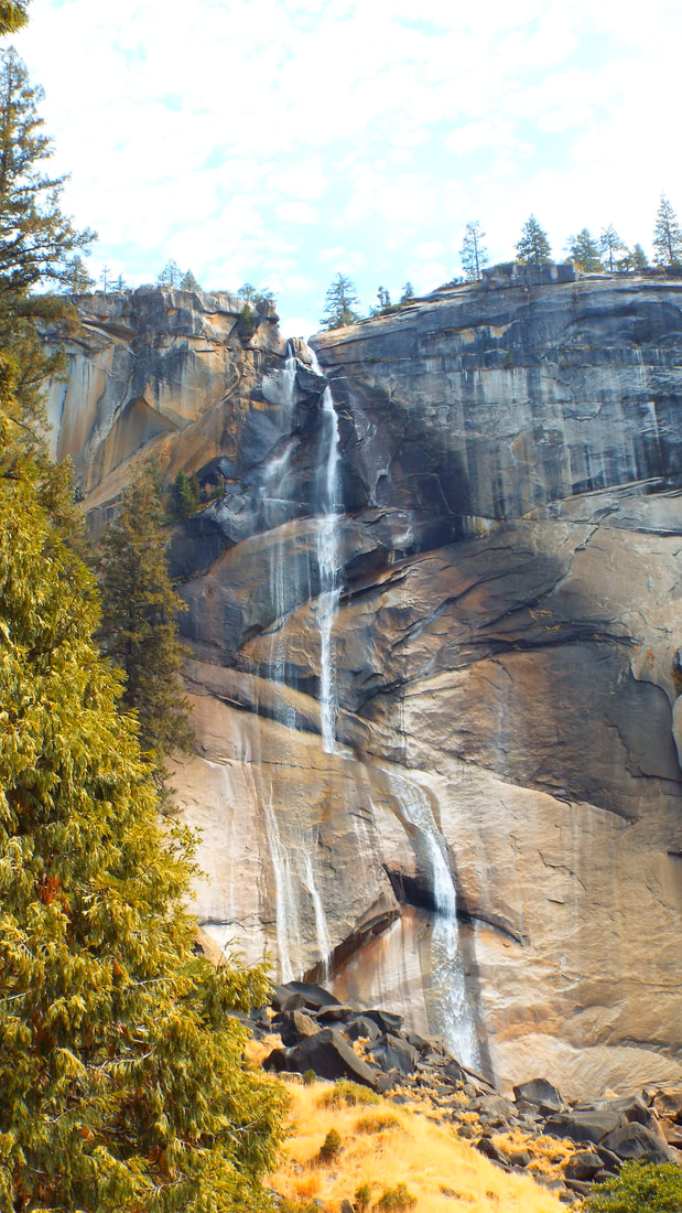 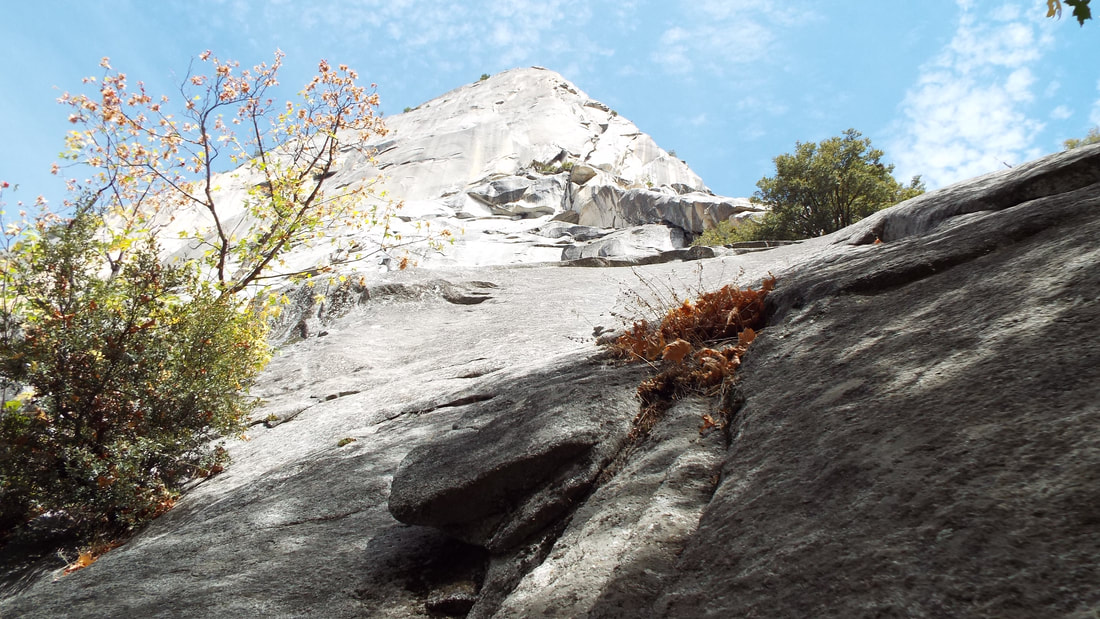 As we moved around Liberty Cap we could see the shear lines in the rock that extended up the side. 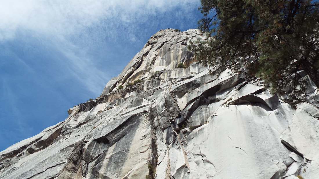 The view from the top of Nevada falls was fantastic.  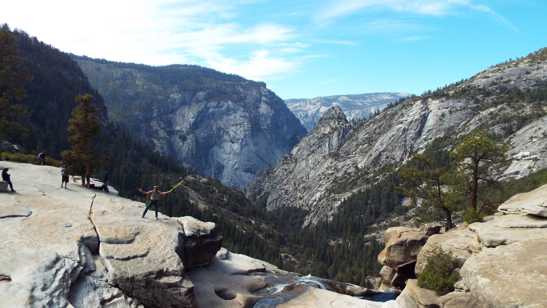 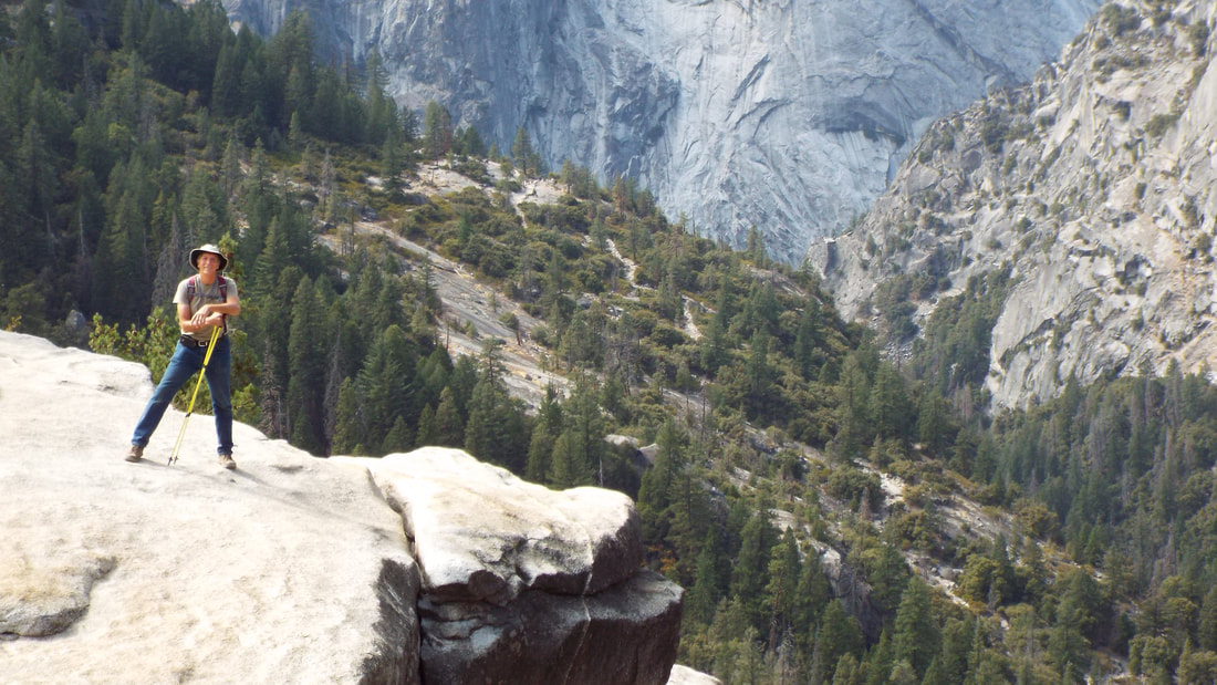 Time to start the hike back down the John Muir trail. We had some great views of the Nevada falls and the mountains on that side of the valley. 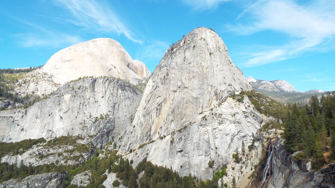 Lets see if we can zoom in and show just how small we felt. 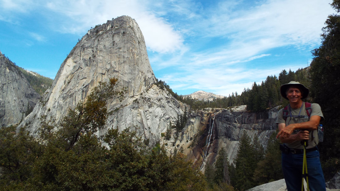 We saw several waterfalls on the hike, but the best ones were Bridal Veil, Vernal and Nevada. We were in view of Half Dome almost all the time and could see Mt. Broadrick, Grizzly Peak, Liberty Cap, and several others on most of the hike. We were never really alone on the trail. If we did get a time when we were not within 100 feet of another hiker, it was noticed and very rare. Most of the time we were within 20 feet of others. As we started back from the trailhead to the truck we had two deer walk out into the road and path. Exhausted we returned to the RV. It was a great hike and we were able to check off one more “Bucket List” item.
2 Comments
Anthony Hual
10/3/2018 12:05:10 pm
that looks like a lot of fun!
Phyllis Sarkis
10/3/2018 06:30:22 pm
I'm so happy ya'll enjoyed the hike! How long did it take to complete it? Leave a Reply. |
AuthorWe are a couple who have started on a new adventure... Archives
February 2024
Categories |


 RSS Feed