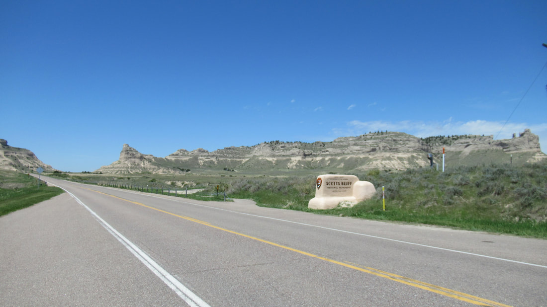
 Today, we will hike to the top of Scotts Bluff. During the virus the national park service has closed the visitor center and does not allow parking at the top of the bluff. We might understand closing the visitor center but allowing people to park at the center but not drive to the top and park. ??? This was actually good for us. Because the road is closed, we are able to hike up the trail and then walk back down on the road. When people left Chimney Rock heading west, they looked to the bluff as the next stop 23 miles away. That was too far for one day but would make two short days of travel. It was known that the bluff was the next place with a clean water spring. Our drive to the bluff was just under 30 minutes. It makes you reflect on how good our lives are today. 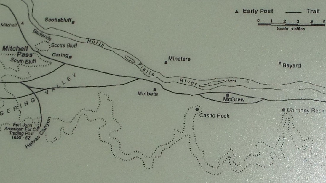 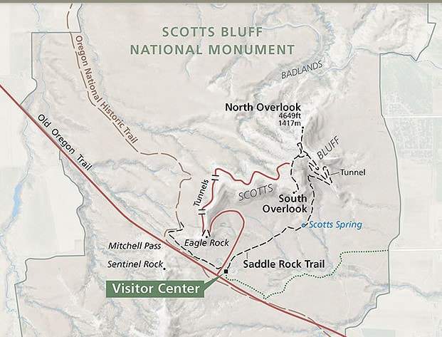 The national monument was created by Franklin D. Roosevelt using the Civilian Conservation Corps (CCC) for construction. CCC started work at Scott's Bluff National Monument in December 1933 and was completed April 1939. The first task was to make a trail to the top for tools and workers. This later became the Saddle Rock Trail. The young men hand dug out the parking lot at the top, roadway, and the three tunnels. This sounds impossible but the bluff is compacted sand. On our hike up, we could rub the bluff wall with our hands and sand would fall from the surface. Both this monument and Chimney Rock are constantly changing and each year look slightly different than they did before. 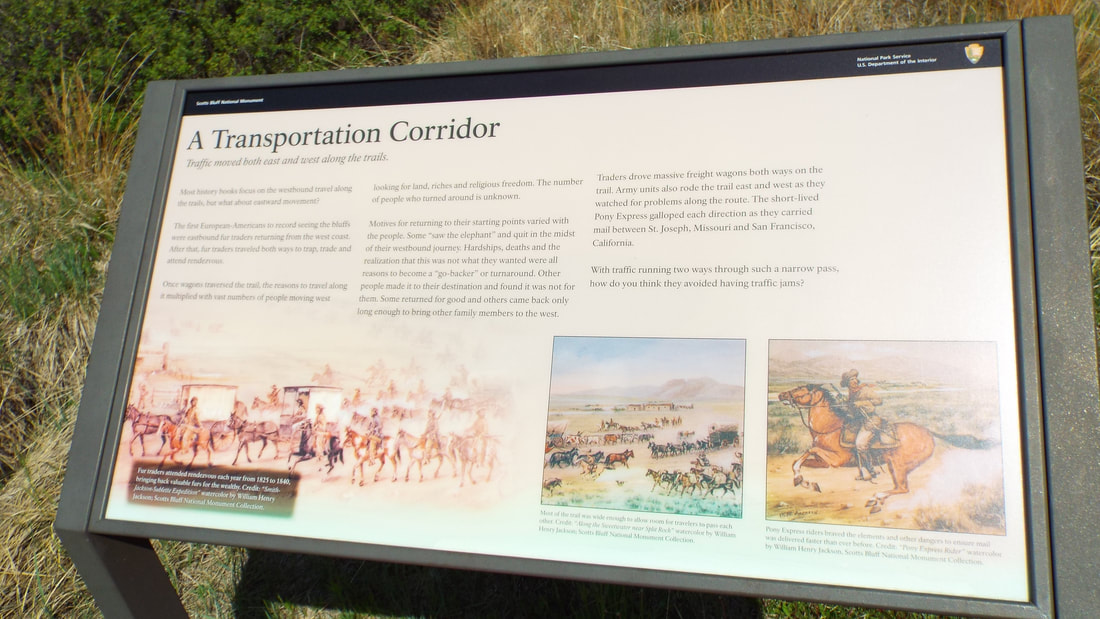 We decided to take the Oregon Trail Pathway first. It is only a 1 mile round trip walk in the old Oregon trail. Most of the time we were in an indention that has sides over 4 feet tall most of the way. This park has an audio tour. It is accessed by calling a number on posts along the way and putting in the stop number. It was very informative. They have placed three types of wagons that were used on the emigration west. After leaving Independence, Missouri in April, the pioneers would have arrived here sometime mid-june. 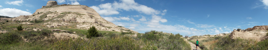 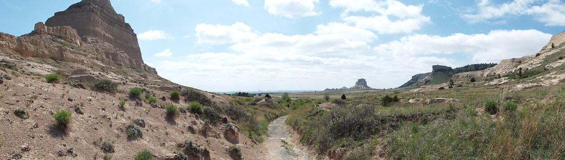 At the end of the trail, we were at an overlook that showed the next portion of the trip for those traveling west on the trail. 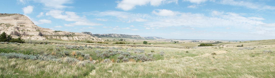 Our walk back was "eventful". Ok I walked right up on a snake in the path. We had walked through that portion of the path just 10 minutes before but that was long enough for the 2 foot long prairie rattlesnake to start sunning itself. It was a cool night and the day had warmed quite a bit. When I was less than 4 feet from him, I said "Well, Hi what are you doing here?'" and started backing away holding my arm out so Shawna would not come any closer. Shawna was not amused with my comment to the snake. It rattled and we gave it more room. I tossed a few pieces of pea gravel to get him to understand that we insisted he move on and waited for him to leave. When he finally left the path, moving just 2 feet off and as we passed he rattled at us again. This would be the first of three snakes we would seen on the visit. 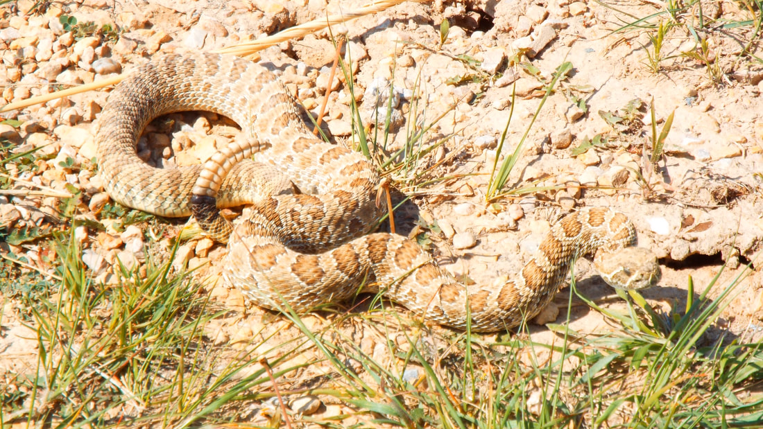 He did pose for a picture before leaving. 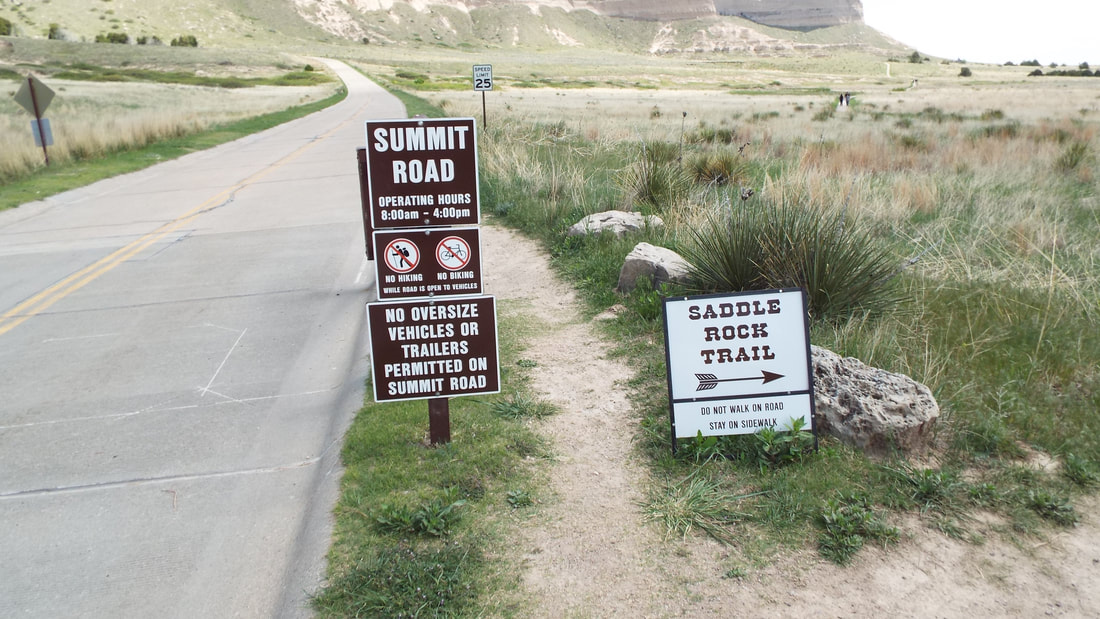 Next, we hiked up to the top of Scotts Bluff. The Saddle Rock Trail is 1.6 miles up to the top with a gain of 435 feet in elevation. "Just a good stretch of the legs" as I say. 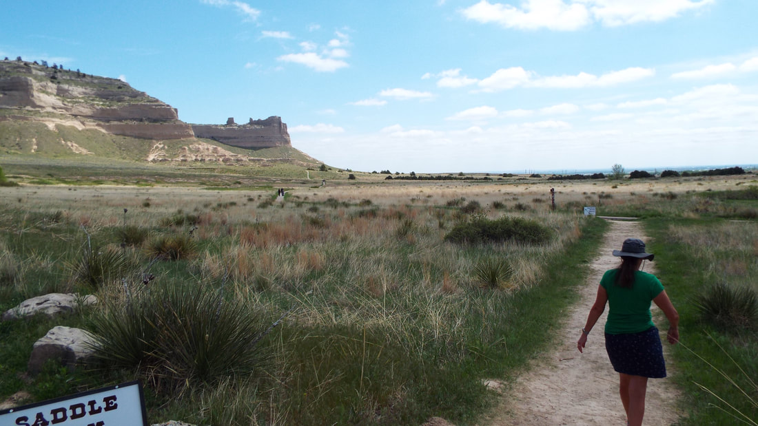 The views along the way were pretty spectacular. Along the way up, we had a green garter snake cross the trail ahead of us. We would see one more of these before the summit. We also passed the spring used by the settlers for fresh water. The spring is fed by a natural “cistern” that collects rain and snowmelt runoff from the bluff and releases it to the surface on this side of the bluff. It was difficult to see since it is now overgrown with bushes and small trees. The warning of falling rock is no joke. The regularly have portions of the cliff calve off and fall. This is not a place to lose track of your surroundings because not only could you get your head smashed in by a rock but you could step off the trail to a 200 foot drop. There are no railings on the trail up. The next surprise was the hand dug tunnel through the mountain. It was only a bit more than 3 feet wide and less than 7 feet tall. 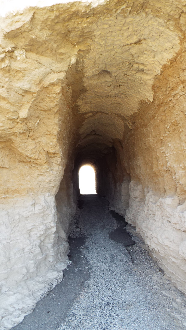 The view from the other side was just as beautiful. One more snake before we reach the summit. The green snake was twice the length of the rattlesnake. The summit gave some great views in all directions. Looking back down at the trail gave some appreciation for the effort it took to make the trail up to the top. The highest point on the bluff is marked at 4,659 feet (1,420 m) above sea level. This marker now sticks up above the surface of the surrounding rock because of the erosion that has occurred in the 75 years since the marker was placed. It was easy to see how soft is the rock and how the bluff is constantly changing. Our hike down from the summit was on the road to the visitor center parking lot. The geology of the bluff is interesting. The levels of sand, ash, and siltstone are visible 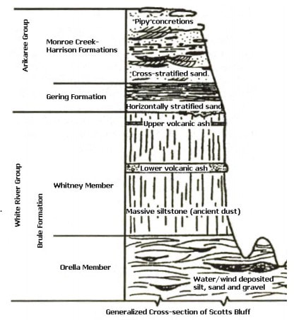 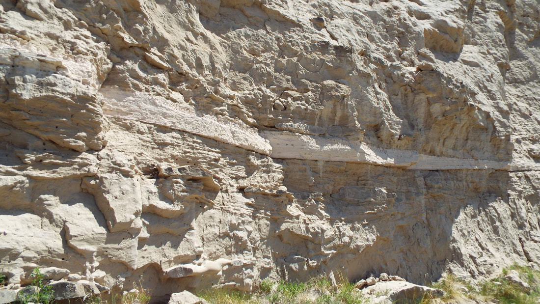
0 Comments
Leave a Reply. |
AuthorWe are a couple who have started on a new adventure... Archives
February 2024
Categories |
 RSS Feed